Azad Jammu and Kashmir, abbreviated as AJK and commonly known as Azad Kashmir, is a nominally self-governing jurisdiction administered by Pakistan. The territory lies west of the Indian-administered state of Jammu and Kashmir, and was part of the former princely state of Jammu and Kashmir.

The term Line of Control (LoC) refers to the military control line between the Indian and Pakistani controlled parts of the former princely state of Jammu and Kashmir—a line which does not constitute a legally recognized international boundary, but is the de facto border. Originally known as the Cease-fire Line, it was redesignated as the "Line of Control" following the Simla Agreement, which was signed on 3 July 1972. The part of the former princely state that is under Indian control is known as the state of Jammu and Kashmir. The Pakistani-controlled part is divided into Azad Jammu and Kashmir and Gilgit–Baltistan. The northernmost point of the Line of Control is known as NJ9842. The India–Pakistan border continues from the southernmost point on the LoC.

Ghulam Nabi Azad is an Indian politician of the Indian National Congress and was the Minister of Health and Family Welfare. Presently, he serves as the Leader of opposition in Rajya Sabha.

Udhampur (ˌʊd̪ʱəmpur) is a city and a municipal council in Udhampur District in the Indian state of Jammu and Kashmir. Situated among lush green forests of Eucalyptus, it is the second-largest city of the Jammu region and the fourth-largest city in the state of Jammu and Kashmir. Named after Raja Udham Singh, it serves as the district capital and the Northern Command headquarters of the Indian Army. A Forward Base Support Unit (FBSU) of the Indian Air Force is also stationed here. Udhampur is used by the Armed Forces as a transit point between Jammu and Srinagar when travelling by road.

Jammu is the most populous district in the Indian state of Jammu and Kashmir and is home to the winter capital (Jammu) of Jammu and Kashmir.. The largest city is Jammu.
Tawi is a river that flows through the city of Jammu. Tawi river is considered sacred and holy, as is the case with most rivers in India.

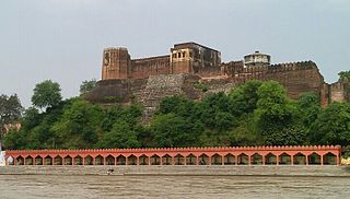
Reasi is a town and a notified area committee and tehsil in the Indian state of Jammu and Kashmir. Situated at the bank of River Chenab, it is the headquarters of the Reasi district. In the eighth century, Reasi was a part of the Bhimgarh state established by Bhim Dev. The name Reasi is derived from the town's old name "Rasyal".

Wikipedia:WikiProject Indian cities
Babu Parmanand was an Indian politician and the governor of Haryana from 19 June 1999 to 2 July 2004. He was born in Sarore village of the present-day Samba district in Jammu and Kashmir state. In 1962, he was elected for the first time to the Jammu and Kashmir Legislative Assembly from Ramgarh constituency. He was the speaker of the Jammu and Kashmir Legislative Assembly in 1980. He has a son, Dr. Rajendra Prasad, who is a doctor in AIIMS hospital.

Samba District is a newly formed district in the Indian state of Jammu and Kashmir. Before its formation, this area was part of Jammu district and Kathua district.

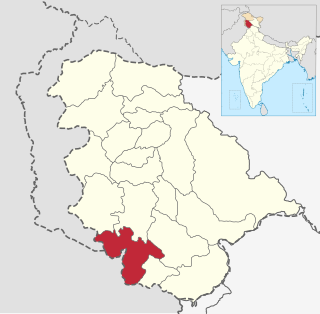
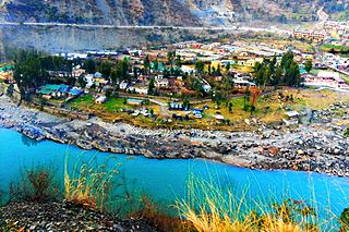
Ramban is one of the 22 districts in the state of Jammu and Kashmir, India. Ramban is located in the lap of Pir Panjal range of the mighty Himalayas. It was carved out of erstwhile Doda District keeping in view the backwardness, remoteness and aspiration of people of the area. District Ramban started functioning as independent unit on 1 April 2007. Ramban town is the district headquarters. The town is located midway between Jammu and Srinagar along the Chenab river, on National Highway-44, approximately 150 km from Jammu and Srinagar.
The Dogra Muslim are a Muslim community found in the Indian state of Jammu and Kashmir. They are Muslim converts from the larger Hindu Dogra community. A large number of Dogra Muslim are also now found in the province of Punjab in Pakistan. They are also known as Rajahs, especially in Pakistan.
Rathsoon or Rathsun is one of the village and block in the Beerwah tehsil of the Budgam district in Jammu and Kashmir, India. The village population is over 7,500, being one of the largest in tehsil Beerwah. Rathsoon has a shrine of one Sufi Saint Baba Hanifuddin Reshi, located on the hill top known as Daraish. The neighboring village is Ohangam Beerwah. The village is 27 km away from Srinagar. The nearest town is Magam, 4.5 km away.

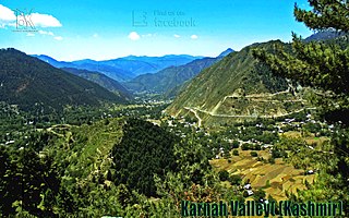
Karnah is an administrative tehsil of the Kupwara district in Jammu and Kashmir, India. It has 42 villages out of which 40 have population and is 78 kilometres (48 mi) away from the main town of Kupwara and 170 km away from Summer capital of Jammu and Kashmir Srinagar.

Seeloo also known as "Seelu" is a small village located in baramulla District in the state of jammu and kashmir. The village is situated on the Srinagar-Kupwara national highway and is located on the banks of the Pohru River. Seeloo consists of 5 mohalla This includes Al-umar, Naikpora, Telwanpora, Bhat Mohala, and Hajam Mohalla.

Jammu is one of the three administrative divisions within Jammu and Kashmir, the northernmost state in India. It consists of the districts of Jammu, Doda, Kathua, Ramban, Reasi, Kishtwar, Poonch, Rajouri, Udhampur and Samba. Most of the land is hilly or mountainous, including the Pir Panjal Range which separates it from the Kashmir Valley and part of the Great Himalayas in the eastern districts of Doda and Kishtwar. Its principal river is the Chenab. Chenab Valley is another important division in Jammu region.

Purmandal is a village located on the Devika River in Samba district, Jammu and Kashmir, India. The village and its temples are a pilgrimage site for Hindus, who believe bathing in the river cleanses the soul.

Popular sports in Jammu and Kashmir include cricket and football along with sports like golf, winter sports, water sports and adventure sports. Jammu and Kashmir has produced international and national level players including Gul Dev, Aamir Aziz, Chain Singh, Iqra Rasool, Mehrajuddin Wadoo, Mithun Manhas, Abid Nabi, Parvez Rasool, Tajamal Islam and Palak Kaur.


