
Gondar or Gonder is a city and woreda in Amhara Region, Ethiopia. Located in the Semien Gondar Zone of the Amhara Region, Gondar is north of Tana Lake on the Lesser Angereb River and southwest of the Simien Mountains. It has a latitude and longitude of 12°36′N37°28′E with an elevation of 2133 meters above sea level. As of 2016, Gondara has a population of 299,969.

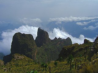
Amhara Region is a regional state in northern Ethiopia, and the homeland of the Amhara people. Previously known as "Region 3", its capital is Bahir Dar. Ethiopia's largest inland body of water, Lake Tana, which is the source of the Blue Nile river, is located within Amhara. The region also contains the Semien Mountains National Park, which includes Ras Dashan, the highest point in Ethiopia. Amhara is bordered by the state of Sudan to the west and northwest, and in other directions by other regions of Ethiopia: Tigray to the north, Afar to the east, Benishangul-Gumuz to the west and southwest, and Oromia to the south.

Gorgora is a town and peninsula in northwestern Ethiopia. It is located south of Gondar on the north shore of Lake Tana, in the Semien Gondar Zone of the Amhara Region. Gorgora has a latitude and longitude of 12°14′N37°18′E.
Dembiya is a historic region of Ethiopia, intimately linked with Lake Tana. According to the account of Manuel de Almeida, Dembiya was "bounded on East by Begemder, on South by Gojjam, on West by Agaws of Achefer and Tangha. Lake Tsana, formerly called Dambaya, is in this region." Alexander Murray, in his preface to the third volume of Bruce's account, further describes it as "on the east it includes Foggora, Dara, and Alata; on the north-east Gondar, the metropolis, and the rich district beneath it; on the southwest, the district of Bed and, on the west, the lands around Waindaga and Dingleber."
Semien Gondar is a Zone in the Ethiopian Amhara Region. This Zone is named for the city of Gondar, the capital of Ethiopia until the mid-19th century.

South Gondar is a Zone in the Ethiopian Amhara Region. This zone is named for the city of Gondar, which was the capital of Ethiopia until the mid-19th century, and has often been used as a name for the local province.
Gondar Zuria is a woreda in the Amhara Region of Ethiopia. Part of the Semien Gondar Zone, Gondar Zuria
Dembiya is one of the woredas in the Amhara Region of Ethiopia. It is named for the former province of Dembiya, which was located roughly in the same location. Part of the Semien
Dera is one of the woredas in the Amhara Region of Ethiopia. Part of the Debub Gondar Zone, Dera is bordered on the south by the Abbay River which separates it from the Mirab Gojjam
Kemekem (also known as Libo Kemekem is one of the woredas in the Amhara Region of Ethiopia. Part of the Debub Gondar Zone, Kemekem is bordered on the south by the Reb
Achefer was one of the 105 woredas in the Amhara Region of Ethiopia. It was named for the historic district of Achefer, which was first mentioned in the 16th century. Part of the Mirab Gojjam Zone, Achefer was bordered on the south by the Agew Awi Zone, on the west by the Semien Gondar Zone, on the north by Lake Tana, on the northeast by Bahir Dar Zuria, and on the southeast by Merawi; the Lesser Abay River defined the woreda's eastern boundary. The woreda included Dek Island. The administrative center was Yesmala; other towns in Achefer included Durbete, Kunzela, Chiba and Wandege. Acheref was divided for Debub Achefer and Semien Achefer woredas.
Bahir Dar Zuria is one of the woredas in the Amhara Region of Ethiopia. Part of the Mirab Gojjam Zone, this woreda is bordered on the south by Yilmana Densa, on the southwest by Mecha, on the northwest by the Gilgel Abay River which separates it from Semien Achefer, on the north by Lake Tana, on the shores of Lake Tana situates the city and special zone of Bahir Dar, and on the east by the Abay River which separates it from the Debub Gondar Zone.
Kuarit is one of the woredas in the Amhara Region of Ethiopia. Part of the Mirab Gojjam Zone, Kuarit is bordered on the southwest by Jabi Tehnan, on the west by Sekela, on the north by Yilmana Densa, on the east by the Misraq Gojjam Zone, and on the southeast by Dega Damot. The major town in Kuarit is Gebeze Mariam. Goncha woreda was separated from Kuarit.

Enfraz or Infraz, Amharic: እንፍራዝ infrāz. Also called Guba'e, Ge'ez: ጉባኤ gūbā'ē, "assembly" and Guzara, Amharic: ጉዛራ, gūzārā) is an historic town and district in northern Ethiopia. Located in the mountainous area overlooking the northeast shore of Lake Tana in the Semien Gondar Zone of the Amhara Region, it sits at a latitude and longitude of 12°15′30″N37°37′45″E.

Dengel Ber is a town in western Ethiopia. Located on the south-western shore of Lake Tana in the Semien Gondar Zone of the Amhara Region, this town has a latitude and longitude of 11°57′N37°00′E. Access to this town includes track roads to both Shawra and Kunzela and weekly service by the Bahir Dar-Gorgora ferry on Lake Tana. While the name of the town is indisputably Amharic, there is some disagreement over the meaning of its name: while "Pass of the Virgin" has been the most common interpretation since at least the days James Bruce visited Ethiopia, Huntingford and Beckingham state that it means "pass of canna plants".
Ebnat(Ibnat) is a town in the South Gondar Zone of the Amhara Region, Ebnat has a latitude and longitude of 12°7′N38°3′E. It is the administrative center of Ebnat woreda and is at an elevation of 2972 meters above sea level.
Nefas Mewcha is a town in northern Ethiopia. Located in the Debub Gondar Zone of the Amhara Region, this town has a latitude and longitude of 11°44′N38°28′E and an elevation of 3150 meters above sea level. It is the administrative center of Lay Gayint woreda.
Ayikel is a town in western Ethiopia. Located in the Semien Gondar Zone of the Amhara Region, it has a latitude and longitude of 12°33′N37°04′E with an altitude of 2146 meters above sea level. The settlement is situated on the east-west road connecting Gondar with Metemma, and is the administrative center of Chilga woreda.
Takusa is one of the woredas in the Amhara Region of Ethiopia. Part of the Semien Gondar Zone, Takusa is bordered on the south by Alefa, on the west by Qwara, on the northwest by the Metemma, on the north by Chilga, on the northeast by Dembiya, and on the east by Lake Tana. Towns in Takusa include Delgi. Takusa was part of Alefa woreda.
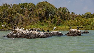
The Zege Peninsula is located on the southern shore of Lake Tana in Ethiopia, and is situated at. It is 600 km northwest of Addis Ababa, the capital city of Ethiopia. Lake Tana is the largest lake in Ethiopia, and is the source of the Blue Nile river. The peninsula is attached to dry land on its western part. As a place name, the word "zege" signifies a peninsula that encloses two rural qebele, the former monastery and Zägé town at the gate of the main land of the peninsula. At present, Zegé is part of Bahir Dar city administration, and is 32 km from the main town, the capital of Amhara National Regional State. The origin of the term "zegié" is somewhat obscure. Informants from Ura Kidane miheret monastic church, one of the earliest church in the peninsula associated the term to Debra Zegag and Abba Nahom; where as some monks who were servants of Mähal Zegié Giyorgis attributed the term to Zengie and to Abun Betre Maryam, founder of Zegie monastery. Still another church scholar, Aleqa Aynakulu Mersha, related the term to a name of a tribe called Zegie 1955 E.C:466; Tadese Tamrat, 1994:954-959). On the peninsula of Zege there are six Monastic churches, all established between the 14th and 17th centuries.