A tributary, or affluent, is a stream or river that flows into a larger stream or main stem river or a lake. A tributary does not flow directly into a sea or ocean. Tributaries and the main stem river drain the surrounding drainage basin of its surface water and groundwater, leading the water out into an ocean. The Irtysh is a chief tributary of the Ob river and is also the longest tributary river in the world with a length of 4,248 km (2,640 mi). The Madeira River is the largest tributary river by volume in the world with an average discharge of 31,200 m3/s (1.1 million cu ft/s).

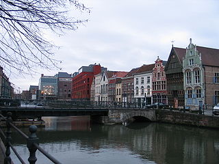
The Scheldt is a 435-kilometre-long (270 mi) river that flows through northern France, western Belgium, and the southwestern part of the Netherlands, with its mouth at the North Sea. Its name is derived from an adjective corresponding to Old English sceald ("shallow"), Modern English shoal, Low German schol, West Frisian skol, and obsolete Swedish skäll ("thin").

Rotselaar is a municipality located in the Belgian province of Flemish-Brabant, near the convergence of the Demer and the Dijle. Since January 1, 1977 the municipality comprises the towns of Rotselaar proper, Werchter and Wezemaal. On January 1, 2006, Rotselaar had a total population of 15,068. The total area is 37.57 km² which gives a population density of 401 inhabitants per km².

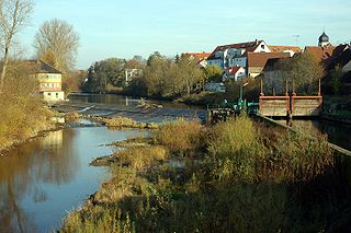
The Brigach is the shorter of two streams that jointly form the river Danube in Baden-Württemberg, Germany. The Brigach has its source at 925 m (3,035 ft) above sea level within St. Georgen in the Black Forest. The Brigach crosses the city Villingen-Schwenningen. 40.4 km (25.1 mi) from the source, the Brigach joins the Breg in Donaueschingen to form the Danube River.

The Dender or Dendre is a 65-kilometre (40-mile) long river in Belgium, the right tributary of the river Scheldt. The confluence of the two rivers is in the Belgian town of Dendermonde.

The Oise is a river of Belgium and France, flowing for 341 km (212 mi) from its source in the Belgian province of Hainaut, south of Chimay. It crosses the border with France after about 20 km (12 mi). It flows into the Seine at Conflans-Sainte-Honorine, a north-western suburb of Paris. Its main tributary is the Aisne. It gave its name to the French departments of Oise and Val-d'Oise.

Ahr is a river in Germany, a left tributary of the Rhine. Its source is at an elevation of approximately 470 metres (1,540 ft) above sea level in Blankenheim in the Eifel, in the cellar of a timber-frame house near the castle of Blankenheim. After 18 kilometres (11 mi) it crosses from North Rhine-Westphalia into Rhineland-Palatinate.

The Ourthe is a 165-kilometre (103 mi) long river in the Ardennes in Wallonia (Belgium). It is a right tributary to the river Meuse. The Ourthe is formed at the confluence of the Ourthe Occidentale and the Ourthe Orientale, west of Houffalize.
The Dyle is a river in central Belgium, left tributary of the Rupel. It is 86 kilometres (53 mi) long. It flows through the Belgian provinces of Walloon Brabant, Flemish Brabant and Antwerp. Its source is in Houtain-le-Val, near Nivelles in Walloon Brabant.

The Rupel is a tidal river in northern Belgium, right tributary of the Scheldt. It is about 12 kilometres (7 mi) long. It flows through the Belgian province of Antwerp. It is formed by the confluence of the rivers Dijle and Nete, in Rumst. It flows into the Scheldt at Schelle. Towns along the Rupel are Rumst, Boom, Niel and Schelle. The Rupel is navigable, and forms part of the waterway to Brussels.

Vossem is a village in the municipality of Tervuren, in Belgium, 15 km from Leuven, or Louvain. It is located in the valley of the Voer creek. There is small nature reserve in Vossem, the Twaalf-Apostelenbos, a swamp.

The Nete is a river in northern Belgium, right tributary of the Rupel. It flows through the Belgian province of Antwerp. It is formed in Lier, at the confluence of the rivers Grote Nete and Kleine Nete. It flows through Duffel and joins the river Dijle in Rumst to form the river Rupel. It drains nearly 60% of Antwerp province.

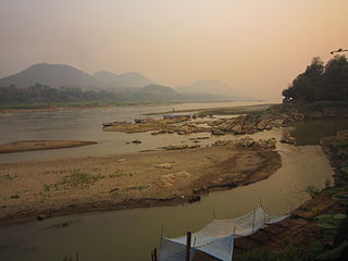
The Kagera River, also known as Akagera River, or Alexandra Nile, is an East African river, forming part of the upper headwaters of the Nile and carrying water from its most distant source. With a total length of 597 km (371 mi) from its source located in Lake Rweru in Rwanda.

Dyle was a department of the French First Republic and French First Empire in present-day Belgium. It was named after the river Dyle (Dijle), which flows through the department. Its territory corresponded more or less with that of the Belgian province of Brabant, now divided into Walloon Brabant, Flemish Brabant and the Brussels-Capital Region. It was created on 1 October 1795, when the Austrian Netherlands and the Prince-Bishopric of Liège were officially annexed by the French Republic. Before the annexation, its territory was partly in the Duchy of Brabant, partly in the County of Hainaut, and partly in some smaller territories.
The Kocher is a 169 km (105 mi)-long right tributary of the Neckar in the north-eastern part of Baden-Württemberg, Germany. The name "Kocher" originates from its Celtic name "cochan" and probably means winding, meandering river. Its total drainage area is 1,960 km2 (760 sq mi). The Kocher rises in the eastern foothills of the Swabian Alb from two karst springs, the Schwarzer (black) Kocher and the Weißer (white) Kocher, that join in Unterkochen near Aalen. The Schwarzer Kocher is approximately 8 km (5.0 mi) long. Its source discharge varies between 50 L/s and 4,000 L/s with an average of 680 L/s. The 3.3 km (2.1 mi) long Weißer Kocher has an average discharge of 400 L/s.

The Gete is a river in Belgium which flows south to north. It is a left tributary of the Demer.
The Hageland is a landscape in the Flemish Region of Belgium, situated in the eastern part of the Province of Flemish Brabant. It is mainly comprised between the cities of Aarschot, Leuven, Tienen and Diest, and probably coincides to some extent with the twelfth-century County of Leuven. The French Government that controlled the area that later became Belgium in the last years of the 18th and early 19th century, had extended Limburg, which since then comprises the minor part of the Hageland at the city of Halen.
The Lachance river is a watercourse whose mouth flows into the Gosselin River, a tributary of the Nicolet River in the city of Victoriaville, in the Arthabaska Regional County Municipality (MRC), in the administrative region of Centre-du-Québec, in Quebec, in Canada.

The Winter brook is the mainstream in a network of partially excavated stream beds in Belgium in the Southern Campine region. The Winter brook originates in Beverlo, and, after a course of 32 km, it flows into the Demer River in Scherpenheuvel-Zichem. Along this course, the stream changes names multiple times.

