Related Research Articles
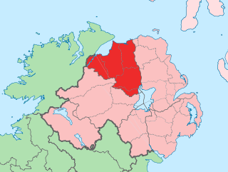
County Londonderry, also known as County Derry, is one of the six counties of Northern Ireland, one of the thirty-two counties of Ireland and one of the nine counties of Ulster. Before the partition of Ireland, it was one of the counties of the Kingdom of Ireland from 1613 onward and then of the United Kingdom after the Acts of Union 1800. Adjoining the north-west shore of Lough Neagh, the county covers an area of 2,118 km2 (818 sq mi) and today has a population of about 252,231.
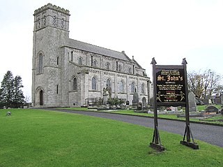
Moneymore is a village and townland in County Londonderry, Northern Ireland. It had a population of 1,897 in the 2011 census. It is situated within Mid-Ulster District. It is an example of a plantation village in Mid-Ulster built by the Drapers' Company of London.

Draperstown is a village in the Sperrin Mountains in County Londonderry, Northern Ireland. It is situated in the civil parish of Ballinascreen and is part of Mid-Ulster district. It is also part of the Church of Ireland parish of Ballynascreen and the Catholic parish of Ballinascreen, and within the former barony of Loughinsholin.

Aghagallon (from Irish Achadh Gallan , meaning 'field of the standing stones' is a small village and civil parish in County Antrim, Northern Ireland. It is about three miles northeast of Lurgan, County Armagh, and had a population of 824 in the 2001 census.
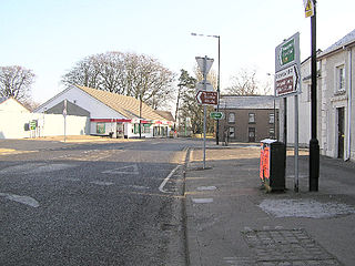
Tobermore, from Irish An Tobar Mór, meaning 'the great well') is a small village in County Londonderry, Northern Ireland named after the townland of Tobermore. The village, which has a predominantly Protestant population, lies 2.5 miles (4.0 km) south-south-west of Maghera and 5.5 miles (8.9 km) north-west of Magherafelt. Tobermore is within the civil parish of Kilcronaghan and is part of Mid-Ulster District. It was also part of the former barony of Loughinsholin.

Desertmartin is a small village in County Londonderry, Northern Ireland. It is four miles from Magherafelt, at the foot of Slieve Gallion. In the 2001 Census the greater Desertmartin area had a population of 1,276. It lies within Desertmartin parish, Mid-Ulster District, and the historic barony of Loughinsholin. Neighbouring settlements include Draperstown, Magherafelt, Moneymore, and Tobermore.

Brackaghlislea is a townland lying within the civil parish of Kilcronaghan, County Londonderry, Northern Ireland. It lies to the south-west of the parish and is bounded to the south and west by the civil parish of Ballinascreen. It is bounded by the following townlands: Drumard, Gortahurk, Mormeal, Tamnyaskey and Tullyroan. It was apportioned to the Drapers company and freeholds.

Clooney is a townland lying within the civil parish of Kilcronaghan, County Londonderry, Northern Ireland. It lies in north-east of the parish and is bounded in the north by the Moyola River as well as the parish of Termoneeny. It is bounded by the following townlands; Ballynahone Beg, Ballynahone More, Gortamney, Moyesset, and Tobermore. It was apportioned to the Drapers company as well as freeholds.
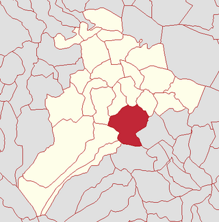
Coolsaragh is a townland lying within the civil parish of Kilcronaghan, County Londonderry, Northern Ireland. It lies in the south of the parish on the boundary with the civil parish of Desertmartin, and it is bounded by the townlands of: Annagh & Moneysterlinn, Cloughfin, Gortahurk, Keenaght, Killynumber, Killytoney, Longfield, and Tullyroan. It was apportioned to the Drapers company.

Drumballyhagan and Drumballyhagan Clark are two townlands lying within the civil parish of Kilcronaghan, County Londonderry, Northern Ireland. Situated in the north of the parish, the two townlands are separated by the Moyola River, of which the southern portion was held by a person surnamed "Clark". Together they are bounded by the townlands of; Ballynahone Beg, Bracaghreilly, Drumcrow, Fallagloon, Lisnamuck, Moneyshanere, and Tobermore. It was apportioned to the Vintners company.

Tobermore is a townland lying within the civil parish of Kilcronaghan, County Londonderry, Northern Ireland. It lies in the north-east of the parish, and is bounded by the townlands of; Ballynahone Beg, Calmore, Clooney, Drumballyhagan Clark, Moneyshanere, and Moyesset. It was apportioned to the Drapers company as well as freeholds.
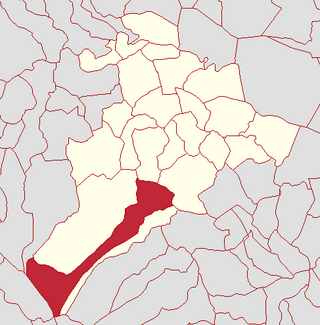
Gortahurk is a townland lying within the civil parish of Kilcronaghan, County Londonderry, Northern Ireland. It lies on the extreme south-west of the parish on the boundary with the parish of Ballynascreen. It is bounded by the townlands of Brackaghlislea, Coolsaragh, Drumard, Keenaght, Letteran, Straw Mountain, Tintagh, and Tullyroan. It was apportioned to the Drapers company.

Cloughfin is a townland lying within the civil parish of Kilcronaghan, County Londonderry, Northern Ireland. It lies in the center of the parish, and is bounded by the following townlands: Calmore, Coolsaragh, Killytoney, and Tullyroan. It was apportioned to the Drapers company and freeholds.

Gortamney is a townland lying within the civil parish of Kilcronaghan, County Londonderry, Northern Ireland. It lies in the east of the parish alongside the boundary of the civil parish of Termoneeny, and is bounded by the townlands of Ballinderry, Ballynahone More, Clooney, Drumsamney, Killynumber, Killytoney, and Moyesset. It was apportioned to the Drapers company and Crown freeholds.

Moybeg Kirley is a townland lying within the civil parish of Kilcronaghan, County Londonderry, Northern Ireland. It is in the north-west of the parish, with the Moyola River forming its northern boundary. It is bounded by the townlands of Drumconready, Drumcrow, Kirley, Moneyguiggy, and Moneyshanere. It was apportioned to the Drapers' Company.

Moyesset is a townland lying within the civil parish of Kilcronaghan, County Londonderry, Northern Ireland. It lies in the centre of the parish, and is bounded by the townlands of; Calmore, Clooney, Gortamney, Killytoney, and Tobermore. It was apportioned to the Drapers company and Crown freeholds.

Tamnyaskey is a townland lying within the civil parish of Kilcronaghan, County Londonderry, Northern Ireland. It lies in the west of the parish, and is bounded by the townlands of Brackaghlislea, Calmore, Granny, Mormeal, and Tullyroan. It wasn't apportioned to any of the London livery companies, being kept as church lands.
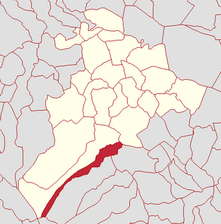
Keenaght is a townland lying within the civil parish of Kilcronaghan, County Londonderry, Northern Ireland. It lies in the south of the parish on the boundary with the civil parish of Desertmartin, and it is bounded by the townlands of: Coolsaragh, Cullion, Gortahurk, Longfield, and Tintagh. It was apportioned to the Drapers company.
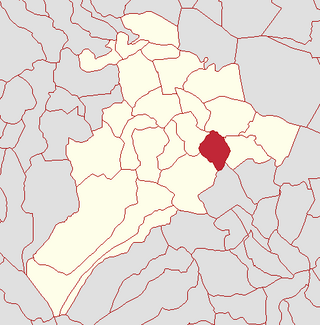
Killynumber is a townland lying within the civil parish of Kilcronaghan, County Londonderry, Northern Ireland. It lies in the south-east with the civil parish of Desertmartin, and it is bounded by the townlands of Annagh & Moneysterlin, Coolsaragh, Drumsamney, Gortamney, and Killytoney. It was apportioned to the Drapers company as well as freeholds.

Killytoney is a townland lying within the civil parish of Kilcronaghan, County Londonderry, Northern Ireland. It lies in the center of the parish, and is bounded by the townlands of Calmore, Cloughfin, Coolsaragh, Gortamney, Killynumber, and Moyesset. It was apportioned to the Drapers company.
References
- ↑ NI Census 2001
- ↑ NINIS Area Profile - Tobermore
- ↑ Planning NI - Draft Magherafelt Area Plan 2015, page 12.
- 1 2 3 Census of Ireland
- 1 2 3 4 5 HistPop; Area, population and number of houses, Vol. III, Ireland, 1881, page 698
- ↑ HistPop; County and County Borough of Londonderry, 1926, Page 27
- 1 2 3 4 5 6 7 http://www.nisra.gov.uk/Census/2011_results.html [ dead link ]
- ↑ NINIS Area Profile for Tobermore
- 1 2 NISRA - Electoral Wards
- 1 2 3 4 5 Department of Agriculture and Rural Development; Tobermore Integrated Village Plan, October 2011