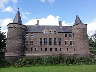
Helmond is a city and municipality in the Metropoolregio Eindhoven of the province of North Brabant in the Southern Netherlands.

Mierlo is a village in the southern Netherlands, in the municipality of Geldrop-Mierlo, North Brabant. Until 2004, it was a separate municipality with an area of 18.09 km2 (7 sq mi).
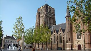
Oosterhout is a municipality and a city in southern Netherlands. The municipality had a population of 56,206 in 2021.

Egmond aan den Hoef is a village in the Dutch province of North Holland. It is a part of the municipality of Bergen, and lies about 7 kilometres (4.3 mi) west of Alkmaar. Until 2001, Egmond aan den Hoef was part of the municipality of Egmond.

Aerdenhout is a village in the municipality of Bloemendaal, Netherlands. Located in the dunes between Haarlem and the beach town of Zandvoort, it ranks as the wealthiest town in the Netherlands. The name "Aerdenhout" means Andere hout, Dutch for "the other wood", and was given it to distinguish this other wood from the Haarlemmerhout, just south of the city Haarlem.

Aarlanderveen is a village in the Dutch province of South Holland. It is a part of the municipality of Alphen aan den Rijn, and lies about 4 km east of Alphen aan den Rijn.

Gemert is a town in the Dutch province of North Brabant. It is located in the municipality of Gemert-Bakel.

Van Dik Hout are a Dutch pop group from Den Helder in the north of the Netherlands. They formed in the late 1980s as a school band, but moved later to Amsterdam where they rechristened themselves into Van Dik Hout.

The Catholic Church in the Netherlands is part of the worldwide Catholic Church under the spiritual leadership of the Pope in Rome. Its primate is the Metropolitan Archbishop of Utrecht, since 2008 Willem Jacobus Eijk. In 2015 Catholicism was the single largest religion of the Netherlands, forming some 23% of the Dutch people, based on in-depth interviewing, down from 40% in the 1960s.
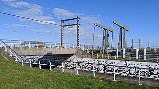
Breezand is a village in the Dutch province of North Holland. It is a part of the municipality of Hollands Kroon, which is known for its flower bulbs, and lies about 7 km southeast of Den Helder.
Huisduinen is a village in the Dutch province of North Holland. It is a part of the municipality of Den Helder, and lies about 2 km west of Den Helder.

Kortenhoef is a village in North Holland, Netherlands with a population of about 6,780. It is an important part of the municipality of Wijdemeren, and lies about 5 km northwest of Hilversum. Kortenhoef was a separate municipality until 1966, when it was merged with 's-Graveland retaining the latter name; it merged with Loosdrecht and Nederhorst den Berg to form the new municipality of Wijdemeren in 2002.
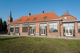
Lamswaarde is a village in the Dutch province of Zeeland. It is a part of the municipality of Hulst and lies about 23 km southwest of Bergen op Zoom.

Sint Annaparochie is a village in the municipality of Waadhoeke in Friesland, Netherlands. It lies approximately 15 km (9 mi) northwest of Leeuwarden and had approximately 4,830 inhabitants in 2021. The village is named after Saint Anne, the mother of Mary.

Den Dungen is a village in the Dutch province of North Brabant. It is located in the municipality of Sint-Michielsgestel next to the village Maaskantje.

Wanroij is a village in the Dutch province of North Brabant. It is located in the former municipality of Sint Anthonis, about 9 km west of the town of Boxmeer.
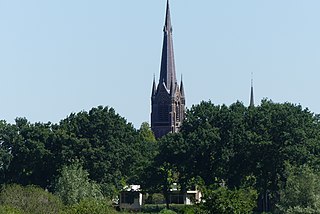
Ulvenhout is a village in the Dutch province of North Brabant. It is located in the municipality of Breda. The village was divided by the A58 motorway. The southern part belongs to the municipality of Alphen-Chaam and is called Ulvenhout AC.

Oosternieland is a village in the municipality of Het Hogeland, Groningen, the Netherlands. It is located just north of Zijldijk, along the N46 road between the city of Groningen and the Eemshaven seaport. It had a population of around 100 in January 2017.

Den Ham is a linear village in the municipality of Westerkwartier in the Netherlands province Groningen. The village lies on the road from Aduard to Saaksum.

Den Andel is a village in the municipality Het Hogeland which is part of the province Groningen in the Netherlands. It is located about 20 kilometres (12 mi) north of the city of Groningen near the Wadden Sea coast.


