
Cape Cod is a peninsula extending into the Atlantic Ocean from the southeastern corner of Massachusetts, in the northeastern United States. Its historic, maritime character and ample beaches attract heavy tourism during the summer months. The name Cape Cod, coined in 1602 by Bartholomew Gosnold, is the ninth oldest English place-name in the U.S.

Provincetown is a New England town located at the extreme tip of Cape Cod in Barnstable County, Massachusetts, in the United States. A small coastal resort town with a year-round population of 3,664 as of the 2020 United States Census, Provincetown has a summer population as high as 60,000. Often called "P-town" or "Ptown", the locale is known as a vacation destination for its beaches, harbor, artists and tourist industry.

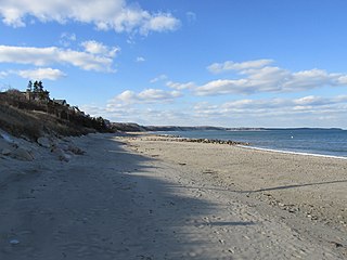
Dennis Port is a census-designated place (CDP) in the town of Dennis in Barnstable County, Cape Cod, Massachusetts, United States. At the 2010 census, its population was 3,162.

Chatham is a town in Barnstable County, Massachusetts, United States. Chatham is located at the southeastern tip of Cape Cod and has historically been a fishing community. First settled by the English in 1664, the township was originally called Monomoit based on the indigenous population's term for the region. Chatham was incorporated as a town on June 11, 1712, and has become a summer resort area. The population was 6,594 at the 2020 census and can swell to 25,000 during the summer months. There are four villages that comprise the town, those being Chatham (CDP), South Chatham, North Chatham, and West Chatham. Chatham is home to the Monomoy National Wildlife Refuge and the decommissioned Monomoy Point Light, both located on Monomoy Island. A popular attraction is the Chatham Light, which is an operational lighthouse that is operated by the United States Coast Guard.

Plymouth is a town and county seat of Plymouth County, Massachusetts, United States. Located in Greater Boston, the town holds a place of great prominence in American history, folklore, and culture, and is known as "America's Hometown". Plymouth was the site of the colony founded in 1620 by the Mayflower Pilgrims, where New England was first established. It is the oldest municipality in New England and one of the oldest in the United States. The town has served as the location of several prominent events, one of the more notable being the First Thanksgiving feast. Plymouth served as the capital of Plymouth Colony from its founding in 1620 until the colony's merger with the Massachusetts Bay Colony in 1691. The English explorer John Smith named the area Plymouth and the region 'New England' during his voyage of 1614. It was a later coincidence that, after an aborted attempt to make the 1620 trans-Atlantic crossing from Southampton, the Mayflower finally set sail for America from Plymouth, England.

Dennis is a town in Barnstable County, Massachusetts, United States, near the center of the Cape Cod peninsula. It is a seaside resort town with colonial mansions along the northern Cape Cod Bay coastline and beaches along the southern Nantucket Sound. As of the 2020 census, its population was 14,674.

Cotuit is one of the villages of the Town of Barnstable on Cape Cod in Barnstable County, Massachusetts, United States. Located on a peninsula on the south side of Barnstable about midway between Falmouth and Hyannis, Cotuit is bounded by the Santuit River to the west on the Mashpee town line, the villages of Marstons Mills to the north and Osterville to the east, and Nantucket Sound to the south. Cotuit is primarily residential with several small beaches including Ropes Beach, Riley's Beach, The Loop Beach and Oregon Beach.

Peregrine White was the first boy born on the Pilgrim ship the Mayflower in the harbour of Massachusetts, the second baby born on the Mayflower's historic voyage, and the first known English child born to the Pilgrims in America. His parents, William White and his pregnant wife Susanna, with their son Resolved White and two servants, came on the Mayflower in 1620. Peregrine White was born while the Mayflower lay at anchor in the harbor at Cape Cod. In later life, he became a person of note in Plymouth Colony, active in both military and government affairs.
Sagamore Beach is a village on Cape Cod, in the town of Bourne, Massachusetts, United States. The northern half of the Sagamore census-designated place, Sagamore Beach faces Cape Cod Bay, and the Cape Cod Canal courses through it. Along with Buzzards Bay and Bournedale, it is one of three communities that comprise the county of Barnstable.

The Cape Cod Rail Trail (CCRT) is a 25.5-mile (41.0 km) paved rail trail located on Cape Cod in Massachusetts. The trail route passes through the towns of Yarmouth, Dennis, Harwich, Brewster, Orleans, Eastham, and Wellfleet. It connects to the 6-plus mile (10 km) Old Colony Rail Trail leading to Chatham, the 2 mile Yarmouth multi-use trail, and 8 miles (13 km) of trails within Nickerson State Park. Short side trips on roads lead to national seashore beaches including Coast Guard Beach at the end of the Nauset Bike Trail in Cape Cod National Seashore. The trail is part of the Claire Saltonstall Bikeway.

Cape Cod Regional Technical High School, also known as Cape Tech, Cape Cod Tech, Lower Cape Tech, and sometimes abbreviated as CCT, is a public vocational and technical high school located in Harwich, Massachusetts, United States.
Great Herring Pond is a 376-acre (1.5 km2) warm water pond mostly located in Plymouth, Massachusetts, with the southern portion extending into Bourne. The village of Pondville in the Cedarville section of Plymouth lies on the eastern shore of the pond. The pond has an average depth of 20 ft and a maximum depth of 42 ft. The bottom is composed of sand, rubble and muck. A tire reef was installed in 1979 to provide additional fish shelter. The inflow comes from Little Herring Pond, and the outflow goes into the Herring River in Bourne. The Public Access Board gravel ramp in Bourne enters shallow water and is therefore best suited for canoes, inflatable and other shallow-draft, hand-carried craft.

The Old Indian Meeting House is a historic meeting house at 410 Meetinghouse Road in Mashpee, Massachusetts. Built in 1758, the meetinghouse is the oldest Native American church in the eastern United States. The building was listed on the National Register of Historic Places in 1998.

Henry White Cannon was a United States Comptroller of the Currency from 1884 to 1886.
Cleveland Island is a small heavily forested island located in Wakeby Pond in Mashpee, Massachusetts. It once belonged to president Grover Cleveland. Cleveland once said that Daniel Webster caught a trout near the island, and then "talked mighty strong and fine to that fish and told him what a mistake he had made, and that he would have been all right if he had left the bait alone.
Cahoon Hollow Beach is a beach in the Cape Cod National Seashore in Wellfleet, Massachusetts. It was named for the Cahoon family who had lived on the Outer Cape for many years.
Isaiah C. Inman was sheriff of Barnstable County, Massachusetts in the late 1800s. He previously served as a deputy sheriff and was a justice of the peace. Inman Road Beach in Dennis, Massachusetts is named for his family. He was buried in Swan Pond Cemetery in Dennis Port.

Susanna (Jackson) White Winslow was a passenger on the Mayflower and successively wife of fellow Mayflower passengers William White and Edward Winslow.
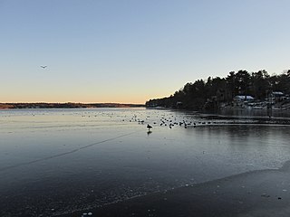
Scargo Lake is a fresh water kettle pond in Dennis, Massachusetts on Cape Cod.
