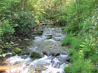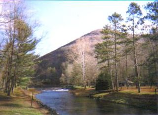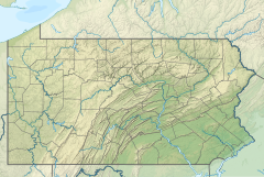
Renovo is a borough in Clinton County, Pennsylvania, United States, 28 miles (45 km) northwest of Lock Haven. In 1900, 4,082 people lived there, and in 1910, 4,621 lived there, but in the 2010 census the borough population was 1,228.

South Renovo is a borough in Clinton County, Pennsylvania, United States, located on the West Branch Susquehanna River, directly across from Renovo. The population was 439 at the 2010 census, down from 557 in 2000.

Pennsylvania Route 120 is a state highway in the Commonwealth of Pennsylvania in the United States. It stretches from U.S. Route 219 in Ridgway east to US 220 near Lock Haven.

Anderson Creek is a 23.6-mile-long (38.0 km) tributary of the West Branch Susquehanna River in Clearfield County, Pennsylvania, in the United States.

Tiadaghton State Forest is a Pennsylvania State Forest in the Pennsylvania Department of Conservation and Natural Resources, Bureau of Forestry. The forest is primarily in western and southern Lycoming County, with small portions in Clinton, Potter, Tioga, and Union Counties. The district's topography consists of narrow, flat to sloping plateaus cut by deep, steep-sloped valleys carved by fast moving mountain streams, including Pine Creek, Slate Run, and their tributaries. The Tiadaghton district extends south across the lowland along the west branch of the Susquehanna River to the narrow crests of Bald Eagle Mountain and North and South White Deer Ridge. The majority of forest cover is dominated by mixed oak forests, with some areas of northern hardwoods. The Tiadaghton State Forest is one of eight forest districts in the Pennsylvania Wilds region.

Sproul State Forest is a Pennsylvania state forest in Pennsylvania Bureau of Forestry District #10. The main offices are located in Renovo, Pennsylvania in Clinton County in the United States.
Young Womans Creek is an 11.3-mile-long (18.2 km) tributary of the West Branch Susquehanna River in Pennsylvania in the United States.

Beech Creek is a 27.3-mile-long (43.9 km) tributary of Bald Eagle Creek in Centre and Clinton counties, in Pennsylvania in the United States.

Kettle Creek is a tributary of the West Branch Susquehanna River running through Tioga, Potter, and Clinton counties, in Pennsylvania. It is slightly less than 43 miles (69 km) long. Although many streams in the Kettle Creek watershed are considered "Class A Wild Trout streams" by the Pennsylvania Fish and Boat Commission, the lower reaches of the stream experience acid mine drainage. The upper reaches of the creek are considered to be very high-quality.

Kettle Creek State Park is a 1,793-acre (726 ha) Pennsylvania state park in Leidy Township, Clinton County, Pennsylvania in the United States. The park is in a valley and is surrounded by mountains and wilderness. It features the Alvin R. Bush Dam built in 1961 by the U.S. Army Corps of Engineers as a flood control measure in the West Branch Susquehanna River basin. Many of the recreational facilities at the park were built during the Great Depression by the young men of the Civilian Conservation Corps. Kettle Creek State Park is seven miles (10 km) north of Westport and Pennsylvania Route 120. It is largely surrounded by Sproul State Forest.

Bucktail State Park Natural Area is a 16,433-acre (6,650 ha) Pennsylvania state park in Cameron and Clinton Counties in Pennsylvania in the United States. The park follows Pennsylvania Route 120 for 75 miles (121 km) between Emporium and Lock Haven. Bucktail State Park Natural Area park runs along Sinnemahoning Creek and the West Branch Susquehanna River and also passes through Renovo. The park is named for the Civil War Pennsylvania Bucktails Regiment and is primarily dedicated to wildlife viewing, especially elk.

Hyner Run State Park is a 180-acre (73 ha) Pennsylvania state park in Chapman Township, Clinton County, Pennsylvania in the United States. The park is 6 miles (9.7 km) east of Renovo and 3 miles (5 km) north of Hyner on Pennsylvania Route 120. Hyner Run State Park is surrounded by Sproul State Forest.

Hyner View State Park is a 6-acre (2.4 ha) Pennsylvania state park in Chapman Township, Clinton County, Pennsylvania in the United States. The park is 6 miles (9.7 km) east of Renovo and 3 miles (4.8 km) north of Hyner on Pennsylvania Route 120. Hyner View State Park is surrounded by Sproul State Forest.

Pennsylvania Route 144 is a state highway located in the U.S. state of Pennsylvania, covering a distance of about 109 miles (175 km). The southern terminus is located near an interchange with U.S. Route 322 (US 322) at State Route 2015 in Potter Township while the northern terminus is located at US 6 in Galeton. Between Snow Shoe and Renovo, PA 144 is known as the High Plateau Scenic Byway, a Pennsylvania Scenic Byway.

The Donut Hole Trail is a 94.2-mile (151.6 km) hiking trail in north-central Pennsylvania, through Sproul State Forest and roughly parallel to the West Branch Susquehanna River. Most of the trail is in Clinton County, with a short segment at its western end in Cameron County. The Donut Hole Trail is regarded as one of the most challenging and remote backpacking trails in Pennsylvania, encountering just six paved roads along its entire length and featuring many difficult climbs and creek crossings.
Drury Run is a tributary of the West Branch Susquehanna River in Clinton County, Pennsylvania, in the United States. It is 7.71 miles (12.41 km) long and its watershed is 11.5 square miles in area, most of which is forest. The stream's tributaries are affected by acid mine drainage, as are the lower reaches of the stream itself. It begins in Tamarack Swamp and flows through Leidy Township, Noyes Township, and Renovo. Brook trout, brown trout, creek chub, and eastern blacknose dace all inhabit the stream.

The Jack Paulhamus/Garby Trail is a 13.2-mile (21.2 km) hiking trail in north-central Pennsylvania, through portions of Sproul State Forest. It was built to connect the Donut Hole Trail and Chuck Keiper Trail. A portion of its route is concurrent with the Donut Hole Trail. The JPG is known for its significant climbing, as it features two very low points at Hyner Run and the West Branch Susquehanna River, with high ground on top of the Allegheny Plateau in between.

The Chuck Keiper Trail is a hiking trail system in north-central Pennsylvania, consisting of 50.6 linear miles of trails, forming a loop with a cross-connector through Sproul State Forest. Most of the system is in Clinton County, with a portion of the southwestern segment of the loop in Centre County. The trail is known for traversing one of the least populated regions of Pennsylvania, combining high areas on top of the Allegheny Plateau with many rugged climbs into and out of stream hollows; the trail also visits two state natural areas and two state wild areas. It is often cited as one of Pennsylvania's most remote and difficult backpacking trails.
Fish Dam Run is a 5.42 mi (8.72 km) long second-order tributary to West Branch Susquehanna River. This is the only stream of this name in the United States.


