Densmore Mills, Nova Scotia

Last updated

Densmore Mills (Also known as East Noel) is a small community in the Canadian province of Nova Scotia, located in The Municipality of the District of East Hants in Hants County.

Canada Country in North America

Canada is a country in the northern part of North America. Its ten provinces and three territories extend from the Atlantic to the Pacific and northward into the Arctic Ocean, covering 9.98 million square kilometres, making it the world's second-largest country by total area. Canada's southern border with the United States is the world's longest bi-national land border. Its capital is Ottawa, and its three largest metropolitan areas are Toronto, Montreal, and Vancouver. As a whole, Canada is sparsely populated, the majority of its land area being dominated by forest and tundra. Consequently, its population is highly urbanized, with over 80 percent of its inhabitants concentrated in large and medium-sized cities, many near the southern border. Canada's climate varies widely across its vast area, ranging from arctic weather in the north, to hot summers in the southern regions, with four distinct seasons.

Nova Scotia Province of Canada

Nova Scotia is one of Canada's three Maritime Provinces, and one of the four provinces that form Atlantic Canada. Its provincial capital is Halifax. Nova Scotia is the second-smallest of Canada's ten provinces, with an area of 55,284 square kilometres (21,300 sq mi), including Cape Breton and another 3,800 coastal islands. As of 2016, the population was 923,598. Nova Scotia is Canada's second-most-densely populated province, after Prince Edward Island, with 17.4 inhabitants per square kilometre (45/sq mi).

Hants County, Nova Scotia County in Nova Scotia, Canada

Hants County is a county in the Canadian province of Nova Scotia.

Contents

Acadians

East Noel may have been Vil Robere - first settled by the Robert Henry family. Dwellings marked on contemporaneous maps suggest that the village around the Noel Bay was much larger than any other along the shore. These maps suggest that around the Noel Bay there may have been two villages - Vil Noel to the west and Vil Robere to the east in present-day East Noel (also known as Densmore Mills, Nova Scotia). The fact that Vil Robere was the first village established might lend itself to the strong possibility that Noel Doiron would likely have joined his brother-in-law in the Noel Bay, which also suggests that Vil Robere is East Noel.

Alternatively, there is evidence to suggest that Vil Robere is Selma, Nova Scotia.

Selma, Nova Scotia human settlement in Canada

Selma is a small community in the Canadian province of Nova Scotia, located in The Municipality of the District of East Hants in Hants County.

Ulster Scots (Irish)

After the exodus of the Acadians, Francis Densmore was the first to settle the community on the east side of the Noel Bay twenty two years later (1772). The year prior, Timothy O'Brien has begun to settle the west side of the Noel Bay, now known as Noel, Nova Scotia. Francis and his wife Sarah had the following inscription written on their tombstone in East Noel: "Frank and Sarah were the first settlers of this Place)."

Noel, Nova Scotia human settlement in Canada

Noel is a community in the Canadian province of Nova Scotia, located in the Municipal District of East Hants, which is in Hants County, Nova Scotia. The community is most well known for being named after its most prominent resident Noël Doiron and for ship building in the nineteenth century. Noel Doiron is the namesake of the village as well as the surrounding communities of Noel Shore, Nova Scotia, East Noel, Noel Road, Nova Scotia, North Noel Road, Nova Scotia. The earliest recorded reference to the community of "Noel" was by surveyor Charles Morris in 1752. Prior to that date, the area is referred to as "Trejeptick", which first appears in the Colonial Office minutes of Annapolis Royal in 1734. Noel was also the home of the Osmond O'Brien Shipyard.

Related Research Articles

Bass River, Nova Scotia human settlement in Canada

Bass River is an unincorporated rural community in western Colchester County, north-central Nova Scotia, in the Maritimes of Canada. It is shares the name of the river located there, that flows into Cobequid Bay.

Municipality of the District of East Hants District municipality in Nova Scotia, Canada

East Hants, officially named the Municipality of the District of East Hants, is a district municipality in Hants County, Nova Scotia, Canada. Statistics Canada classifies the district municipality as a municipal district.

Hantsport Community in Nova Scotia, Canada

Hantsport is a Canadian community located in Hants County, Nova Scotia. It is administratively part of the Municipality of the District of West Hants.

Milford Station, Nova Scotia human settlement in Canada

Milford Station is a Canadian village in Nova Scotia's East Hants municipal district in the Shubenacadie Valley.

Aspotogan Peninsula peninsula

The Aspotogan Peninsula is a peninsula in the eastern part of Lunenburg County, Nova Scotia, separating St. Margarets Bay in the east from Mahone Bay in the west. The peninsula was originally settled by second generation French immigrants on the east side and by second generation German immigrants on the west side. Traditionally fishing was a major industry for communities throughout the peninsula, however other primary industries such as farming and forestry were historically important as well. Shipping and shipbuilding were secondary and tertiary industries that also came into prominence during the 19th and early 20th centuries.

Nova Scotia Route 215 highway in Nova Scotia

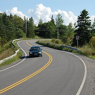
Route 215 is collector road in the Canadian province of Nova Scotia.

Gore, Nova Scotia human settlement in Canada

Gore is a rural Canadian community in central Hants County, Nova Scotia. It is located just 25 minutes from Elmsdale; 30 minutes from Halifax Stanfield International Airport; and 45 minutes from Truro. It was named after Sir Charles Stephen Gore. The community was settled primarily by the 84th Regiment of Foot.

Burntcoat Head, Nova Scotia human settlement in Canada

Burntcoat Head is an unincorporated rural Canadian community in Hants County, Nova Scotia and is known internationally as the site where it was officially recorded that the Bay of Fundy, and specifically Burntcoat, has the highest tides in the world.

Maitland, Hants County, Nova Scotia village in the East Hants, Nova Scotia

Maitland, East Hants, Nova Scotia is a village in the East Hants, Nova Scotia municipal district, and home to the historic Lawrence House Museum, part of the Nova Scotia Museum. The community was part of the Douglas Township until it was named Maitland after Governor General of Nova Scotia Peregrine Maitland (1828–34), when building the Shubenacadie Canal was first attempted (1826–1831). The Canal was supposed to start at Maitland, Nova Scotia and run through the province to Maitland Street, Dartmouth, the canal being "bookended" by two "Maitland" landmarks.

Kennetcook human settlement in Canada

Kennetcook is a community in the Canadian province of Nova Scotia, located in the Municipal District of East Hants. Also see adjacent community of Upper Kennetcook.

Gormanville, Nova Scotia human settlement in Canada

Gormanville is a community in the Canadian province of Nova Scotia, located in the Municipal District of East Hants in Hants County. The same families of Ulster Scots people, the Densmores and O'Briens, who had earlier settled Noel, Nova Scotia were the first to settle the area. The community was named much later after Matthew Gorman (1884). His two sons died young at age 22 and 27 and are buried in the Saint Francis Xavier Roman Catholic Cemetery, in Maitland, Hants County, Nova Scotia.

Noel Shore, Nova Scotia human settlement in Canada

Noel Shore is a community in the Canadian province of Nova Scotia, located in the Municipal District of East Hants. The community is named after Noel Doiron and may have originally been named Vil Robere. Acadians left the area during the Acadian Exodus (1710). Birthplace of one of the famous "Miller Brothers", Harry Herbert Miller winner of the American Medal of Honor for actions during the Spanish–American War. His brother Willard Miller was born in the neighbouring community of Maitland, Nova Scotia.

Mount Denson human settlement in Canada

Mount Denson is a small community in the Canadian province of Nova Scotia, located in The Municipality of the District of West Hants in Hants County. The community is named after Mount Denson; the mid-eighteenth-century estate of Henry Denny Denson.

North Noel Road, Nova Scotia human settlement in Canada

North Noel Road is a small community in the Canadian province of Nova Scotia, located in The Municipality of the District of East Hants in Hants County. The community is named after Noel Doiron.

Noel Road, Nova Scotia human settlement in Canada

Noel Road is a small community in the Canadian province of Nova Scotia, located in The Municipality of the District of East Hants in Hants County. The community is named after Noel Doiron.

Douglas is a former township in the Canadian province of Nova Scotia. The township was the eventual destination of Loyalists fleeing the Siege of Ninety Six during the American Revolutionary War. In 1861, along with the township of Rawdon, Nova Scotia, the Douglas township became part of the newly formed Municipal District of East Hants, along with neighbouring townships.

References

Coordinates: 45°18′14.37″N63°42′11.96″W / 45.3039917°N 63.7033222°W / 45.3039917; -63.7033222 (Densmore Mills, Nova Scotia)

Geographic coordinate system Coordinate system

A geographic coordinate system is a coordinate system that enables every location on Earth to be specified by a set of numbers, letters or symbols. The coordinates are often chosen such that one of the numbers represents a vertical position and two or three of the numbers represent a horizontal position; alternatively, a geographic position may be expressed in a combined three-dimensional Cartesian vector. A common choice of coordinates is latitude, longitude and elevation. To specify a location on a plane requires a map projection.