Deori, Bilaspur district

Last updated

See Deori (disambiguation) for disambiguation

Deori
city
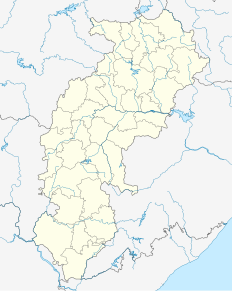
India Chhattisgarh location map.svg
Red pog.svg
Deori
Location in Chhattisgarh, India
India location map.svg
Red pog.svg
Deori
Deori (India)
Coordinates: 21°27′N82°37′E / 21.45°N 82.62°E / 21.45; 82.62 Coordinates: 21°27′N82°37′E / 21.45°N 82.62°E / 21.45; 82.62
CountryFlag of India.svg  India
State Chhattisgarh
District Bilaspur
Elevation 247 m (810 ft)
Population (2001)
  Total 11,636
Languages
  Official Hindi, Chhattisgarhi
Time zone IST (UTC+5:30)
Vehicle registration CG

Deori is a census town in Bilaspur district in the state of Chhattisgarh, India.

A census town is a type of town that satisfies certain characteristics, depending on the country in which it is located.
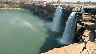
Chhattisgarh Central-east state in India

Chhattisgarh is one of the 29 states of India, located in the centre-east of the country. It is the tenth-largest state in India, with an area of 135,191 km2 (52,198 sq mi). With a 2011 population of 25.5 million, Chhattisgarh is the 16th-most populated state in the country. A resource-rich state, it is a source of electricity and steel for the country, accounting for 15% of the total steel produced. Chhattisgarh is one of the fastest-developing states in India.

India Country in South Asia

India, also known as the Republic of India, is a country in South Asia. It is the seventh largest country by area and with more than 1.3 billion people, it is the second most populous country as well as the most populous democracy in the world. Bounded by the Indian Ocean on the south, the Arabian Sea on the southwest, and the Bay of Bengal on the southeast, it shares land borders with Pakistan to the west; China, Nepal, and Bhutan to the northeast; and Bangladesh and Myanmar to the east. In the Indian Ocean, India is in the vicinity of Sri Lanka and the Maldives, while its Andaman and Nicobar Islands share a maritime border with Thailand and Indonesia.

Contents

Geography

Deori is located at 21°27′N82°37′E / 21.45°N 82.62°E / 21.45; 82.62 . [1] It has an average elevation of 247 metres (810  feet).

Demographics

As of 2001 India census, [2] Deori had a population of 11,636. Males constitute 52% of the population and females 48%. Deori has an average literacy rate of 62%, higher than the national average of 59.5%: male literacy is 72% and, female literacy is 52%. In Deori, 16% of the population is under 6 years of age.

Related Research Articles

Baldeogarh city in Madhya Pradesh, India

Baldeogarh is a town and a nagar panchayat in Tikamgarh district in the state of Madhya Pradesh, India.

Bikihakola Census Town in West Bengal, India

Bikihakola is a census town in Panchla CD Block of Howrah Sadar subdivision in Howrah district in the state of West Bengal, India.

Bishnah town in Jammu and Kashmir, India

Bishnah is a town and a notified area committee in Jammu district in the state of Jammu & Kashmir, India.

Dhamdha city in Chhattisgarh, India

The city of Dhamdha is situated in the district of Durg in the state of Chhattisgarh, India.

Jawar city in Madhya Pradesh, India

Jawar is a town and a nagar panchayat in Sehore district in the Indian state of Madhya Pradesh.

Kadipur Town in Uttar Pradesh, India

Kadipur is a town and a nagar panchayat (tehsil) in Sultanpur district in the Indian state of Uttar Pradesh.

Kalikapur, India city in Jharkhand, India

Kalikapur is a census town in Pashchimi Singhbhum district in the Indian state of Jharkhand.

Katra, Gonda city in Uttar Pradesh, India

Katra is a town and a nagar panchayat in Gonda district in the Indian state of Uttar Pradesh.

Kharod city in Chhattisgarh, India

Kharod is a town and a nagar panchayat in Janjgir-Champa district in the Indian state of Chhattisgarh.

Kishangarh Bas city in Rajasthan, India

Kishangarh Bas is a census town in Alwar district in the Indian state of Rajasthan.

Mohgaon city in Madhya Pradesh, India

Mohgaon is a town and a nagar parishad in Chhindwara district in the Indian state of Madhya Pradesh.

Palera city in Madhya Pradesh, India

Palera is a town and a nagar panchayat in Tikamgarh district in the Indian state of Madhya Pradesh.

Phulpur, Allahabad Town Area in Uttar Pradesh, India

Phulpur is a town area in Allahabad district in the Indian state of Uttar Pradesh. It is known for being the Lok Sabha seat from which Jawaharlal Nehru got elected to the Indian Parliament. Phulpur is Lok Sabha and Vidhan Sabha seat both.

Raghunathpur, Buxar Village in Bihar, India

Raghunathpur is a census town in Buxar District in the Indian state of Bihar.

Ranapur city in Madhya Pradesh, India

Ranapur is a town and a nagar panchayat in Jhabua district in the Indian state of Madhya Pradesh.

Theog Town in Himachal Pradesh, India

Theog is a town and a municipal committee as well as a tehsil in Shimla district in the Indian state of Himachal Pradesh. First settlements were in 1902.

Jamul, Durg city in Chhattisgarh, India

Jamul is a town and a nagar panchayat in Durg district in the Indian state of Chhattisgarh.

Deori, Sagar city in Madhya Pradesh, India

Deori is a historical city is situated on the banks of river Sukhchain, on the Narsinghpur Sagar road. Deori is a municipality under Sagar district in the state of Madhya Pradesh, India.

Deori, Shahdol city in Madhya Pradesh, India

See Deori (disambiguation) for disambiguation

Fatehabad, Haryana Town in Haryana, India

Fatehabad is a town and a municipal committee in Fatehabad district in the state of Haryana, India.

References