Derwent Rural District

Last updated

Derwent was a rural district in the East Riding of Yorkshire from 1935 to 1974. [1]

Rural districts were a type of local government area – now superseded – established at the end of the 19th century in England, Wales, and Ireland for the administration of predominantly rural areas at a level lower than that of the administrative counties.

East Riding of Yorkshire County of England

The East Riding of Yorkshire, or simply East Riding, is an area in Northern England and can refer either to the administrative county of the East Riding of Yorkshire which is a unitary authority, to the ceremonial county (Lieutenancy) of the East Riding of Yorkshire or to the easternmost of the three subdivisions (ridings) of the traditional county of Yorkshire.

It was created under a County Review Order in 1935, from most of the Escrick Rural District and the Riccal Rural District, and part of the Howden Rural District. [1]

Local Government Act 1929 United Kingdom legislation

The Local Government Act 1929 was an Act of the Parliament of the United Kingdom that made changes to the Poor Law and local government in England and Wales.

Escrick was a rural district in the East Riding of Yorkshire from 1894 to 1935.

Riccal was a rural district in the East Riding of Yorkshire, England from 1894 to 1935.

It was abolished in 1974 under the Local Government Act 1972, going on to form part of the district of Selby of North Yorkshire. Several parishes in the area were transferred from Selby to the City of York in 1996.

Local Government Act 1972 United Kingdom legislation

The Local Government Act 1972 is an Act of the Parliament of the United Kingdom that reformed local government in England and Wales on 1 April 1974.

North Yorkshire County of England

North Yorkshire is a non-metropolitan county and largest ceremonial county in England. It is located primarily in the region of Yorkshire and the Humber but partly in the region of North East England. The estimated population of North Yorkshire was 602,300 in mid-2016.
Related Research Articles

Haltemprice human settlement in United Kingdom

Haltemprice is an area in the East Riding of Yorkshire, England, directly to the west of Hull. Originally an extra-parochial area, it became a civil parish in 1858, in 1935 it was expanded by the combination of the urban districts of Cottingham, Anlaby, and Sculcoates to form a new urban district; the district included the villages of Anlaby, Cottingham, Hessle, Kirk Ella, Skidby, West Ella and Willerby. Urban districts were abolished 1974.

Selby District District in England

Selby District is a local government district of North Yorkshire, England. The local authority, Selby District Council, is based in the town of Selby and provides services to an area which includes Tadcaster and a host of villages. The Local Authority had a population of 83,449 at the 2011 Census. It is the southern most district of North Yorkshire, and it borders the City of York, a unitary authority, the districts of the City of Leeds and the City of Wakefield, in West Yorkshire, the town of Doncaster, in South Yorkshire, the ceremonial county of the East Riding of Yorkshire, and the Borough of Harrogate.

Wharfedale was a rural district in the West Riding of Yorkshire from 1894 to 1974. It comprised the northern side of lower Wharfedale, the lower Washburn Valley and several parishes between Leeds and the River Wharfe. Until 1937 it also included a detached part, the parish of Esholt north of Bradford.

Bridlington was a rural district in the East Riding of Yorkshire in England from 1894 to 1974. It covered a coastal area, and surrounded the municipal borough of Bridlington on its land borders. The district covered Flamborough and Flamborough Head.

Howden was a rural district in the East Riding of Yorkshire, England from 1894 to 1974.

Holderness was a rural district in the East Riding of Yorkshire from 1935 to 1974. It covered the southern part of the East Riding's North Sea coast.

Norton was a rural district in the East Riding of Yorkshire from 1894 to 1974. It was based on the small town of Norton-on-Derwent, and was formed under the Local Government Act 1894 from that part of the Malton rural sanitary district which was in the East Riding.

Goole was a rural district in the West Riding of Yorkshire, England from 1894 to 1974.

Beverley was a rural district in the East Riding of Yorkshire, England from 1894 to 1974.

Ouse and Derwent human settlement in United Kingdom

Ouse and Derwent was a wapentake of the historic East Riding of Yorkshire, England consisting of the westerly part of the county, between the River Ouse and the River Derwent. Established in medieval times, it ceased to have much significance in the 19th century when the wapentakes were superseded by other administrative divisions for most local government purposes.

Driffield was a rural district in the East Riding of Yorkshire in England from 1894 to 1974. It surrounded the municipal borough of Driffield.

Patrington Rural District

Patrington was a rural district in the East Riding of Yorkshire, England from 1894 to 1935.

Pocklington was a rural district in the East Riding of Yorkshire, England from 1894 to 1974.

Sculcoates was a rural district in the East Riding of Yorkshire, England from 1894 to 1935.

Skirlaugh was a rural district in the East Riding of Yorkshire, England from 1894 to 1935.

Sherburn was a rural district in the East Riding of Yorkshire from 1894 to 1935. It was formed under the Local Government Act 1894 from that part of the Scarborough rural sanitary district which was in the East Riding.

Chorley Rural District was a rural district in the administrative county of Lancashire, England from 1894 to 1974.

Wayland Rural District

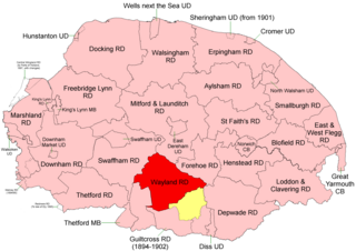
Wayland Rural District was a rural district in Norfolk, England from 1894 to 1974.

References

  1. 1 2 "Relationships / unit history of Derwent RD". A Vision of Britain Through Time. Great Britain Historical GIS Project. Archived from the original on 14 May 2011. Retrieved 23 July 2009.

The Great Britain Historical GIS, is a spatially enabled database that documents and visualises the changing human geography of the British Isles, although is primarily focussed on the subdivisions of the United Kingdom mainly over the 200 years since the first census in 1801. The project is currently based at the University of Portsmouth, and is the provider of the website A Vision of Britain through Time.


Coordinates: 53°50′56″N0°59′17″W / 53.849°N 0.988°W / 53.849; -0.988

Geographic coordinate system Coordinate system

A geographic coordinate system is a coordinate system that enables every location on Earth to be specified by a set of numbers, letters or symbols. The coordinates are often chosen such that one of the numbers represents a vertical position and two or three of the numbers represent a horizontal position; alternatively, a geographic position may be expressed in a combined three-dimensional Cartesian vector. A common choice of coordinates is latitude, longitude and elevation. To specify a location on a plane requires a map projection.