Strahovice is a village in Moravian-Silesian Region of the Czech Republic. It is part of micro-region Hlučínsko. It has around 900 inhabitants.

Křičeň is a village in the Pardubice Region of the Czech Republic. It has around 240 inhabitants.

Rogoźno is a town in Poland, in Greater Poland Voivodeship, about 40 km north of Poznań. Its population is 11,337 (2010). It is the seat of the administrative district (gmina) called Gmina Rogoźno.

Seidli is a village in the Agdam Rayon of Azerbaijan.

Zagorzyce is a village in the administrative district of Gmina Miechów, within Miechów County, Lesser Poland Voivodeship, in southern Poland. It lies approximately 4 kilometres (2 mi) north-west of Miechów and 36 km (22 mi) north of the regional capital Kraków.

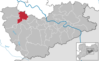
Wurgwitz is a district of the Saxon city Freital in Sächsische Schweiz-Osterzgebirge district.
Nowa Sucha is a village in the administrative district of Gmina Grębków, within Węgrów County, Masovian Voivodeship, in east-central Poland.
Aniołka Pierwsza is a village in the administrative district of Gmina Trzcinica, within Kępno County, Greater Poland Voivodeship, in west-central Poland.
Olszyna is a village in the administrative district of Gmina Rogoźno, within Oborniki County, Greater Poland Voivodeship, in west-central Poland.
Trzebieszyno (Klaryszewo) is a village in Gmina Miastko, Bytów County, Pomeranian Voivodeship, in northern Poland. It lies approximately 23 kilometres (14 mi) south-west of Bytów and 71 km (44 mi) south-west of Gdańsk.
Redwanki is a village in the administrative district of Gmina Ustka, within Słupsk County, Pomeranian Voivodeship, in northern Poland. It lies approximately 10 kilometres (6 mi) east of Ustka, 15 km (9 mi) north of Słupsk, and 109 km (68 mi) west of the regional capital Gdańsk.
Nowa Wieś is a village in the administrative district of Gmina Rybno, within Działdowo County, Warmian-Masurian Voivodeship, in northern Poland. It lies approximately 5 kilometres (3 mi) east of Rybno, 22 km (14 mi) north-west of Działdowo, and 55 km (34 mi) south-west of the regional capital Olsztyn.
Międzylesie is a village in the administrative district of Gmina Ostróda, within Ostróda County, Warmian-Masurian Voivodeship, in northern Poland. It lies approximately 4 kilometres (2 mi) north-east of Ostróda and 34 km (21 mi) west of the regional capital Olsztyn.
Bożniewice is a village in the administrative district of Gmina Bobolice, within Koszalin County, West Pomeranian Voivodeship, in north-western Poland. It lies approximately 12 kilometres (7 mi) north-west of Bobolice, 26 km (16 mi) south-east of Koszalin, and 138 km (86 mi) north-east of the regional capital Szczecin.

Weißig is a municipal subdivision of Freital in Sächsische Schweiz-Osterzgebirge district. It consists of two other villages, Oberweißig and Unterweißig.

Somsdorf is a municipal subdivision of Freital in Sächsische Schweiz-Osterzgebirge district. It lies in the west of Freital, between the Rote Weißeritz and the Wilde Weißeritz.
Lahe is a village in Haljala Parish, Lääne-Viru County, in northeastern Estonia.
The Dresden–Werdau railway is an electrified, double-track main line in the German state of Saxony. It runs from Dresden via Freiberg, Chemnitz and Zwickau to Werdau wye, where it joins the Leipzig-Hof railway.
August Pieper was a German architect, active in Dresden, Cologne and Hamburg. His brother was the engineer Carl Pieper (1842–1901), who also lived and worked in Hamburg in the 1880s.