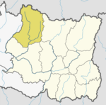
Solukhumbu District (Nepali: सोलुखुम्बु जिल्ला[solukʰumbu], Sherpa: ཤར་ཁུམ་བུ་རྫོང་།, Wylie: shar khum bu dzong) is one of 14 districts of Province No. 1 of eastern Nepal. As the name suggests, it consists of the subregions Solu and Khumbu.
Bapha is a village development committee in Solukhumbu District in the Sagarmatha Zone of north-eastern Nepal. At the time of the 1991 Nepal census it had a population of 3,031 people living in 579 individual households.
Basa, Nepal is a village development committee in Solukhumbu District in the Sagarmatha Zone of north-eastern Nepal. At the time of the 1991 Nepal census it had a population of 3256.
Beni is a village development committee in Solukhumbu District in the Sagarmatha Zone of north-eastern Nepal. At the time of the 1991 Nepal census it had a population of 1927 people living in 352 individual households.
Bhakanje is a village development committee in Solukhumbu District in the Sagarmatha Zone of north-eastern Nepal. At the time of the 1991 Nepal census it had a population of 1188 people living in 226 individual households.
Tingla is a village development committee in Solukhumbu District in the Sagarmatha Zone of north-eastern Nepal. At the time of the 1991 Nepal census it had a population of 3,738 people living in 710 individual households.
Chaulakharka is a village development committee in Solukhumbu District in the Sagarmatha Zone of north-eastern Nepal. At the time of the 1991 Nepal census it had a population of 1839 people living in 372 individual households.

Chaurikharka is a village development committee in Solukhumbu District in the Sagarmatha Zone of northeastern Nepal. At the time of the 1991 Nepal census it had a population of 2422 people living in 502 individual households.
Chheskam is a village development committee in Solukhumbu District in the Sagarmatha Zone of north-eastern Nepal. At the time of the 1991 Nepal census it had a population of 2824 people living in 641 individual households.
Goli is a village development committee in Solukhumbu District in the Sagarmatha Zone of north-eastern Nepal. At the time of the 1991 Nepal census it had a population of 2276 people living in 455 individual households.
Gudel is a village development committee in Solukhumbu District in the Sagarmatha Zone of north-eastern Nepal. At the time of the 1991 Nepal census it had a population of 3489 people living in 712 individual households. The people are part of the Kulung culture. The village is the home of Mauli Dhan featured in a set of videos and an article for National Geographic as the Last Honey Hunter. The last to maintain the traditional practice of dangerously retrieving hallucinogenic honey from hives on the walls of local cliffs. It is not well-connected with roads and transport.
Jubu is a village development committee in Solukhumbu District in the Sagarmatha Zone of north-eastern Nepal. At the time of the 1991 Nepal census it had a population of 3544 people living in 706 individual households.
Kaku, Nepal is a village development committee in Solukhumbu District in the Sagarmatha Zone of north-eastern Nepal. At the time of the 1991 Nepal census it had a population of 3896 people living in 750 individual households.
Kangel is a village development committee in Solukhumbu District in the Sagarmatha Zone of north-eastern Nepal. At the time of the 1991 Nepal census it had a population of 2087 people living in 416 individual households.
Loding Tamakhani is a village development committee in Solukhumbu District in the Sagarmatha Zone of north-eastern Nepal. At the time of the 1991 Nepal census it had a population of 1157.
Mukli is Headquarter of Thulung Dudhkoshi Rural Municipality, Ward No. 6 formerly a Village Development Committee in Solukhumbu District in the Sagarmatha Zone of north-eastern Nepal. At the time of the 1991 Nepal census it had a population of 2651 people living in 501 individual households.
Necha Batase is a village development committee in Solukhumbu District in the Sagarmatha Zone of north-eastern Nepal. At the time of the 1991 Nepal census it had a population of 3522 people living in 680 individual households.
Nele is a village development committee in Solukhumbu District in the Sagarmatha Zone of north-eastern Nepal. At the time of the 1991 Nepal census it had a population of 2021 people living in 364 individual households.
Panchan, Nepal is a village development committee in Solukhumbu District in the Sagarmatha Zone of north-eastern Nepal. At the time of the 1991 Nepal census it had a population of 1698 people living in 318 individual households.

Salyan, Solukhumbu is a village development committee in Solukhumbu District in the Sagarmatha Zone of north-eastern Nepal. At the time of the 1991 Nepal census it had a population of 5307 people living in 1034 individual households. It has been merged into Necha Salyan Gaupalika.