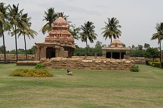
Tirunelveli district is a district of Tamil Nadu state in South India. It is the largest district in terms of area with Tirunelveli as its headquarters. Tirunelveli District was formed on 1 September 1790 by the British East India Company, and comprised the present Tirunelveli and Thoothukudi districts and parts of Virudhunagar and Ramanathapuram district. As of 2011, the district had a population of 3,077,233.

Desur is a Town panchayat in Tiruvanamalai district in the Indian state of Tamil Nadu.

Kangeyam is a second grade municipality in Kangeyam taluk of Tirupur district in the Indian state of Tamil Nadu. It is situated on National Highway 67. Kangeyam is a commercial center in Tamil Nadu with the main commercial interests being rice hulling, coconut oil extraction, Ghee production and groundnut cultivation.The town is located at the distance of 28 km from the district headquarters Tiruppur,45 km from the Erode and 70 km from the industrial town of Coimbatore.

Kayathar is a panchayat town in Thoothukudi district in the Indian state of Tamil Nadu. It is situated along National Highway 7 (NH7) between Tirunelveli and Kovilpatti.

Nangavalli is a panchayat town in Salem district in the Indian state of Tamil Nadu.

Palakkodu is a panchayat town in Dharmapuri district in the Indian state of Tamil Nadu.

Pallipattu is a town in Tiruvallur district in the state of Tamil Nadu, India. It is located 113 kilometres from Chennai, 40 kilometres from Chittoor, 51 kilometres from Tirupathi, 36 kilometres from Tiruttani, 50 kilometres from Arakkonam and border place of the state of Andhra Pradesh

Puzhal is a town in Chennai district in the Indian state of Tamil Nadu. The town is well known for Puzhal central prison. Puzhal is located on the banks of Puzhal Lake.
Vedasandur is a panchayat town in Dindigul district Located at Madurai Region Indian state of Tamil Nadu. Vedasandur town is 21 km from Dindigul city, and 82 km From Madurai Metropolitan City.

Naluvedapathy is a coastal village in the Indian state of Tamil Nadu. It is located in the Vedaranyam taluk of the Nagapattinam district. It sits on the mouth of the Addapar River. Based on the 2001 census in India and numerous village and tsunami censuses after the 2004 Indian Ocean tsunami, it has a population of approximately 4500 people, most of whom lower middle class and intermediate caste. The village's primary businesses, like other villages on the coast of Tamil Nadu, are farming and fishing. The entire Nagapattinam district was severely affected by the Indian Ocean tsunamis, however, Naluvedapathy emerged virtually unscathed. This was due to the presence of a very large windbreak planted by inhabitants of the region in 2002.

Uthukottai is a border town and panchayat town in Tamil Nadu, next to Andhra Pradesh, located on the banks of the Arani river. The town features a channel which helps to direct water from the Krishna river for local irrigation.
Keelakolathur is a village in the Ariyalur taluk of Ariyalur district, Tamil Nadu, India.

Poondi is a village in the Thiruvallur taluk of Tiruvallur district, Tamil Nadu, India. It has a has fresh water lake to cater the daily needs of water for Chennai area. The place is also known for Oondreswarar Temple, which was displaced to its current location to ease the construction of the reservoir.

Local Bodies in Tamil Nadu constitute the three tier administration set-up in the South Indian state of Tamil Nadu. It is a system of local government which forms the last level from the Centre. Chennai Corporation in the then Madras Presidency, established in 1688, is the oldest such Local Body not only in India but also in any commonwealth nations outside United Kingdom.

Kovilambakkam is a village which is located within Kancheepuram district, Tamil Nadu, India. It is administered by the Kovilambakkam Village Panchayat, which is under control of the St.Thomas Mount Panchayat Union and Tambaram Taluk.

Vadamadurai is a panchayat village in Thiruvallur district in the Indian state of Tamil Nadu.

Elavur is a village in the Tiruvallur district of Tamil Nadu, India. It is located in the Gummidipoondi taluk. It is located in the Andhra Pradesh Border..It is the Gateway of Tamil Nadu.

Puduvoyal is a village panchayat located in the Thiruvallur district of Indian state of Tamil Nadu.


