The Ausable River, also known as AuSable River and originally written as "Au Sable", runs in the U.S. state of New York, from the Adirondack Mountains and past the village of Lake Placid and Au Sable Forks to empty into Lake Champlain. It has an East and West branch that join at Au Sable Forks. The river forms a partial boundary between Clinton County and Essex County. The Ausable River is known for its gorge, Ausable Chasm, located a few miles east of Keeseville.

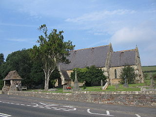
Wick is a village in South Gloucestershire, England. It is the main settlement in the civil parish of Wick and Abson. The population of this civil parish taken at the 2011 census was 1,989.

Stebník is a village and municipality in the Bardejov District in the Prešov Region of northeast Slovakia.
Merakamudidam is a village in Vizianagaram district of the Indian state of Andhra Pradesh, India.

Pleșcuța, a commune in Arad County, Romania, is situated in the Hălmagiu Basin, at the foot of Codru-Moma Mountains and Metaliferi Mountains, along the upper course of the Crișul Alb River. It is connected with the Gurahonț Basin by the epigenetic defile of the Crișul Alb existing between Pleșcuța and Gurahonț. The commune stretches over 7000 hectares and is composed of seven villages: Aciuța (Acsuca), Budești (Bugyfalva), Dumbrava (Körösdombró), Gura Văii (Vojkaháza), Pleșcuța, Rostoci (Rosztócs) and Tălagiu (Talács).

Piszczatka is a village in the administrative district of Gmina Nurzec-Stacja, within Siemiatycze County, Podlaskie Voivodeship, in north-eastern Poland, close to the border with Belarus. It lies approximately 11 kilometres (7 mi) south-east of Nurzec-Stacja, 26 km (16 mi) east of Siemiatycze, and 78 km (48 mi) south of the regional capital Białystok.

Witoldów is a village in the administrative district of Gmina Widawa, within Łask County, Łódź Voivodeship, in central Poland. It lies approximately 4 kilometres (2 mi) south-west of Widawa, 25 km (16 mi) south-west of Łask, and 57 km (35 mi) south-west of the regional capital Łódź.

Digov is a village in the Lerik Rayon of Azerbaijan. The village forms part of the municipality of Mistan.

Dervishalikyshlak is a village in the Khachmaz Rayon of Azerbaijan.

Padar is a village in the Qubadli Rayon of Azerbaijan.
Grudzeń-Kolonia is a village in the administrative district of Gmina Sławno, within Opoczno County, Łódź Voivodeship, in central Poland.

Biechów is a village in the administrative district of Gmina Pacanów, within Busko County, Świętokrzyskie Voivodeship, in south-central Poland. It lies approximately 5 kilometres (3 mi) south-west of Pacanów, 22 km (14 mi) south-east of Busko-Zdrój, and 62 km (39 mi) south-east of the regional capital Kielce.

Skotniki Górne is a village in the administrative district of Gmina Wiślica, within Busko County, Świętokrzyskie Voivodeship, in south-central Poland. It lies approximately 9 kilometres (6 mi) north of Wiślica, 8 km (5 mi) south-west of Busko-Zdrój, and 52 km (32 mi) south of the regional capital Kielce.
Bielawy is a village in the administrative district of Gmina Gostynin, within Gostynin County, Masovian Voivodeship, in east-central Poland.
Nowa Wieś is a village in the administrative district of Gmina Rząśnik, within Wyszków County, Masovian Voivodeship, in east-central Poland.

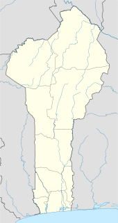
Sinendé is a town, arrondissement, and commune in the Borgou Department of central Benin. The commune covers an area of 2289 square kilometres and as of 2002 had a population of 63,373 people.
Đông Hưng is a commune (xã) and village in Lục Nam District, Bắc Giang Province, in northeastern Vietnam.

Babin Kal is a village in the municipality of Bela Palanka, Serbia. According to the 2002 census, the village has a population of 51 people. Babin Kal at one time had a set of tennis courts, notable as the location for big serving Ivo Karlović's first junior tournament win, a victory somewhat tarnished by a fine he received for inadvertently exposing himself during his exuberant celebrations.
Vojnovec Kalnički is a village in Croatia.
The Dharasu Power Station is a run-of-the-river hydroelectric power station on the Bhagirathi River located at Dharasu in Uttarkashi district, Uttarakhand, India. The power station was commissioned in 2008 and has a 304 MW capacity.


