
The Bay of Bengal is the northeastern part of the Indian Ocean. The world's largest bay, geographically it is positioned between the Indian subcontinent and the Indochinese peninsula, located below the Bengal region.

Bangladesh is a densely populated, low-lying, mainly riverine country located in South Asia with a coastline of 580 km (360 mi) on the northern littoral of the Bay of Bengal. The delta plain of the Ganges (Padma), Brahmaputra (Jamuna), and Meghna Rivers and their tributaries occupy 79 percent of the country. Four uplifted blocks occupy 9 percent and steep hill ranges up to approximately 1,000 metres (3,300 ft) high occupy 12 percent in the southeast and in the northeast. Straddling the Tropic of Cancer, Bangladesh has a tropical monsoon climate characterised by heavy seasonal rainfall, high temperatures, and high humidity. Natural disasters such as floods and cyclones accompanied by storm surges periodically affect the country. Most of the country is intensively farmed, with rice the main crop, grown in three seasons. Rapid urbanisation is taking place with associated industrial and commercial development. Exports of garments and shrimp plus remittances from Bangladeshis working abroad provide the country's three main sources of foreign exchange income.

The Ganges Delta is a river delta predominantly covering the Bengal region of the Indian subcontinent, consisting of Bangladesh and the Indian state of West Bengal. It is the world's largest river delta and it empties into the Bay of Bengal with the combined waters of several river systems, mainly those of the Brahmaputra River and the Ganges River. It is also one of the most fertile regions in the world, thus earning the nickname the Green Delta. The delta stretches from the Hooghly River in the west as far as the Meghna River in the east.

The Sundarbans National Park is a national park in West Bengal, India, and core part of tiger reserve and biosphere reserve. It is part of the Sundarbans on the Ganges Delta and adjacent to the Sundarban Reserve Forest in Bangladesh. It is located to south-west of Bangladesh. The delta is densely covered by mangrove forests, and is one of the largest reserves for the Bengal tiger. It is also home to a variety of bird, reptile and invertebrate species, including the salt-water crocodile. The present Sundarban National Park was declared as the core area of Sundarban Tiger Reserve in 1973 and a wildlife sanctuary in 1977. On 4 May 1984 it was declared a national park. It is a UNESCO World Heritage Site inscribed in 1987, and it has been designated as a Ramsar site since 2019. It is considered as a World Network of Biosphere Reserve from 1989.
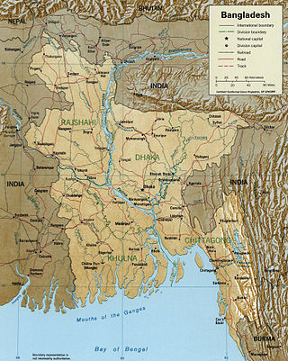
The Meghna is one of the major rivers in Bangladesh, one of the three that form the Ganges Delta, the largest delta on earth, which fans out to the Bay of Bengal. A part of the Surma-Meghna River System, the Meghna is formed inside Bangladesh in Kishoreganj District above the town of Bhairab Bazar by the joining of the Surma and the Kushiyara, both of which originate in the hilly regions of eastern India as the Barak River. The Meghna meets its major tributary, the Padma, in Chandpur District. Other major tributaries of the Meghna include the Dhaleshwari, the Gumti, and the Feni. The Meghna empties into the Bay of Bengal in Bhola District via four principal mouths, named Tetulia (Ilsha), Shahbazpur, Hatia, and Bamni.

The Padma is a major river in Bangladesh. It is the eastern and main distributary of the Ganges, flowing generally southeast for 356 kilometres (221 mi) to its confluence with the Meghna River near the Bay of Bengal. The city of Rajshahi is situated on the banks of the river. Since 1966, over 66,000 hectares of land has been lost to erosion of the Padma.

The 1991 Bangladesh cyclone was one of the deadliest tropical cyclones in recorded history. It was also one of the most powerful cyclones in the Indian Ocean. Forming out of a large area of convection over the Bay of Bengal on April 24, the tropical cyclone initially developed gradually while meandering over the southern Bay of Bengal. On April 28, the storm began to accelerate northeastwards under the influence of the southwesterlies, and rapidly intensified to super cyclonic storm strength near the coast of Bangladesh on April 29. After making landfall in the Chittagong district of southeastern Bangladesh with winds of around 250 km/h (155 mph), the cyclone rapidly weakened as it moved through northeastern India, degenerating into a remnant low over the Yunnan province in western China.

Bhola District is an administrative district (zila) in south-central Bangladesh, which includes Bhola Island, the largest island of Bangladesh. It is located in the Barisal Division and has an area of 3,403.48 km2. It is bounded by Lakshmipur and Barisal District to the north, the Bay of Bengal to the south, by Lakshmipur and Noakhali districts, the (lower) Meghna river and Shahbazpur Channel to the east, and by Patuakhali District and the Tetulia river to the west. About 400 million cubic feet natural gas has been found at Kachia in Bhola which is being used to run a power station.
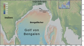
The Bengal Fan, also known as the Ganges Fan, is the largest submarine fan on Earth.
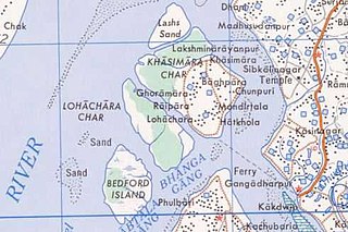
Lohachara Island was an islet which was permanently flooded in the 1980s. It was located in the Hooghly River as part of the Sundarban delta in the Sundarban National Park, located near the Indian state of West Bengal. The definite disappearance of the island was reported by Indian researchers in December 2006, which led to international press coverage. No specific study was ever done to prove that the island was permanently inundated because of sea level rise.

Char Fasson is an upazila of Bhola District in the Division of Barisal, Bangladesh.

Ramgati is an upazila (sub-district) of Lakshmipur District in Bangladesh, part of the Chittagong Division. The Government of Bangladesh plans to build an airport in this upazila.
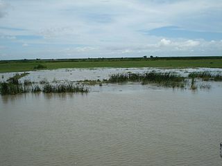
Bhola Island is the largest island of Bangladesh with an area of 1,295 km2 (500 sq mi) and a coastline of 324 km (201 mi). It accounts for most of the land area of Bhola District in Barisal Division.

Manpura Island is an island in the northern Bay of Bengal, Bangladesh, at the mouth of the Meghna river. It consists of Manpura upazila, Bhola District. The island has an area of 373 km2. Other major offshore islands of this region are Bhola Island and Hatia Island. All of these islands are densely populated.
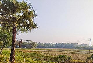
Hatiya Island is an island in the northern Bay of Bengal, Bangladesh, at the mouth of the Meghna river. The island falls under Hatiya Upazila of Noakhali District. The island has an area of 480 km2. Other major offshore islands of this region are Bhola Island and Manpura Island. All of these islands are densely populated. It is frequently subject to cyclones and destructive ocean waves.
Urir Char is an inhabited island in the Bay of Bengal. It is also a union parishad of Sandwip Upazila under Chattogram District in Chattogram Division, Bangladesh.
Char Nizam, also known as Char Nizam Kalkini, is a remote island in the Meghna river delta in the Bhola district of Bangladesh. The closest body of land is Dhal Char, a similar island to the west.

Char Kukri-Mukri Wildlife Sanctuary is a wildlife sanctuary in southern Charfession Upazila of Bangladesh, located on Char Kukri Mukri island in the Bay of Bengal. The area of the sanctuary is 40 ha, and is elongated in shape. It is 130 km from Barisal town in the gangetic delta on the mouth of Meghna river. It is also called Charfasson wildlife sanctuary. Most part of the sanctuary is submerged twice in a day due to high tide and is covered with dense mangrove vegetation. The soil type is clay.

Jakob Tower is a tourist watchtower located in the Char Fasson town of Bhola Island in southern Bangladesh. Natural beauty can be enjoyed from this tower up to an area of 100 km2 (39 sq mi). It is the tallest watchtower in Bangladesh as well as in the subcontinent. Built in the style of the Eiffel Tower, the 16-story watchtower can accommodate 50 visitors on each floor and 500 visitors throughout the tower.


