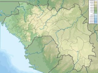
Transport in Guinea is composed by a variety of systems that people in the country use to get around as well as to and from domestic and international destinations.

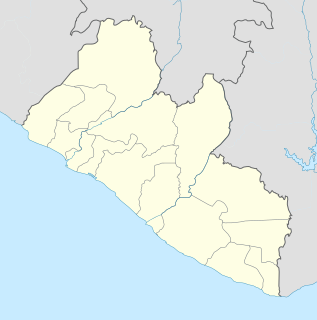
Liberia is a Sub-Saharan nation in West Africa located at 6 °N, 9 °W. It borders the north Atlantic Ocean to the southwest and three other African nations on the other three sides.
Liberia is one of the poorest countries in the world, and its economy is extremely underdeveloped, largely due to the First Liberian Civil War in 1989-96. The civil war destroyed much of Liberia's economy, especially the infrastructure in and around Monrovia. The war also caused a brain drain and the loss of capital, as the civil war involved overthrowing the Americo-Liberian minority that ruled the country. Some returned during 1997, but many have not.

Mount Richard-Molard, also known as Mount Nimba, is a mountain along the border of Ivory Coast and Guinea in West Africa. The highest peak for both countries and the Nimba Range is at 1,752 m (5,748 ft). The mountain is a part of the Guinea Highlands, which straddles the borders between the two countries and Liberia. The nearest major settlements are the town Yekepa to the west in Liberia, Bossou and N'Zoo in Guinea.
Yekepa is a town in northern Nimba County in Liberia, lying near the Guinean border. It was the base for Lamco's iron ore mining operation until it was destroyed in the First Liberian Civil War which lasted from 1989 to 1997. Nearby Guesthouse Hill is one of the highest points in the nation. The community is home to the African Bible College University. Rehabilitation of the once prosperous mining town has now been taken up by Arcelor Mittal, the steel giant. The company received the green light in May 2007 after many a controversy. It has begun the reconstruction of hospital, schools and the township.

Sulima is a town in the extreme south east of Sierra Leone, lying at the mouth of the Moa River. Originally a trading post in the nineteenth century, it has a large population of refugees from Liberia.

Forécariah is a sub-prefecture and town located in western Guinea. Population 21,710.
Yela is a town in northern Liberia.
Moussaya is a town and sub-prefecture in the Forécariah Prefecture in the Kindia Region of western Guinea.

There are 84 kilometres of railway in Sierra Leone, all of which is private and of a narrow gauge, 1,067 mm.
Kongo is a small town in western Liberia on the border with Sierra Leone. It serves an iron ore mine, with a narrow gauge railway, which are currently out of use. There are similar iron ore deposits across the Mana River which forms the border.
Mehla is a town in central Liberia. Its elevation in 252m.
Bong Town is a populated place in the Bong County of Liberia.

Railways in Liberia comprised two lines from the port of Monrovia in the northeast, and one line from the port of Buchanan in the centre. The principal traffic is, or was, iron ore. In 2010, only the Bong mine railway was operational but the Lamco Railway was at least partially rebuilt by Arcelor Mittal and put back into service in 2011.
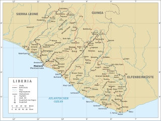
The history of rail transport in Liberia began shortly after World War II, when the Freeport of Monrovia was completed, with limited rail access. It had been developed by American military forces.
Bidwell is an unincorporated community in northern Laclede County, in the Ozarks of southern Missouri. The community is located just west of Missouri Route 5 and 2.5 miles south of Decaturville in southern Camden County.