Diep River (Limpopo)

Last updated
Diep River
South Africa relief location map.svg
Red pog.svg
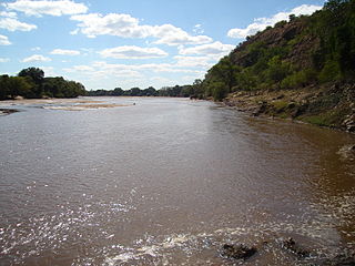
Location of the Diep River's mouth
Etymology Afrikaans for 'deep river' [1]
Location
Country South Africa
Province Limpopo
Physical characteristics
Source 
 - locationSSE of Polokwane
 - elevation1,450 m (4,760 ft)
Mouth Sand River (Polokwane)
 - location Limpopo Province
 - coordinates 23°41′23″S29°35′46″E / 23.68972°S 29.59611°E / -23.68972; 29.59611 Coordinates: 23°41′23″S29°35′46″E / 23.68972°S 29.59611°E / -23.68972; 29.59611
 - elevation1,116 m (3,661 ft)
Basin features
Tributaries 
 - right Turfloop

The Diep River is a river located in northern Limpopo Province, South Africa. It is a tributary of the Sand River (Polokwane).

South Africa Republic in the southernmost part of Africa

South Africa, officially the Republic of South Africa (RSA), is the southernmost country in Africa. It is bounded to the south by 2,798 kilometres (1,739 mi) of coastline of Southern Africa stretching along the South Atlantic and Indian Oceans; to the north by the neighbouring countries of Namibia, Botswana, and Zimbabwe; and to the east and northeast by Mozambique and Eswatini (Swaziland); and it surrounds the enclaved country of Lesotho. South Africa is the largest country in Southern Africa and the 25th-largest country in the world by land area and, with over 57 million people, is the world's 24th-most populous nation. It is the southernmost country on the mainland of the Old World or the Eastern Hemisphere. About 80 percent of South Africans are of Sub-Saharan African ancestry, divided among a variety of ethnic groups speaking different African languages, nine of which have official status. The remaining population consists of Africa's largest communities of European (White), Asian (Indian), and multiracial (Coloured) ancestry.

Sand River (Limpopo) river in Limpopo, South Africa

The Sand River or Polokwane River is a watercourse in Limpopo Province, South Africa, a right hand tributary of the Limpopo River. Its new name "Polokwane River" is homonymous with the name of the town of Polokwane, formerly Pietersburg, about 200 kilometres (120 mi) upriver from its mouth. The Sand River flows by the western edge of this town.

Contents

The Diep is a seasonal river that originates about 12 km SSE of Polokwane and flows roughly northwards until it joins the Sand River, just 22 km northeast of the same town. The confluence is located right after the Turfloop River, its only significant tributary, joins its right bank.

Polokwane Place in Limpopo, South Africa

Polokwane, also known by its former name, Pietersburg, is the capital of the Limpopo Province of South Africa. It is South Africa's largest urban centre north of Gauteng. It was one of the host cities of the 2010 FIFA World Cup.

See also

Related Research Articles

Limpopo River river in central southern Africa

The Limpopo River rises in South Africa, and flows generally eastwards to the Indian Ocean in Mozambique. The term Limpopo is the original Sepedi name diphororo tša meetse, meaning "gushing strong waterfalls". The river is approximately 1,750 kilometres (1,087 mi) long, with a drainage basin 415,000 square kilometres (160,200 sq mi) in size. The mean discharge measured over a year is 170 m3/s at its mouth. The Limpopo is the second largest river in Africa that drains to the Indian Ocean, after the Zambezi River.

Limpopo The northernmost province of South Africa

Limpopo is the northernmost province of South Africa. It is named after the Limpopo River, which forms the province's western and northern borders. The name "Limpopo" has its etymological origin in the Northern Sotho language word diphororo tša meetse, meaning "strong gushing waterfalls". The capital is Polokwane.

Olifants River (Limpopo) river in South Africa

The Olifants River, Lepelle or Obalule is a river in South Africa and Mozambique, a tributary of the Limpopo River. It falls into the Drainage Area B of the Drainage basins of South Africa. The historical area of the Pedi people, Sekhukhuneland, is located between the Olifants River and one of its largest tributaries, the Steelpoort River.

Mokolo River river in South Africa

The Mokolo River is a major watercourse in Limpopo Province of South Africa. This river collects much of the drainage of the Waterberg Massif and discharges it to the Limpopo River. The river's catchment area comprises 8,387 square kilometres (3,238 sq mi).

Mzingwane River river in Zimbabwe

The Mzingwane River, formerly known Umzingwane River as or Umzingwani River is a major left-bank tributary of the Limpopo River in Zimbabwe. It rises near Fort Usher, Matobo District, south of Bulawayo and flows into the Limpopo River near Beitbridge, downstream of the mouth of the Shashe River and upstream of the mouth of the Bubye River.

Polokwane Local Municipality Local municipality in Limpopo, South Africa

The Polokwane Local Municipality is a local municipality located within the Capricorn District in the Limpopo Province of South Africa. It shares its name with the city of Polokwane.

Chuniespoort Place in Limpopo, South Africa

Chuniespoort is a mountain pass situated in the Limpopo Province, on the R37, the road between Polokwane and Lebowakgomo, South Africa. The river flowing through this gorge of the Strydpoort Mountains is known as the Chunies River, one of the tributaries of the Olifants River.

Crocodile River (Limpopo) river, tributary of the Limpopo, in South Africa

The Crocodile River is a river in South Africa. After its confluence with the Marico River, both rivers form the Limpopo River.

Drainage Basin A, is one of the drainage basins of South Africa. The main river in this system is the Limpopo River. It is subdivided into 9 sub-drainage basins.

Wolkberg Wilderness Area

The Wolkberg Wilderness Area is a protected area in Limpopo Province, South Africa. It is located in the Wolkberg, a subrange of the Drakensberg approximately 14 kilometres (8.7 mi) south-east of Haenertsburg and 60 kilometres (37 mi) east of Polokwane. The 2,127 metres (6,978 ft) high Ysterkroon and the surrounding 22,000 hectares was proclaimed a Wilderness Area in 1977.

Steelpoort River river in South Africa

The Steelpoort River or Tubatse is a river in Limpopo Province, South Africa. It flows northeastwards and is a right hand tributary of the Olifants River, joining it at the lower end of its basin. Its source is located at Kwaggaskop, a farm between Dullstroom, Stoffberg and Belfast.

Wolkberg mountain range

The Wolkberg is a mountain range in Limpopo Province, South Africa. It constitutes a northern subrange of the Drakensberg system. The range extends for about 30 km (19 mi) in a NW/SE direction north of Sekhukhuneland. The nearest towns are Haenertsburg and Tzaneen.

Brak River river in South Africa

The Brak River is a river located in northern Limpopo Province, South Africa. It is a tributary of the Sand River (Polokwane).

Hout River river in South Africa

The Hout River is a river located in northern Limpopo Province, South Africa. It is a left hand tributary of the Sand River (Polokwane).

Matlabas River river in South Africa

The Matlabas River is a river in Limpopo Province, South Africa. It is a tributary of the Limpopo River. The river's catchment area comprises 3,448 square kilometers. The entire catchment area of the river is located within the Waterberg District Municipality.

Nwanedi River river in South Africa

The Nwanedi River is a watercourse in Limpopo Province, South Africa. It is a tributary of the Limpopo River flowing east of the Nzhelele, joining the right bank of the Limpopo 58 km east of Musina at the South Africa/Zimbabwe border.

Elands River (North West) river in South Africa

The Elands River is a river in the North West Province, South Africa. It is a tributary of the Crocodile River (West), part of the Limpopo River basin.

Tongwane River

The Tongwane River is a river in Limpopo Province, South Africa. It flows southward and is a tributary of the Olifants River, joining it southeast of Polokwane.

References