
Ongole is a city in Prakasam district of the Indian state of Andhra Pradesh. It is the headquarters of Prakasam district. It is famous for Ongole cattle, an indigenous breed of oxen.

Srikakulam is a city and the headquarters of Srikakulam district in the Indian state of Andhra Pradesh. As of 2011 census, it has a population of 165,735. There are many other places of Buddhist Tourism such as Salihundam, Kalinga Patnam, Dabbaka Vaani Peta, Nagari Peta, Jagati Metta, Singupuram etc. in Srikakulam District. The Buddhist heritage site of Salihundam has some unique features. It has a beautiful star atop a stupa, rock cut massive stupas inside chaitya grihas, brick stupas with wheel pattern plan, votive stupas, inscriptions on the steps leading to the stupas and museum housing over two dozen sculpted statue and figurines of Buddha, Jain Teerthankars and other deities
Barwani or Badwani is a municipal town in Barwani district of Madhya Pradesh, India, that is situated near the left bank of the Narmada River. It is the administrative headquarters of Barwani district and has also served as the capital of the former princely state of Barwani. Barwani is only accessible by road.

Vizianagaram, also known as Vijayanagaram, is a city and the headquarters of the Vizianagaram district in the Indian state of Andhra Pradesh. It is located in the Eastern Ghats, about 24 km (15 mi) west of the Bay of Bengal and 40 km (25 mi) north-northeast of Visakhapatnam. The city has a population of 228,025 and was established as the capital of the Vizianagaram estate by Raja Vijayaram Raj from the Pusapati dynasty. The rulers had a notable role in the history of the region in the 18th century and were patrons of education and arts.
Kodad is a town in Suryapet district of the Indian state of Telangana. It is a municipality and the mandal headquarters of Kodad mandal in Kodad revenue division. It lies on the National Highway 65 between Hyderabad and Vijayawada. It is 44 km away from the district headquarters Suryapet

Proddatur (1915) is a city in the YSR Kadapa District of Andhra Pradesh, located on the banks of the Penna River. The city is a municipality, and also the mandal headquarters of Proddatur mandal. It is the second-largest town in former Kadapa District. It is the oldest municipality which formed before Independence.

Tadepalligudem is a city in West Godavari district of the Indian state of Andhra Pradesh. It is a Selection Grade municipality and the mandal headquarters of Tadepalligudem mandal and Tadepalligudem Revenue Division. Tadepalligudem is one of the biggest City in West Godavari district

Kovur is a village in Nellore district of the Indian state of Andhra Pradesh. The village is also the headquarters of the Kovur Mandal and Assembly Constituency. It is located in Kovur mandal of Nellore revenue division. It forms a part of Nellore Urban Development Authority. The poet "Thikkanna" was born in this place.
Bapatla is a town and district headquarters of Bapatla district in the Indian state of Andhra Pradesh. It is a municipality and the mandal headquarters of Bapatla mandal of Bapatla revenue division. The nearest towns and cities to Bapatla are Chirala, Ponnur, Tenali and Guntur of 17 km, 22 km, 50 km and 53 km respectively.

Hindupuram is a city in Sri Sathya Sai district of the Indian state of Andhra Pradesh. It is located to the edge of the Andhra–Karnataka border and is the headquarters of Hindupuram mandalam. Hindupuram is the Parliamentary Constituency in the newly formed District Sri Sathya Sai. It is located about 67 km from district headquarters Puttaparthi, 100 km from Bengaluru the capital of Karnataka, 95 km From Kadiri.
Kandukur or Kandukuru is a town in SPSR Nellore district of the Indian state of Andhra Pradesh. It is a municipality and the headquarters of Kandukur mandal as well as Kandukur revenue division. Kandukur Mandal is located at the south-east side of the Prakasam District having geographical area around 225 km2.There is only 1 city in the Kandukur Mandal, which is Kandukur Municipality having an area of 37.63 km2.
Pedana is a municipality and the headquarters of Pedana mandal under Machilipatnam revenue division of Krishna district of the Indian state of Andhra Pradesh. It is located at a distance of 8 km (5.0 mi) from the district headquarters, Machilipatnam.

Repalle is a town in Bapatla district of the Indian state of Andhra Pradesh. The town is one of the 12 municipalities in Bapatla district and the headquarters of Repalle mandal under the administration of Repalle revenue division. It is situated near Krishna River in the Coastal Andhra region of the state.

Chirala, is a city in Bapatla district of the Indian state of Andhra Pradesh. It is a municipality and the headquarters of Chirala mandal in Chirala revenue division. As of 2011, it had a population of above 170,000.

Nagari is a town in Chittoor district of the Indian state of Andhra Pradesh. It is the mandal headquarters of Nagari mandal in Nagari revenue division.

Pathapatnam is a town in Srikakulam district of the Indian state of Andhra Pradesh. It is located in Pathapatnam mandal of Palakonda revenue division. Pathapatnam is located on the border of Srikakulam district of Andhra Pradesh and Gajapati district of Odisha. Parlakhemundi, the headquarters of Gajapati District, can be considered as twin town of Pathapatnam because of its close proximity. It is located around 65 km from srikakulam. It was the old capital of Paralakhemundi Gajapati Maharajah of his erstwhile kingdom.
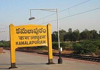
Kamalapuram is a Town in YSR Kadapa district of the Indian state of Andhra Pradesh. It is located in Kamalapuram mandal of Kadapa revenue division and is the Thaluka headquarter of Kamalapuram assembly constituency.

Peda Avutapalli is a developing town in Unguturu mandal, Krishna district, Andhra Pradesh, India. It is located 7.5 km from the Vijayawada Airport. Comes under Gannavaram constituency, Current MLA Dr.Vallabhaneni Vamsi Mohan(TDP).
Chilakaluripet is a city in Palnadu district of the Indian state of Andhra Pradesh. It is the Mandal headquarters of Chilakaluripet Mandal in Narasaraopet Revenue Division.
Pinakadimi is a village in Eluru district of the Indian state of Andhra Pradesh. It is located in Pedavegi mandal of Eluru revenue division. It is located at a distance of 7 km from district headquarters Eluru city.

