Dinara, Kutch

Last updated

Dinara is a village near Bhuj of Kutch district of Gujarat, India.

Bhuj City in Gujarat, India

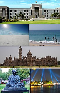
Bhuj is a Municipality and District Headquarter of Kutch District in the state of Gujarat, India.

Kutch district District of Gujarat in India

Kutch district is a district of Gujarat state in western India. Covering an area of 45,674 km², it is the largest district of India. The population of Kutch is about 2,092,000. It has 10 Talukas, 939 villages and 6 Municipalities. The Kutch district is home to the Kutchi people who speak the Kutchi language.

Gujarat State in India

Gujarat is a state on the western coast of India with a coastline of 1,600 km (990 mi) – most of which lies on the Kathiawar peninsula – and a population in excess of 60 million. It is the sixth largest Indian state by area and the ninth largest state by population. Gujarat is bordered by Rajasthan to the northeast, Daman and Diu to the south, Dadra and Nagar Haveli and Maharashtra to the southeast, Madhya Pradesh to the east, and the Arabian Sea and the Pakistani province of Sindh to the west. Its capital city is Gandhinagar, while its largest city is Ahmedabad. The Gujarati-speaking people of India are indigenous to the state. The economy of Gujarat is the third-largest state economy in India with 14.96 lakh crore (US$210 billion) in gross domestic product and a per capita GDP of 157,000 (US$2,200).

Places of interest

About half a mile to the south of village, the ruins of a white-limestone Jain temple, fifty feet long by eighteen wide, said to be the place where Sadevant and Savalinga, the hero and heroine of a Gujarati romance, used to study. [1]

Related Research Articles

Khavda village in Gujarat, India

Khavda is a village in Bhuj Taluka of Kutch district of Gujarat, India. It lies on the west side of Pachham Island in Greater Rann of Kutch.

Amrapar is a village in Kutch district, Gujarat, India.

Fatehgadh is a town near Rapar of Kutch district of Gujarat, India.

Golay or Gholay is a village of Abdasa Taluka of Kutch district of Gujarat, India.

Gundiyali village in India

Gundiyali is a village near Mandvi of Kutch district of Gujarat, India.

Jara is a village near Bhuj in Kutch district of Gujarat, India.

Morgar or Morgad is a village in Nakhatrana Taluka of Kutch district of Gujarat, India.

Pipar is a village in Lakhpat Taluka of Kutch district of Gujarat, India.

Mithi Rohar or Rohar is a village in Gandhidham Taluka of Kutch district of Gujarat, India.

Vira is a village in Anjar Taluka in Kutch district of Gujarat, India. Nearby temple of Jogninar is place of religious significance.

Magodi is a village in Malpur Taluka in Aravalli district of Gujarat state, India.

Punadra is a town and former princely state in Gujarat, western India.

Sadra is a village, on the banks of Sabarmati river, in Gandhinagar Taluka in Gandhinagar district of Gujarat state, India.

Santalpur is a village in Santalpur Taluka of Patan district of Gujarat state, India.

Varahi is a village in Santalpur taluka of Patan district of Gujarat state of India.

Diyodar, also spelled Diodar or Deodar, is a town and former princely state in Diyodar Taluka of Banaskantha district in Gujarat, western India.

Suigam Is Town And The Headquarter Of Suigam Taluka Of Banaskantha District In Gujarat State Of India

Tervada is a village in Kankrej Taluka of Banaskantha district in Gujarat, India.

Panchasar is a village in Sami Taluka of Patan district of Gujarat, India.

Vaghel is a village in Harij Taluka of Patan district in Gujarat, India.

References

  1. Gazetteer of the Bombay Presidency: Cutch, Palanpur, and Mahi Kantha. Printed at the Government Central Press. 1880. p. 220.

Coordinates: 23°53′42″N69°44′16″E / 23.894863°N 69.737692°E / 23.894863; 69.737692

Geographic coordinate system Coordinate system

A geographic coordinate system is a coordinate system that enables every location on Earth to be specified by a set of numbers, letters or symbols. The coordinates are often chosen such that one of the numbers represents a vertical position and two or three of the numbers represent a horizontal position; alternatively, a geographic position may be expressed in a combined three-dimensional Cartesian vector. A common choice of coordinates is latitude, longitude and elevation. To specify a location on a plane requires a map projection.