
Myanmar is the northwesternmost country of mainland Southeast Asia located on the Indochinese peninsula. With an area of 261,228 sq mi (676,578 km2), it is the second largest country in Southeast Asia and the largest on mainland Southeast Asia. The kite-shaped country stretches from 10'N to 20'N for 1,275 miles (2,050 km) with a long tail running along the western coast of the Malay Peninsula.

Mount Meru, also known as Sumeru, Sineru, or Mahāmeru, is the sacred five-peaked mountain of Hindu, Jain, and Buddhist cosmology and is considered to be the centre of all the physical, metaphysical, and spiritual universes. The mountain is also mentioned in some scriptures of non-Indian based religions such as Taoism, which was influenced by the arrival of Buddhism in China. There is no clear identification of Mount Meru with a particular geophysical location but it is always located in the Himalayan or Aravalli ranges. But it is located in the middle of the four great continents of the cosmo.

The Salween is a Southeast Asian river, about 3,289 km (2,044 mi) long, flowing from the Tibetan Plateau south into the Andaman Sea. The Salween flows primarily within southwest China and eastern Myanmar (Burma), with a short section forming the border of Burma and Thailand. Throughout most of its course, it runs swiftly through rugged mountain canyons. Despite the river's great length, only the last 90 km (56 mi) are navigable, where it forms a modest estuary and delta at Mawlamyine. The river is known by various names along its course, including the Thanlwin in Burma and the Nu Jiang in China. The commonly used spelling "Salween" is an anglicisation of the Burmese name dating from 19th-century British maps.

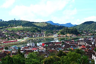
Lashio is the largest town in northern Shan State, Myanmar, about 200 kilometres (120 mi) north-east of Mandalay. It is situated on a low mountain spur overlooking the valley of the Yaw River. Loi Leng, the highest mountain of the Shan Hills, is located 45 km (28 mi) to the south-east of Lashio.

Hkakabo Razi is believed to be Myanmar's highest mountain. The 5,881-meter (19,295 ft)-tall mountain is the highest mountain in Southeast Asia as well. It is located in the northern Myanmar state of Kachin in an outlying subrange of the Greater Himalayan mountain system near the border tripoint with India and China. Its highest status has recently been challenged by 5,870-meter (19,260 ft)-tall Gamlang Razi, located about 6.6 kilometers (4.1 mi) WSW on the Chinese border.

The Pat-kai (Pron:pʌtˌkaɪ) or Patkai Bum are a series of mountains on the Indo-Myanmar border falling in the northeastern Indian states of Arunachal Pradesh, Nagaland and Upper Burma region of Myanmar. In Tai-Ahom language, Pat means to cut and Kai means chicken.
Mogok is a town of around 90,000 people in the Thabeikkyin District of Mandalay Region of Myanmar, located 200 kilometres (120 mi) north of Mandalay and 148 kilometres (92 mi) north-east of Shwebo.

Putao is a town in Kachin State, Myanmar and the principal town in Putao Township. The area around Putao is famous for its variety of birds and rare orchids, especially the so-called "Black Orchid" found in the mountains surrounding Putao. Myanmar's highest mountain, Hkakabo Razi, and other snow-capped peaks are visible from Putao.

Phawngpui, also known as Blue Mountain, is the highest mountain peak in the Mizo Hills and in the state of Mizoram, India, with an elevation of 2157 m. It is in Lawngtlai district, in the southeastern region of Mizoram near the Myanmar border.

The Arakan Mountains, natively referred as Rakhine Yoma and technically known as the Southern Indo-Burman Range, are a mountain range in western Myanmar, between the coast of Rakhine State and the Central Myanmar Basin, in which flows the Irrawaddy River. It is the most prominent of a series of parallel ridges that arc through Assam, Nagaland, Manipur, Mizoram and Myanmar.

The Hengduan Mountains are a group of mountain ranges in southwest China that connect the southeast portions of the Tibetan Plateau with the Yunnan–Guizhou Plateau. The Hengduan Mountains are primarily large north-south mountain ranges that effectively separate lowlands in northern Myanmar from the lowlands of the Sichuan Basin. These ranges are characterized by significant vertical relief originating from the Indian subcontinent's collision with the Eurasian Plate, and further carved out by the major rivers draining the eastern Tibetan Plateau. These rivers, the Yangtze, Mekong, and Salween, are recognized today as the Three Parallel Rivers UNESCO World Heritage Site.

Ngapudaw Township or Ngaputaw Township is a township of Pathein District in the Ayeyarwady Region of Myanmar. The western portion of the township includes Ngayokaung Subtownship and the southern portion of the township includes Hainggyikyun Subtownship, both unofficial divisions used by the Township for statistical and administrative ease. The small village of Kyounku within Hainggyikyun Subtownship is the birthplace of former President of Myanmar Thein Sein.

The Shan Hills, also known as Shan Highland, is a vast mountainous zone that extends through Yunnan to Myanmar and Thailand. The whole region is made up of numerous peaks separated mostly by narrow valleys, as well as a few broader intermontane basins. The ranges in the area are aligned in such a way that they link to the foothills of the Himalayas further to the northwest.
The Tenasserim Hills or Tenasserim Range is the geographical name of a roughly 1,700 km long mountain chain, part of the Indo-Malayan mountain system in Southeast Asia.
Sidoktaya, also Sitoktaya or Setoketaya is a town and seat of Sidoktaya Township in Minbu District of Magway Division, situated in middle west region of Burma. It is bordered with Salin township to the east, with Pwintbyu township to the south-east, with Ngape township to the south, with Minbya township to the west, with Kanpelek township to the north-west and with Saw township to the north. It is a hilly region of Rakhine. Mount Sun Taung, the highest mountain in Rakhine, 6,527 feet (1,989 m) high, is in Sidoktaya township.

Pinlaung is a town 1,510 metres (4,950 ft) above sea level and seat of Pinlaung Township, in the Pa-O Self-Administered Zone of Shan State of eastern-central Burma. It lies along National Road 54, north-west by road from Loikaw. Running through the city center is a rail line connecting Loikaw to Kalaw, two major tourist towns in the area.

The Karen Hills, also known as Kayah-Karen Mountains, are one of the main hill ranges in eastern Burma. They are located at the SW corner of Shan State and in Kayah State, a mountainous region where the only relatively flat area is Loikaw, the capital. The southern end runs into Kayin State. One of the first all-weather roads in Burma was across the Karen Hills connecting Taungoo with Loilem.

The Daen Lao Range is a mountain range of the Shan Hills in eastern Burma and northern Thailand. Most of the range is in Shan State, with its northern limit close to the border with China, and runs southwards across the Thai border, at the northern end of Thailand.

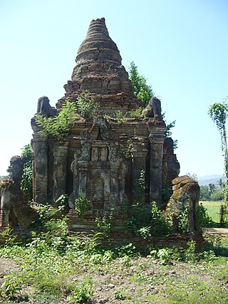
Swan Oo Ponnya Shin (ဆွမ်းဦးပုညရှင်စေတီတော်) is a Buddhist pagoda located in Sagaing, Myanmar. The pagoda was purportedly founded in 1312 by Ponnya, a junior minister at the court of King Thihathu of Myinsaing–Pinya. The pagoda is located at the top of the second highest mountain in Sagaing, called Ponnya Shin Hill.