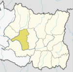
Khotang District is one of 14 districts of Koshi Province of eastern Nepal. The district, with Diktel as its district headquarters, covers an area of 1,591 km2 (614 sq mi) and has a population (2021) of 206,312. The district is bordered by Bhojpur District in the east, Udayapur District in the south, Okhaldhunga District in the west and Solukhumbu District in the North. In this district there are two municipalities and eight rural/urban municipalities.
Baksila is a village and village development committee in Khotang District in the Sagarmatha Zone of eastern Nepal. At the time of the 1991 Nepal census it had a population of 3,996 persons living in 796 individual households. Baksila is a five hours walk from Diktel, headquarters of Khotang District. Surrounded by Baspani, Sungdel, Dipsung, Rakha Saptewor and Kharmi, the village is split into nine wards geographically. It became the headquarters of Kepilasgadhi rural municipality after the local level division in line with the constitution and local level election. It is ward number 4 of Kepilasgadhi RM and Ganesh Bahadur Adhikari is the chairperson of ward. Shree Prithvi Higher Secondary School, Local Buddha Bajar, Kepilasgadhi, etc. are the main places/offices.
Chisapani is a town and Village Development Committee in Khotang District in the Sagarmatha Zone of eastern Nepal. At the time of the 1991 Nepal census it had a population of 4,276 persons living in 791 individual households.
Dandagaun is a village and Village Development Committee in Khotang District in the Sagarmatha Zone of eastern Nepal. At the time of the 1991 Nepal census it had a population of 2,903 persons living in 528 individual households.
Dharapani is a village and Village Development Committee in Khotang District in the Sagarmatha Zone of eastern Nepal. At the time of the 1991 Nepal census it had a population of 2,830 persons living in 535 individual households.
Dhitung is a village and Village Development Committee in Khotang District in the Sagarmatha Zone of eastern Nepal. At the time of the 1991 Nepal census it had a population of 3,009.
Diplung is a village and Village Development Committee in Khotang District in the Sagarmatha Zone of eastern Nepal. At the time of the 1991 Nepal census it had a population of 2,063 persons living in 399 individual households.
Jyamire is a village and Village Development Committee in Khotang District in the Sagarmatha Zone of eastern Nepal. At the time of the 1991 Nepal census it had a population of 1,579 persons living in 298 individual households.
Kharmi is a town and Village Development Committee in Khotang District in the Sagarmatha Zone of eastern Nepal. At the time of the 1991 Nepal census it had a population of 3,807 persons living in 723 individual households.
Kharpa is a village and Village Development Committee in Khotang District in the Sagarmatha Zone of eastern Nepal. At the time of the 1991 Nepal census it had a population of 2,096 living in 393 individual households.
Khotang Bazar is a village and Village Development Committee in Khotang District in Province No. 1 in eastern Nepal. At the time of the 1991 Nepal census, it had a population of 2,433 persons living in 458 individual households.....
Rakha Bangdel is a village and Village Development Committee in Khotang District in the Sagarmatha Zone of eastern Nepal. At the time of the 1991 Nepal census it had a population of 2,915 persons living in 586 individual households.
Ratancha Majhagaun is a town and Village Development Committee in Khotang District in the Sagarmatha Zone of eastern Nepal. At the time of the 1991 Nepal census it had a population of 3,176 persons living in 591 individual households.

Salle is a village and Haleshi Tuwachung Municipality Ward No.9 (Nepal) in Khotang District in the Sagarmatha Zone of eastern Nepal. At the time of the 1991 Nepal census it had a population of 1,931 persons living in 357 individual households.

Sungdel is a village and Village Development Committee in the Khotang District in the Sagarmatha Zone of eastern Nepal. At the time of the 1991 Nepal census it had a population of 2,846 persons living in 585 individual households. It is at the northeast belt of the Khotang district. Currently, there is a high school, Shree surya Ma. Vi, and four primary schools. People run their own hydropower. The majority of people are Koyee Rai. It is the only place where Koyee people speak their mother language, Koyee. This language is also known as Sungdele Bhasa. Most people depend on farming. The highest hill in Khotang district, Loure, is situated in Sungdel.

Koshi Province is the autonomous easternmost province adopted on 20 September 2015 by Constitution of Nepal. The province is rich in natural resources, tourist attractions, recreational activities, and natural beauty. The province covers an area of 25,905 km2 (10,002 sq mi), about 17.5% of the country's total area. With the industrial city of Biratnagar as its capital, the province includes major eastern towns of Birtamod, Sundar Haraincha, Damak, Dharan, Itahari, Triyuga Municipality and Mechinagar, and the Mount Everest, Kangchenjunga and Ama Dablam. Koshi River, the largest river of the nation, forms the province's western boundary. Under the First-past-the-post voting system issued by the Constituency Delimitation Commission, Nepal, the province hosts 28 parliamentary seats and 56 provincial assembly seats.
Khotehang is a rural municipality (gaunpalika) in Khotang District of Province No. 1 of Nepal.
DiprungChuichumma is a rural municipality (gaunpalika), and one of eight rural municipalities located in Khotang District of Province No. 1 in Nepal. There are a total of 10 municipalities in Khotang in which 2 are urban and 8 are rural.
Jantedhunga is a rural municipality (gaunpalika) out of eight rural municipality located in Khotang District of Province No. 1 of Nepal. There are a total of 10 municipalities in Khotang in which 2 are urban and 8 are rural.
Barahapokhari is a rural municipality (gaunpalika) out of eight rural municipality located in Khotang District of Province No. 1 of Nepal. There are a total of 10 municipalities in Khotang in which 2 are urban and 8 are rural.