Related Research Articles

Satellite images are images of Earth collected by imaging satellites operated by governments and businesses around the world. Satellite imaging companies sell images by licensing them to governments and businesses such as Apple Maps and Google Maps.
Surrey Satellite Technology Ltd, or SSTL, is a company involved in the manufacture and operation of small satellites. A spin-off company of the University of Surrey, it is presently wholly owned by Airbus Defence and Space.
RapidEye AG was a German geospatial information provider focused on assisting in management decision-making through services based on their own Earth-observation imagery. The company operated a five-satellite constellation producing 5-meter resolution imagery that was designed and implemented by MacDonald Dettwiler of Richmond, Canada.
CLEO - Cisco router in Low Earth Orbit, is an Internet router from Cisco Systems that was integrated into the UK-DMC Disaster Monitoring Constellation satellite built by Surrey Satellite Technology Ltd (SSTL) as a secondary experimental hosted payload, and launched into space with the satellite from Plesetsk on 27 September 2003.
The National Space Research and Development Agency (NASRDA) is the national space agency of Nigeria. It is a parastatal under Federal Ministry of Science and Technology. The agency is based in the Nigerian capital city of Abuja in the Lugbe district and has a ground receiving station, among various other sites. It has had cooperation in space technology with the United Kingdom, China, Ukraine and Russia. The agency has struggled with meeting its financial plans and some of its facilities are rundown. Despite this, the space agency is one of the most advanced space agencies in Africa, boasting of four satellites and very grand ambitions. Nigeria's satellites have been praised for their high-resolution images. NASRDA is host to one of UN-SPIDER's Regional Support Offices (RSO) in Africa.
UoSAT-12 is a British satellite in Low Earth Orbit. It is the twelfth satellite in the University of Surrey series and was designed and built by Surrey Satellite Technology Ltd. (SSTL). It was launched into orbit in April 1999 on board a Dnepr rocket from Yasny Russia.
DMC International Imaging (DMCii) is the company that manages the Disaster Monitoring Constellation for the International Charter for Space and Major Disasters. It also sells satellite imaging services under contract and manages the operations of spacecraft such as UK-DMC1 & UK-DMC2. DMCII is a wholly owned subsidiary of Surrey Satellite Technology Ltd (SSTL). It recently struck a space deal with Beijing-based 21AT to build three high-resolution Earth observation satellites to map the growth of China.
Deimos-1 is a Spanish Earth imaging satellite which is operated by Deimos Imaging who commercializes its imagery directly but also has distribution agreements with other entities like Astrium GEO and DMC International Imaging.
UK-DMC 2 is a British Earth imaging satellite which is operated by DMC International Imaging. It was constructed by Surrey Satellite Technology, based on the SSTL-100 satellite bus. It is part of Britain's contribution to the Disaster Monitoring Constellation, which is coordinated by DMC International Imaging. It is the successor to the UK-DMC satellite.
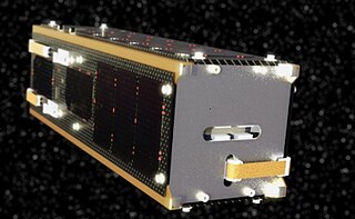
ALSAT-1 is the first Algerian satellite and it is part of a group of satellites collectively known as the Disaster Monitoring Constellation (DMC). The satellite was built by a group of engineers from Surrey Satellite Technology (SSTL) and Algerian Centre National des Techniques Spatiales (CNTS). It was the first DMC satellite to be launched of the five to seven that are planned. The DMC was the first satellite constellation designed for that objective. The launch took place on 28 November 2002 from the Plesetsk Cosmodrome in northern Russia on a Kosmos-3M launcher in -20 degree Celsius weather. It completed its mission after seven years and nine months in August 2010. The satellite was designed to operate for five years.
UK-DMC or UK-DMC 1, also known as BNSCSAT-1, was a British satellite that formed part of the Disaster Monitoring Constellation (DMC). It was built by Surrey Satellite Technology, who operated it via DMC International Imaging on behalf of the British National Space Centre and later the UK Space Agency. It was launched alongside other DMC satellites on 27 September 2003, and retired from service in November 2011.

The Algerian Space Agency, was established on January 16, 2002 in Bouzareah, Algiers. The agency is in charge of the Algerian space program, and has flown five different satellites.
BILSAT-1 was an Earth observation satellite designed and developed by TÜBİTAK Space Technologies Research Institute and produced in Turkey as part of the Disaster Monitoring Constellation (DMC) project in the context of a show-how program led by DMC International Imaging of Surrey Satellite Technology (SSTL).
Planet Labs PBC is an American public Earth imaging company based in San Francisco, California. Their goal is to image the entirety of the Earth daily to monitor changes and pinpoint trends.
Sir Martin Nicholas Sweeting is the founder and executive chairman of Surrey Satellite Technology Ltd (SSTL). SSTL is a corporate spin-off from the University of Surrey, where Sweeting is a Distinguished Professor who founded and chairs the Surrey Space Centre.
UK-DMC 3 is a constellation of three British Earth imaging satellites which are operated by DMC International Imaging. They were constructed by Surrey Satellite Technology and launched by ISRO on 10 July 2015.
Alsat-1B is an Algerian satellite operated by the Agence Spatiale Algerienne for agricultural and disaster monitoring. The contract for the mission was signed in July 2014. The satellite is based on the SSTL-100 bus. The satellite weighs 103 kilograms (227 lb) and carries an Earth imaging payload with 12-metre (39 ft) panchromatic imager and 24-metre (79 ft) multispectral cameras.
The National Space Program (PSN) horizons 2020 planned to put in place space infrastructures, space systems and increase the specialized human resources in space technologies. Among the space systems planned in the PSN are Algeria's satellites, of which a significant number should be partly or totally integrated in the Algerian center for satellite development "CDS". CDS offers the technological environment for national competence to develop the future Algerian satellite systems. Algeria's objectives is to make of space tools a powerful instrument in national prosperity in the fields of earth observation, meteorology and communications.
The domain of international space politics gained significant traction during the Cold War. This was largely fuelled by the ongoing space race between the USA and the USSR. At this time in history, space exploration was an endeavour largely restricted to the global superpowers and seemed out of reach for many smaller, developing, nations to actively participate in. Subsequently, public concerns for the cost of research and development into novel space technologies did not receive sufficient policy and academic attention in Africa. As the Cold War reached its conclusion, political power began to diffuse across the world, and this led to many smaller nation states developing national and regional space capabilities. In the context of Africa, Nigeria, Algeria, Egypt and South Africa were the front-runners in terms of investments into space-related research and development.
References
- ↑ Use of the Delay-Tolerant Networking Bundle Protocol from Space Archived 2008-05-13 at the Wayback Machine , L.Wood et al., Conference paper IAC-08-B2.3.10, 59th International Astronautical Congress, Glasgow, September 2008.
- ↑ UK-DMC satellite first to transfer sensor data from space using 'bundle' protocol Archived 2012-04-26 at the Wayback Machine , press release, Surrey Satellite Technology Ltd, 11 September 2008.
- ↑ K. Hogie, et al., Using standard Internet Protocols and applications in space, Computer Networks, special issue on Interplanetary Internet, vol. 47 no. 5, pp. 603-650, April 2005.
- ↑ K. Hogie, et al., Putting more Internet nodes in space Archived 2008-11-16 at the Wayback Machine , CSC World, Computer Sciences Corporation, pp. 21-23, April/June 2006.
- ↑ J Cooksley, A da Silva Curiel, P Stephens, L Boland, S Jason, W Sun, M Sweeting, "ALSAT-1 First Year In Orbit", 17th AIAA / USU Conference on Small Satellites, 2003
- ↑ Algeria’s first satellite mission completed Archived 10 September 2017 at the Wayback Machine , Robin Wolstenholme, SSTL space blog, 26 August 2010.
- ↑ BilSAT News Archived August 1, 2007, at the Wayback Machine , retrieved 23 July 2007.
- ↑ NigeriaSAT-1 reaches end of long life Archived 10 November 2012 at the Wayback Machine , SSTL space blog, 29 October 2012.
- ↑ UK-DMC-1 to take well-earned retirement Archived 8 August 2015 at the Wayback Machine , SSTL space blog, 25 November 2011.
- ↑ DMCii to launch new higher-resolution satellite imaging service Archived 2015-09-24 at the Wayback Machine , SSTL press release, 20 March 2007.
- ↑ Deimos and Surrey Satellite Technology Contract for Spanish Imaging Mission Archived 2015-09-24 at the Wayback Machine , SSTL press release, 10 October 2006.
- ↑ "SSTL launches two EO satellites for Nigeria". SSTL. Archived from the original on 15 June 2013. Retrieved 2 August 2012.