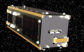
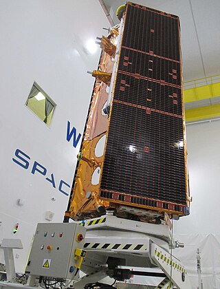
Surrey Satellite Technology Ltd, or SSTL, is a company involved in the manufacture and operation of small satellites. A spin-off company of the University of Surrey, it is presently wholly owned by Airbus Defence and Space.
FalconSAT-2 was a satellite built by students of the United States Air Force Academy as part of the FalconSAT program. It was intended to have been placed into low Earth orbit to study the effects of plasma on communications with spacecraft, however it failed to reach orbit due to a malfunction of its carrier rocket.

The National Space Research and Development Agency (NASRDA) is the national space agency of Nigeria. It is a parastatal under Federal Ministry of Science and Technology. The agency is based in the Nigerian capital city of Abuja in the Lugbe district and has a ground receiving station, among various other sites. In the past, it has cooperated in space technology with the United Kingdom, China, Ukraine and Russia. The agency has struggled with meeting its financial plans and some of its facilities are rundown. Despite this, the space agency is one of the most advanced space agencies in Africa, boasting of four satellites and very grand ambitions. Nigeria's satellites have been praised for their high-resolution images. NASRDA is host to one of UN-SPIDER's Regional Support Offices (RSO) in Africa.
The Disaster Monitoring Constellation for International Imaging (DMCii) or just Disaster Monitoring Constellation (DMC) consists of a number of remote sensing satellites constructed by Surrey Satellite Technology Ltd (SSTL) and operated for the Algerian, Nigerian, Turkish, British and Chinese governments by DMC International Imaging. The DMC provides emergency Earth imaging for disaster relief under the International Charter for Space and Major Disasters, which the DMC formally joined in November 2005. Other DMC Earth imagery is used for a variety of civil applications by a variety of governments. Spare available imaging capacity is sold under contract.

GeoEye Inc. was an American commercial satellite imagery company based in Herndon, Virginia. GeoEye was merged into the DigitalGlobe corporation on January 29, 2013.
UK-DMC 2 is a British Earth imaging satellite which is operated by DMC International Imaging. It was constructed by Surrey Satellite Technology, based on the SSTL-100 satellite bus. It is part of Britain's contribution to the Disaster Monitoring Constellation, which is coordinated by DMC International Imaging. It is the successor to the UK-DMC satellite.

ALSAT-1 is the first Algerian satellite and it is part of a group of satellites collectively known as the Disaster Monitoring Constellation (DMC). The satellite was built by a group of engineers from Surrey Satellite Technology (SSTL) and Algerian Centre National des Techniques Spatiales (CNTS). It was the first DMC satellite to be launched of the five to seven that are planned. The DMC was the first satellite constellation designed for that objective. The launch took place on 28 November 2002 from the Plesetsk Cosmodrome in northern Russia on a Kosmos-3M launcher in -20 degree Celsius weather. It completed its mission after seven years and nine months in August 2010. The satellite was designed to operate for five years.
UK-DMC or UK-DMC 1, also known as BNSCSAT-1, was a British satellite that formed part of the Disaster Monitoring Constellation (DMC). It was built by Surrey Satellite Technology, who operated it via DMC International Imaging on behalf of the British National Space Centre and later the UK Space Agency. It was launched alongside other DMC satellites on 27 September 2003, and retired from service in November 2011.
UoSAT-3, also known as UO-14 and OSCAR-14, is a British satellite in Low Earth Orbit. It was built by a spin-off company of the University of Surrey, Surrey Satellite Technology (SSTL) and launched in January 1990 from French Guiana. The satellite functioned as one of a series of OSCAR satellite in orbit around the Earth, as well as observing Earth and performing scientific experiments.
UoSAT-4, also known as UO-15 and OSCAR-15, is a British satellite in Low Earth Orbit. It was built by a spin-off company of the University of Surrey, Surrey Satellite Technology (SSTL) and launched in January 1990 from French Guiana.
VNREDSat-1 is the first optical Earth Observing satellite of Vietnam; its primary mission is to monitor and study the effects of climate change, predict and take measures to prevent natural disasters, and optimise the management of Vietnam's natural resources.
BILSAT-1 was an Earth observation satellite designed and developed by TÜBİTAK Space Technologies Research Institute and produced in Turkey as part of the Disaster Monitoring Constellation (DMC) project in the context of a show-how program led by DMC International Imaging of Surrey Satellite Technology (SSTL).
Sapphire is a Canadian space surveillance satellite which was launched in 2013. Sapphire was commissioned and integrated by MacDonald, Dettwiler and Associates (MDA) based on an SSTL-150 bus produced by Surrey Satellite Technology (SSTL) and an optical payload produced by COM DEV International.

Planet Labs PBC is a publicly trading American Earth imaging company based in San Francisco, California. Their goal is to image the entirety of the Earth daily to monitor changes and pinpoint trends.
Deimos-2 is a Spanish remote sensing Earth observation satellite built for Elecnor Deimos under an agreement with Satrec Initiative, a satellite manufacturing company in South Korea.

Sir Martin Nicholas Sweeting is the founder and executive chairman of Surrey Satellite Technology Ltd (SSTL). SSTL is a corporate spin-off from the University of Surrey, where Sweeting is a Distinguished Professor who founded and chairs the Surrey Space Centre.
Alsat-1B is an Algerian satellite operated by the Agence Spatiale Algerienne for agricultural and disaster monitoring. The contract for the mission was signed in July 2014. The satellite is based on the SSTL-100 bus. The satellite weighs 103 kilograms (227 lb) and carries an Earth imaging payload with 12-metre (39 ft) panchromatic imager and 24-metre (79 ft) multispectral cameras.
The National Space Program (PSN) horizons 2020 planned to put in place space infrastructures, space systems and increase the specialized human resources in space technologies. Among the space systems planned in the PSN are Algeria's satellites, of which a significant number should be partly or totally integrated in the Algerian center for satellite development "CDS". CDS offers the technological environment for national competence to develop the future Algerian satellite systems. Algeria's objectives is to make of space tools a powerful instrument in national prosperity in the fields of earth observation, meteorology and communications.

Paz is a Spanish Earth observation and reconnaissance satellite launched on 22 February 2018. It is Spain's first spy satellite. The satellite is operated by Hisdesat. Paz was previously referred to as SEOSAR.

Orbital Express Launch Ltd., or Orbex, is a United Kingdom-based aerospace company that is developing a small commercial orbital rocket called Prime. Orbex is headquartered in Forres, Moray, in Scotland and has subsidiaries in Denmark and Germany. Its future launch complex, Sutherland spaceport, is being built on the A' Mhòine peninsula in the county of Sutherland, northern Scotland.


