Geocentric orbit

Last updated

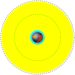
A geocentric orbit, Earth-centered orbit, or Earth orbit involves any object orbiting Earth, such as the Moon or artificial satellites. In 1997, NASA estimated there were approximately 2,465 artificial satellite payloads orbiting Earth and 6,216 pieces of space debris as tracked by the Goddard Space Flight Center. [1] More than 16,291 objects previously launched have undergone orbital decay and entered Earth's atmosphere. [1]

Contents

A spacecraft enters orbit when its centripetal acceleration due to gravity is less than or equal to the centrifugal acceleration due to the horizontal component of its velocity. For a low Earth orbit, this velocity is about 7.8 km/s (28,100 km/h; 17,400 mph); [2] by contrast, the fastest crewed airplane speed ever achieved (excluding speeds achieved by deorbiting spacecraft) was 2.2 km/s (7,900 km/h; 4,900 mph) in 1967 by the North American X-15. [3] The energy required to reach Earth orbital velocity at an altitude of 600 km (370 mi) is about 36  MJ/kg, which is six times the energy needed merely to climb to the corresponding altitude. [4]

Spacecraft with a perigee below about 2,000 km (1,200 mi) are subject to drag from the Earth's atmosphere, [5] which decreases the orbital altitude. The rate of orbital decay depends on the satellite's cross-sectional area and mass, as well as variations in the air density of the upper atmosphere. Below about 300 km (190 mi), decay becomes more rapid with lifetimes measured in days. Once a satellite descends to 180 km (110 mi), it has only hours before it vaporizes in the atmosphere. [6] The escape velocity required to pull free of Earth's gravitational field altogether and move into interplanetary space is about 11.2 km/s (40,300 km/h; 25,100 mph). [7]

List of terms and concepts

Altitude
as used here, the height of an object above the average surface of the Earth's oceans (mean see level).
Analemma
a term in astronomy used to describe the plot of the positions of the Sun on the celestial sphere throughout one year. Closely resembles a figure-eight.
Apogee
is the farthest point that a satellite or celestial body can go from Earth, at which the orbital velocity will be at its minimum.
Eccentricity
a measure of how much an orbit deviates from a perfect circle. Eccentricity is strictly defined for all circular and elliptical orbits, and parabolic and hyperbolic trajectories.
Equatorial plane
as used here, an imaginary plane extending from the equator on the Earth to the celestial sphere.
Escape velocity
as used here, the minimum velocity an object without propulsion needs to have to move away indefinitely from the Earth. An object at this velocity will enter a parabolic trajectory; above this velocity it will enter a hyperbolic trajectory.
Impulse
the integral of a force over the time during which it acts. Measured in (N·sec or lb * sec).
Inclination
the angle between a reference plane and another plane or axis. In the sense discussed here the reference plane is the Earth's equatorial plane.
Orbital arc
an imaginary arc in the sky as seen from any given location on the surface of the Earth.
Orbital characteristics
the six parameters of the Keplerian elements needed to specify that orbit uniquely.
Orbital period
as defined here, time it takes a satellite to make one full orbit around the Earth.
Perigee
is the nearest approach point of a satellite or celestial body from Earth, at which the orbital velocity will be at its maximum.
Sidereal day
the time it takes for a celestial object to rotate 360°. For the Earth this is: 23 hours, 56 minutes, 4.091 seconds.
Solar time
as used here, the local time as measured by a sundial.
Velocity
an object's speed in a particular direction. Since velocity is defined as a vector, both speed and direction are required to define it.

Types

The following is a list of different geocentric orbit classifications.

Altitude classifications

Low (cyan) and Medium (yellow) Earth orbit regions to scale. The black dashed line is the geosynchronous orbit. The green dashed line is the 20,230 km orbit used for GPS satellites. Orbits around earth scale diagram.svg
Low (cyan) and Medium (yellow) Earth orbit regions to scale. The black dashed line is the geosynchronous orbit. The green dashed line is the 20,230 km orbit used for GPS satellites.

Transatmospheric orbit (TAO)
Geocentric orbits with altitudes at apogee higher than 100 km (62 mi) and perigee that intersects with the defined atmosphere. [8]
Low Earth orbit (LEO)
Geocentric orbits ranging in altitude from 160 km (100 mi) to 2,000 km (1,200 mi) above mean sea level. At 160 km, one revolution takes approximately 90 minutes, and the circular orbital speed is 8 km/s (26,000 ft/s).
Medium Earth orbit (MEO)
Geocentric orbits with altitudes at apogee ranging between 2,000 km (1,200 mi) and that of the geosynchronous orbit at 35,786 km (22,236 mi).
Geosynchronous orbit (GEO)
Geocentric circular orbit with an altitude of 35,786 km (22,236 mi). The period of the orbit equals one sidereal day, coinciding with the rotation period of the Earth. The speed is approximately 3 km/s (9,800 ft/s).
High Earth orbit (HEO)
Geocentric orbits with altitudes at apogee higher than that of the geosynchronous orbit. A special case of high Earth orbit is the highly elliptical orbit, where altitude at perigee is less than 2,000 km (1,200 mi). [9]

Inclination classifications

Inclined orbit
An orbit whose inclination in reference to the equatorial plane is not 0.
Polar orbit
A satellite that passes above or nearly above both poles of the planet on each revolution. Therefore it has an inclination of (or very close to) 90 degrees.
Polar Sun synchronous orbit
A nearly polar orbit that passes the equator at the same local time on every pass. Useful for image-taking satellites because shadows will be the same on every pass.

Eccentricity classifications

Circular orbit
An orbit that has an eccentricity of 0 and whose path traces a circle.
Elliptic orbit
An orbit with an eccentricity greater than 0 and less than 1 whose orbit traces the path of an ellipse.
Hohmann transfer orbit
An orbital maneuver that moves a spacecraft from one circular orbit to another using two engine impulses. This maneuver was named after Walter Hohmann.
Geosynchronous transfer orbit (GTO)
A geocentric-elliptic orbit where the perigee is at the altitude of a low Earth Orbit (LEO) and the apogee at the altitude of a geosynchronous orbit.
Highly elliptical orbit (HEO)
Geocentric orbit with apogee above 35,786 km and low perigee (about 1,000 km) that result in long dwell times near apogee.
Molniya orbit
A highly elliptical orbit with inclination of 63.4° and orbital period of ½ of a sidereal day (roughly 12 hours). Such a satellite spends most of its time over a designated area of the Earth.
Tundra orbit
A highly elliptical orbit with inclination of 63.4° and orbital period of one sidereal day (roughly 24 hours). Such a satellite spends most of its time over a designated area of the Earth.
Hyperbolic trajectory
An "orbit" with eccentricity greater than 1. The object's velocity reaches some value in excess of the escape velocity, therefore it will escape the gravitational pull of the Earth and continue to travel infinitely with a velocity (relative to Earth) decelerating to some finite value, known as the hyperbolic excess velocity.
Escape Trajectory
This trajectory must be used to launch an interplanetary probe away from Earth, because the excess over escape velocity is what changes its heliocentric orbit from that of Earth.
Capture Trajectory
This is the mirror image of the escape trajectory; an object traveling with sufficient speed, not aimed directly at Earth, will move toward it and accelerate. In the absence of a decelerating engine impulse to put it into orbit, it will follow the escape trajectory after periapsis.
Parabolic trajectory
An "orbit" with eccentricity exactly equal to 1. The object's velocity equals the escape velocity, therefore it will escape the gravitational pull of the Earth and continue to travel with a velocity (relative to Earth) decelerating to 0. A spacecraft launched from Earth with this velocity would travel some distance away from it, but follow it around the Sun in the same heliocentric orbit. It is possible, but not likely that an object approaching Earth could follow a parabolic capture trajectory, but speed and direction would have to be precise.

Directional classifications

Prograde orbit
an orbit in which the projection of the object onto the equatorial plane revolves about the Earth in the same direction as the rotation of the Earth.
Retrograde orbit
an orbit in which the projection of the object onto the equatorial plane revolves about the Earth in the direction opposite that of the rotation of the Earth.

Geosynchronous classifications

Semi-synchronous orbit (SSO)
An orbit with an altitude of approximately 20,200 km (12,600 mi) and an orbital period of approximately 12 hours
Geosynchronous orbit (GEO)
Orbits with an altitude of approximately 35,786 km (22,236 mi). Such a satellite would trace an analemma (figure 8) in the sky.
Geostationary orbit (GSO)
A geosynchronous orbit with an inclination of zero. To an observer on the ground this satellite would appear as a fixed point in the sky.
Clarke orbit
Another name for a geostationary orbit. Named after the writer Arthur C. Clarke.
Earth orbital libration points
The libration points for objects orbiting Earth are at 105 degrees west and 75 degrees east. More than 160 satellites are gathered at these two points. [10]
Supersynchronous orbit
A disposal / storage orbit above GSO/GEO. Satellites will drift west.
Subsynchronous orbit
A drift orbit close to but below GSO/GEO. Satellites will drift east.
Graveyard orbit, disposal orbit, junk orbit
An orbit a few hundred kilometers above geosynchronous that satellites are moved into at the end of their operation.

Special classifications

Sun-synchronous orbit
An orbit which combines altitude and inclination in such a way that the satellite passes over any given point of the planet's surface at the same local solar time. Such an orbit can place a satellite in constant sunlight and is useful for imaging, spy, and weather satellites.
Moon orbit
The orbital characteristics of Earth's Moon. Average altitude of 384,403 kilometres (238,857 mi), elliptical inclined orbit.

Non-geocentric classifications

Horseshoe orbit
An orbit that appears to a ground observer to be orbiting a planet but is actually in co-orbit with it. See asteroids 3753 (Cruithne) and 2002 AA29.
Sub-orbital flight
A launch where a spacecraft approaches the height of orbit but lacks the velocity to sustain it.

Tangential velocities at altitude

Orbit Center-to-center
distance
Altitude above
the Earth's surface
Speed Orbital period Specific orbital energy
Earth's own rotation at surface (for comparison— not an orbit)6,378 km0 km 465.1 m/s (1,674 km/h or 1,040 mph)23 h 56 min 4.09 sec−62.6 MJ/kg
Orbiting at Earth's surface (equator) theoretical6,378 km0 km7.9 km/s (28,440 km/h or 17,672 mph)1 h 24 min 18 sec−31.2 MJ/kg
Low Earth orbit 6,600–8,400 km200–2,000 km
  • Circular orbit: 7.7–6.9 km/s (27,772–24,840 km/h or 17,224–15,435 mph) respectively
  • Elliptic orbit: 10.07–8.7 km/s respectively
1 h 29 min – 2 h 8 min−29.8 MJ/kg
Molniya orbit 6,900–46,300 km500–39,900 km1.5–10.0 km/s (5,400–36,000 km/h or 3,335–22,370 mph) respectively11 h 58 min−4.7 MJ/kg
Geostationary 42,000 km35,786 km3.1 km/s (11,600 km/h or 6,935 mph)23 h 56 min 4.09 sec−4.6 MJ/kg
Orbit of the Moon 363,000–406,000 km357,000–399,000 km0.97–1.08 km/s (3,492–3,888 km/h or 2,170–2,416 mph) respectively27.27 days−0.5 MJ/kg
The lower axis gives orbital speeds of some orbits Comparison satellite navigation orbits.svg
The lower axis gives orbital speeds of some orbits

See also

Related Research Articles

<span class="mw-page-title-main">Orbit</span> Curved path of an object around a point

In celestial mechanics, an orbit is the curved trajectory of an object such as the trajectory of a planet around a star, or of a natural satellite around a planet, or of an artificial satellite around an object or position in space such as a planet, moon, asteroid, or Lagrange point. Normally, orbit refers to a regularly repeating trajectory, although it may also refer to a non-repeating trajectory. To a close approximation, planets and satellites follow elliptic orbits, with the center of mass being orbited at a focal point of the ellipse, as described by Kepler's laws of planetary motion.

<span class="mw-page-title-main">Geosynchronous orbit</span> Orbit keeping the satellite at a fixed longitude above the equator

A geosynchronous orbit is an Earth-centered orbit with an orbital period that matches Earth's rotation on its axis, 23 hours, 56 minutes, and 4 seconds. The synchronization of rotation and orbital period means that, for an observer on Earth's surface, an object in geosynchronous orbit returns to exactly the same position in the sky after a period of one sidereal day. Over the course of a day, the object's position in the sky may remain still or trace out a path, typically in a figure-8 form, whose precise characteristics depend on the orbit's inclination and eccentricity. A circular geosynchronous orbit has a constant altitude of 35,786 km (22,236 mi).

<span class="mw-page-title-main">Geostationary orbit</span> Circular orbit above Earths Equator and following the direction of Earths rotation

A geostationary orbit, also referred to as a geosynchronous equatorial orbit (GEO), is a circular geosynchronous orbit 35,786 km (22,236 mi) in altitude above Earth's equator, 42,164 km (26,199 mi) in radius from Earth's center, and following the direction of Earth's rotation.

<span class="mw-page-title-main">Low Earth orbit</span> Orbit around Earth between 160 and 2000 km

A low Earth orbit (LEO) is an orbit around Earth with a period of 128 minutes or less and an eccentricity less than 0.25. Most of the artificial objects in outer space are in LEO, with an altitude never more than about one-third of the radius of Earth.

Altitude is a distance measurement, usually in the vertical or "up" direction, between a reference datum and a point or object. The exact definition and reference datum varies according to the context. Although the term altitude is commonly used to mean the height above sea level of a location, in geography the term elevation is often preferred for this usage.

<span class="mw-page-title-main">Hohmann transfer orbit</span> Transfer manoeuvre between two orbits

In astronautics, the Hohmann transfer orbit is an orbital maneuver used to transfer a spacecraft between two orbits of different altitudes around a central body. Examples would be used for travel between low Earth orbit and the Moon, or another solar planet or asteroid. In the idealized case, the initial and target orbits are both circular and coplanar. The maneuver is accomplished by placing the craft into an elliptical transfer orbit that is tangential to both the initial and target orbits. The maneuver uses two impulsive engine burns: the first establishes the transfer orbit, and the second adjusts the orbit to match the target.

<span class="mw-page-title-main">Geostationary transfer orbit</span> Hohmann transfer orbit used to reach geosynchronous or geostationary orbit

A geostationary transfer orbit (GTO) or geosynchronous transfer orbit is a type of geocentric orbit. Satellites that are destined for geosynchronous (GSO) or geostationary orbit (GEO) are (almost) always put into a GTO as an intermediate step for reaching their final orbit.

<span class="mw-page-title-main">Orbital mechanics</span> Field of classical mechanics concerned with the motion of spacecraft

Orbital mechanics or astrodynamics is the application of ballistics and celestial mechanics to the practical problems concerning the motion of rockets, satellites, and other spacecraft. The motion of these objects is usually calculated from Newton's laws of motion and the law of universal gravitation. Orbital mechanics is a core discipline within space-mission design and control.

<span class="mw-page-title-main">Molniya (satellite)</span> Soviet military surveillance and communications satellites

The Molniya series satellites were military and communications satellites launched by the Soviet Union from 1965 to 2004. These satellites used highly eccentric elliptical orbits known as Molniya orbits, which have a long dwell time over high latitudes. They are suited for communications purposes in polar regions, in the same way that geostationary satellites are used for equatorial regions.

<span class="mw-page-title-main">Molniya orbit</span> Type of high-latitude satellite orbit

A Molniya orbit is a type of satellite orbit designed to provide communications and remote sensing coverage over high latitudes. It is a highly elliptical orbit with an inclination of 63.4 degrees, an argument of perigee of 270 degrees, and an orbital period of approximately half a sidereal day. The name comes from the Molniya satellites, a series of Soviet/Russian civilian and military communications satellites which have used this type of orbit since the mid-1960s.

<span class="mw-page-title-main">Orbital spaceflight</span> Spaceflight where spacecraft orbits an astronomical body

An orbital spaceflight is a spaceflight in which a spacecraft is placed on a trajectory where it could remain in space for at least one orbit. To do this around the Earth, it must be on a free trajectory which has an altitude at perigee around 80 kilometers (50 mi); this is the boundary of space as defined by NASA, the US Air Force and the FAA. To remain in orbit at this altitude requires an orbital speed of ~7.8 km/s. Orbital speed is slower for higher orbits, but attaining them requires greater delta-v. The Fédération Aéronautique Internationale has established the Kármán line at an altitude of 100 km (62 mi) as a working definition for the boundary between aeronautics and astronautics. This is used because at an altitude of about 100 km (62 mi), as Theodore von Kármán calculated, a vehicle would have to travel faster than orbital velocity to derive sufficient aerodynamic lift from the atmosphere to support itself.

Delta-<i>v</i> budget Estimate of total change in velocity of a space mission

In astrodynamics and aerospace, a delta-v budget is an estimate of the total change in velocity (delta-v) required for a space mission. It is calculated as the sum of the delta-v required to perform each propulsive maneuver needed during the mission. As input to the Tsiolkovsky rocket equation, it determines how much propellant is required for a vehicle of given empty mass and propulsion system.

<span class="mw-page-title-main">High Earth orbit</span> Geocentric orbit with an altitude entirely above that of a geosynchronous orbit

High Earth orbit (HEO) is a region of space around the Earth where satellites and other spacecraft are placed in orbits that are very high above the planet's atmosphere. This area is defined as an altitude higher than 35,786 km above sea level, which is the radius of a circular geosynchronous orbit. HEO extends to end of the Earth's sphere of influence. Satellites in HEO are primarily used for communication, navigation, scientific research, and military applications. A variety of satellites, such as TESS, have been placed in HEO.

A supersynchronous orbit is either an orbit with a period greater than that of a synchronous orbit, or just an orbit whose major axis is larger than that of a synchronous orbit. A synchronous orbit has a period equal to the rotational period of the body which contains the barycenter of the orbit.

<span class="mw-page-title-main">Tundra orbit</span> Highly elliptical and highly inclined synchronous orbit

A Tundra orbit is a highly elliptical geosynchronous orbit with a high inclination, an orbital period of one sidereal day, and a typical eccentricity between 0.2 and 0.3. A satellite placed in this orbit spends most of its time over a chosen area of the Earth, a phenomenon known as apogee dwell, which makes them particularly well suited for communications satellites serving high-latitude regions. The ground track of a satellite in a Tundra orbit is a closed figure 8 with a smaller loop over either the northern or southern hemisphere. This differentiates them from Molniya orbits designed to service high-latitude regions, which have the same inclination but half the period and do not loiter over a single region.

<span class="mw-page-title-main">Medium Earth orbit</span> Earth-centered orbit above low Earth orbit and below geostationary orbit

A medium Earth orbit (MEO) is an Earth-centered orbit with an altitude above a low Earth orbit (LEO) and below a high Earth orbit (HEO) – between 2,000 and 35,786 km above sea level.

A near-equatorial orbit is an orbit that lies close to the equatorial plane of the object orbited. Such an orbit has an inclination near 0°. On Earth, such orbits lie on the celestial equator, the great circle of the imaginary celestial sphere on the same plane as the equator of Earth. A geostationary orbit is a particular type of equatorial orbit, one which is geosynchronous. A satellite in a geostationary orbit appears stationary, always at the same point in the sky, to observers on the surface of the Earth.

<span class="mw-page-title-main">Ground track</span> Path on the surface of the Earth or another body directly below an aircraft or satellite

A ground track or ground trace is the path on the surface of a planet directly below an aircraft's or satellite's trajectory. In the case of satellites, it is also known as a suborbital track or subsatellite track, and is the vertical projection of the satellite's orbit onto the surface of the Earth.

This glossary of astronomy is a list of definitions of terms and concepts relevant to astronomy and cosmology, their sub-disciplines, and related fields. Astronomy is concerned with the study of celestial objects and phenomena that originate outside the atmosphere of Earth. The field of astronomy features an extensive vocabulary and a significant amount of jargon.

References

  1. 1 2 "Satellite Situation Report, 1997". NASA Goddard Space Flight Center. 2000-02-01. Archived from the original on 2006-08-23. Retrieved 2006-09-10.
  2. Hill, James V. H. (April 1999), "Getting to Low Earth Orbit", Space Future, archived from the original on 2012-03-19, retrieved 2012-03-18.
  3. Shiner, Linda (November 1, 2007), X-15 Walkaround, Air & Space Magazine, retrieved 2009-06-19.
  4. Dimotakis, P.; et al. (October 1999), 100 lbs to Low Earth Orbit (LEO): Small-Payload Launch Options, The Mitre Corporation, pp. 1–39, archived from the original on 2017-08-29, retrieved 2012-01-21.
  5. Ghosh, S. N. (2000), Atmospheric Science and Environment, Allied Publishers, pp. 47–48, ISBN   978-8177640434
  6. Kennewell, John; McDonald, Andrew (2011), Satellite Lifetimes and Solar Activity, Commonwealth of Australia Bureau of Weather, Space Weather Branch, archived from the original on 2011-12-28, retrieved 2011-12-31.
  7. Williams, David R. (November 17, 2010), "Earth Fact Sheet", Lunar & Planetary Science, NASA, archived from the original on October 30, 2010, retrieved 2012-05-10.
  8. McDowell, Jonathan (24 May 1998). "Jonathan's Space Report". Transatmospheric orbit (TAO): orbital flight with perigee less than 80 km but more than zero. Potentially used by aerobraking missions and transatmospheric vehicles, also in some temporary phases of orbital flight (e.g. STS pre OMS-2, some failures when no apogee restart)
  9. Definitions of geocentric orbits from the Goddard Space Flight Center Archived May 27, 2010, at the Wayback Machine
  10. Out-of-Control Satellite Threatens Other Nearby Spacecraft, by Peter B. de Selding, SPACE.com, 5/3/10. Archived May 5, 2010, at the Wayback Machine