A retroreflector is a device or surface that reflects radiation back to its source with minimum scattering. This works at a wide range of angle of incidence, unlike a planar mirror, which does this only if the mirror is exactly perpendicular to the wave front, having a zero angle of incidence. Being directed, the retroflector's reflection is brighter than that of a diffuse reflector. Corner reflectors and cat's eye reflectors are the most used kinds.

Lunar Laser Ranging (LLR) is the practice of measuring the distance between the surfaces of the Earth and the Moon using laser ranging. The distance can be calculated from the round-trip time of laser light pulses travelling at the speed of light, which are reflected back to Earth by the Moon's surface or by one of several retroreflectors installed on the Moon. Three were placed by the United States' Apollo program, two by the Soviet Lunokhod 1 and 2 missions, and one by India's Chandrayaan-3 mission.

The history of the telescope can be traced to before the invention of the earliest known telescope, which appeared in 1608 in the Netherlands, when a patent was submitted by Hans Lippershey, an eyeglass maker. Although Lippershey did not receive his patent, news of the invention soon spread across Europe. The design of these early refracting telescopes consisted of a convex objective lens and a concave eyepiece. Galileo improved on this design the following year and applied it to astronomy. In 1611, Johannes Kepler described how a far more useful telescope could be made with a convex objective lens and a convex eyepiece lens. By 1655, astronomers such as Christiaan Huygens were building powerful but unwieldy Keplerian telescopes with compound eyepieces.

LAGEOS, Laser Geodynamics Satellite or Laser Geometric Environmental Observation Survey, are a series of two scientific research satellites designed to provide an orbiting laser ranging benchmark for geodynamical studies of the Earth. Each satellite is a high-density passive laser reflector in a very stable medium Earth orbit (MEO).

Satellite laser ranging (SLR) is a method to measure the distance to satellites in a geocentric orbit. It consists of an astronomical observatory equipped with a laser that sends ultrashort pulses of light. The pulses hit the satellite and bounce back to be caught by the station, which measure the round trip time with the speed of light formula. These measurements are instantaneous and with millimeter level precision, which can be accumulated to provide accurate measurement of orbits and a host of important scientific data. Some satellites have retroreflectors, but the method also works on space debris.
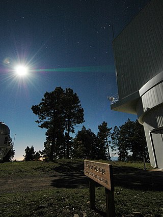
The Apache Point Observatory Lunar Laser-ranging Operation, or APOLLO, is a project at the Apache Point Observatory in New Mexico. It is an extension and advancement of previous Lunar Laser Ranging experiments, which use retroreflectors on the Moon to track changes in lunar orbital distance and motion.
Satellite geodesy is geodesy by means of artificial satellites—the measurement of the form and dimensions of Earth, the location of objects on its surface and the figure of the Earth's gravity field by means of artificial satellite techniques. It belongs to the broader field of space geodesy. Traditional astronomical geodesy is not commonly considered a part of satellite geodesy, although there is considerable overlap between the techniques.

The Meteor spacecraft are weather observation satellites launched by the Soviet Union and Russia since the Cold War. The Meteor satellite series was initially developed during the 1960s. The Meteor satellites were designed to monitor atmospheric and sea-surface temperatures, humidity, radiation, sea ice conditions, snow-cover, and clouds. Between 1964 and 1969, a total of eleven Soviet Union Meteor satellites were launched.
The STARSHINE series of three artificial satellites were student participatory missions sponsored by the United States Naval Research Laboratory.

Third-party evidence for Apollo Moon landings is evidence, or analysis of evidence, about the Moon landings that does not come from either NASA or the U.S. government, or the Apollo Moon landing hoax theorists. This evidence provides independent confirmation of NASA's account of the six Apollo program Moon missions flown between 1969 and 1972.
Strictly speaking, a satellite collision is when two satellites collide while in orbit around a third, much larger body, such as a planet or moon. This definition is typically loosely extended to include collisions between sub-orbital or escape-velocity objects with an object in orbit. Prime examples are the anti-satellite weapon tests. There have been no observed collisions between natural satellites, but impact craters may show evidence of such events. Both intentional and unintentional collisions have occurred between man-made satellites around Earth since the 1980s. Anti-satellite weapon tests and failed rendezvous or docking operations can result in orbital space debris, which in turn may collide with other satellites.
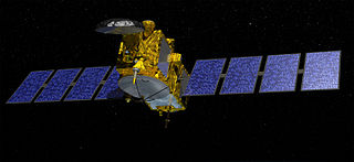
Jason-3 is a satellite altimeter created by a partnership of the European Organisation for the Exploitation of Meteorological Satellites (EUMETSAT) and National Aeronautic and Space Administration (NASA), and is an international cooperative mission in which National Oceanic and Atmospheric Administration (NOAA) is partnering with the Centre National d'Études Spatiales. The satellite's mission is to supply data for scientific, commercial, and practical applications to sea level rise, sea surface temperature, ocean temperature circulation, and climate change.

LARES is a passive satellite system of the Italian Space Agency.

STSat-2C, or Science and Technology Satellite-2C, or Naro Science Satellite (ko:나로과학위성) was a South Korean satellite which was launched in 2013. It was operated by the Korea Aerospace Research Institute (KARI), and was intended to demonstrate technology for future spacecraft. The satellite had a mass of 100 kg (220 lb), and was expected to operate for less than a year.

GEOS-3, or Geodynamics Experimental Ocean Satellite 3, or GEOS-C, was the third and final satellite as part of NASA's Geodetic Earth Orbiting Satellite/Geodynamics Experimental Ocean Satellite program (NGSP) to better understand and test satellite tracking systems. For GEOS 1 and GEOS 2, the acronym stands for Geodetic Earth Orbiting Satellite; this was changed for GEOS-3.

Meteor-3M No.1 was the first and only of the Meteor-3M series polar-orbiting weather satellites. It was launched on 10 December 2001 at 17:18:57 UTC from the Baikonur Cosmodrome in Kazakhstan. The satellite is in a Sun-synchronous orbit with an ascending node time of about 9 AM.
MoonLIGHT is a laser retroreflector developed as a collaboration primarily between the University of Maryland in the United States, and the Italian National Institute for Nuclear Physics - National Laboratories of Frascati (INFN-LNF) to complement and expand on the Lunar Laser Ranging experiment started with the Apollo Program in 1969. MoonLIGHT was planned to be launched in July 2020 as a secondary payload on the MX-1E lunar lander built by the private company Moon Express. However, as of February 2020, the launch of the MX-1E has been canceled. In 2018 INFN proposed to the European Space Agency (ESA) the MoonLIGHT Pointing Actuators (MPAc) project and was contracted by ESA to deliver it. MPAc is an INFN development for ESA, with auxiliary support by the Italian Space Agency (ASI) for prototyping work. In 2021, ESA agreed with NASA to launch MPAc with a Commercial Lunar Payload Services (CLPS) mission. Nova-C, the lander on which MPAc will be integrated, is designed by Intuitive Machines and the landing site is Reiner Gamma. The expected launch date of the Nova-C mission carrying the instrument, IM-3, is in 2025.

Starlette and Stella are nearly identical French geodetic and geophysical satellites. Starlette was launched on 6 February 1975 and Stella on 26 September 1993. Starlette was the first passive laser satellite developed.