Related Research Articles

Milstar is a constellation of military communications satellites in geosynchronous orbit, which are operated by the United States Space Force, and provide secure and jam-resistant worldwide communications to meet the requirements of the Armed Forces of the United States. Six spacecraft were launched between 1994 and 2003, of which only five were operational after launch; the third launch failed, both damaging the satellite and leaving it in an unusable orbit.

The Kosmos rockets were a series of Soviet and subsequently Russian rockets, derived from the R-12 and R-14 missiles, the best known of which is the Kosmos-3M, which has made over 440 launches. The Kosmos family contained a number of rockets, both carrier rockets and sounding rockets, for orbital and sub-orbital spaceflight respectively. The first variant, the Kosmos, first flew on 27 October 1961. Over 700 Kosmos rockets have been launched overall.

Rokot, also transliterated Rockot, was a Soviet Union space launch vehicle that was capable of launching a payload of 1,950 kilograms (4,300 lb) into a 200-kilometre (120 mi) Earth orbit with 63° inclination. It was based on the UR-100N intercontinental ballistic missile (ICBM), supplied and operated by Khrunichev State Research and Production Space Center. The first launches started in the 1990s from Baikonur Cosmodrome out of a silo. Later commercial launches commenced from Plesetsk Cosmodrome using a launch ramp specially rebuilt from one for the Kosmos-3M launch vehicle. The cost of the launcher itself was about US$15 million in 1999; The contract with European Space Agency (ESA) for launching Swarm in September 2013 was worth €27.1 million.
The National Space Research and Development Agency (NASRDA) is the national space agency of Nigeria. It is a parastatal under Federal Ministry of Innovation, Science and Technology. The agency is based in the Nigerian capital city of Abuja in the Lugbe district and has a ground receiving station, among various other sites. In the past, it has cooperated in space technology with the United Kingdom, China, Ukraine and Russia. The agency has struggled with meeting its financial plans and some of its facilities are rundown. Despite this, the space agency is one of the most advanced space agencies in Africa, boasting of four satellites and very grand ambitions. Nigeria's satellites have been praised for their high-resolution images. NASRDA is host to one of UN-SPIDER's Regional Support Offices (RSO) in Africa.

Advanced Extremely High Frequency (AEHF) is a constellation of communications satellites operated by the United States Space Force. They are used to relay secure communications for the United States Armed Forces, the British Armed Forces, the Canadian Armed Forces, the Netherlands Armed Forces and the Australian Defence Force. The system consists of six satellites in geostationary orbits. The final satellite was launched on 26 March 2020. AEHF is backward compatible with, and replaces, the older Milstar system and will operate at 44 GHz uplink and 20 GHz downlink. The AEHF system is a joint service communications system that provides survivable, global, secure, protected, and jam-resistant communications for high-priority military ground, sea and air assets.

Gonets is a Russian civilian low Earth orbit communications satellite system. It consists of a number of satellites, derived from Strela military communications satellites. The first two satellites, which were used to test and validate the system, were launched by a Tsyklon-3 launch vehicle from the Plesetsk Cosmodrome on 13 July 1992, and were designated Gonets-D. The first operational satellites, designated Gonets-D1, were launched on 19 February 1996. After launch, the first three satellites were given military Kosmos designations, a practice which was not continued with the other satellites.
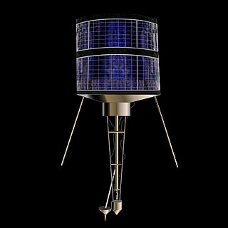
Strela is a Russian military communications satellite constellation operating in low Earth orbit. These satellites operate as mailboxes ("store-and-forward"): they remember the received messages and then resend them after the scheduled time, or by a command from the Earth. Some sources state the satellites are capable of only three months of active operation, but through coordination with others they can serve for about five years. The satellites are used for transmission of encrypted messages and images.
Kosmos-2251 was a Russian Strela-2M military communications satellite. It was launched into Low Earth orbit from Site 132/1 at the Plesetsk Cosmodrome at 04:17 UTC on 16 June 1993, by a Kosmos-3M carrier rocket. The Strela satellites had a lifespan of 5 years, and the Russian government reported that Kosmos-2251 ceased functioning in 1995. Russia was later criticised by The Space Review for leaving a defunct satellite in a congested orbit, rather than deorbiting it. In response, Russia noted that they were not required to do so under international law. In any case, the KAUR-1 satellites had no propulsion system, which is usually required for deorbiting.

Iridium 33 was a communications satellite launched by Russia for Iridium Communications. It was launched into low Earth orbit from Site 81/23 at the Baikonur Cosmodrome at 01:36 UTC on 14 September 1997, by a Proton-K rocket with a Block DM2 upper stage. The launch was arranged by International Launch Services (ILS). It was operated in Plane 3 of the Iridium satellite constellation, with an ascending node of 230.9°.
The Near Earth Network provides orbital communications support for near-Earth orbiting customer platforms via various ground stations, operated by NASA and other space agencies. It uses a number of different dishes scattered around the globe. The antennas must be able to move fast for tracking of objects in low Earth orbit (LEO). The NEN and Space Network (SN) combined were previously referred to as the Spaceflight Tracking and Data Network (STDN).

On February 10, 2009, two communications satellites—the active commercial Iridium 33 and the derelict Russian military Kosmos 2251—accidentally collided at a speed of 11.7 km/s (26,000 mph) and an altitude of 789 kilometres (490 mi) above the Taymyr Peninsula in Siberia. It was the first time a hypervelocity collision occurred between two satellites; previous incidents had involved a satellite and a piece of space debris.
Parus, also Tsyklon-B or Tsiklon-B and Tsikada-M, GRAU index 11F627, was a Russian, previously Soviet satellite constellation used for communication and navigation. As of 2010, 99 Parus satellites had been launched, starting with Kosmos 700 in 1974. All launches had been conducted using Kosmos-3M carrier rockets, flying from sites 132 and 133 at the Plesetsk Cosmodrome.
Kosmos 2481 is a Russian Strela-3 military communications satellite which was launched in 2012 by the Russian Aerospace Defence Forces. It was launched with 2 Gonets-M civilian communication satellites and a research satellite called Yubileiny-2, also known as MiR.
Kosmos 2467 is one of a pair of Russian military communications satellites which were launched in 2010 by the Russian Space Forces. It was launched with Kosmos 2468 and a Gonets-M civilian communication satellite.
Kosmos 2468 is a Russian military communications satellite which was launched in 2010 by the Russian Space Forces. It was launched with Kosmos 2467 and a Gonets-M civilian communication satellite.
Kosmos 2484 is a Russian military store-dump communications satellite launched in 2013, together with Kosmos 2483 and Kosmos 2482.
Kosmos 2483 is a Russian military store-dump communications satellite launched in 2013, together with Kosmos 2484 and Kosmos 2482.
Kosmos 2482 is a Russian military store-dump communications satellite launched in 2013, together with Kosmos 2483 and Kosmos 2484.

A small-lift launch vehicle is a rocket orbital launch vehicle that is capable of lifting 2,000 kilograms (4,400 lb) or less or under 5,000 kilograms (11,000 lb) of payload into low Earth orbit (LEO). The next larger category consists of medium-lift launch vehicles.
Kosmos 2126, also known as Cosmos 2126, was a Russian Satellite that was part of the Strela-1M generation of communications satellites that operated in low Earth orbit to collect (store) information then forward (dump) it to a ground station when overhead of its ground station. Kosmos-2126 was launched in 1991 from the Plesetsk Cosmodrome.
References
- ↑ "2009 - Satellite & Spacecraft Launches and Detailed Orbits". www.zarya.info. Retrieved 2018-03-11.
- ↑ "Strela-3M (Rodnik-S, 14F132)". Gunter's Space Page. Retrieved November 28, 2019.
- ↑ "Cosmos 2452". NASA Space Science Data Coordinated Archive. Retrieved November 28, 2019.
- ↑ "Rodnik military communications satellites". russianspaceweb.com. Retrieved May 8, 2023.
| | This spacecraft or satellite related article is a stub. You can help Wikipedia by expanding it. |