Related Research Articles

A tsunami is a series of waves in a water body caused by the displacement of a large volume of water, generally in an ocean or a large lake. Earthquakes, volcanic eruptions and other underwater explosions above or below water all have the potential to generate a tsunami. Unlike normal ocean waves, which are generated by wind, or tides, which are generated by the gravitational pull of the Moon and the Sun, a tsunami is generated by the displacement of water by a large event.

Hawaiʻi is the largest island in the United States, located in the state of Hawaii. It is the southeasternmost of the Hawaiian Islands, a chain of volcanic islands in the North Pacific Ocean. With an area of 4,028 square miles (10,430 km2), it has 63% of the Hawaiian archipelago's combined landmass. However, it has only 13% of Hawaiʻi's population. The island of Hawaiʻi is the third largest island in Polynesia, behind the two main islands of New Zealand.

Hilo is a census-designated place (CDP) and the largest city in Hawaii County, Hawaii, United States, which encompasses the Island of Hawaiʻi. The population was 44,186 according to the 2020 census.

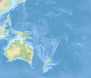
The Hawaiian Islands are an archipelago of eight major islands, several atolls, numerous smaller islets, and seamounts in the North Pacific Ocean, extending some 1,500 miles from the island of Hawaiʻi in the south to northernmost Kure Atoll. Formerly the group was known to Europeans and Americans as the Sandwich Islands, a name that James Cook chose in honor of the then First Lord of the Admiralty John Montagu, 4th Earl of Sandwich. Cook came across the islands by chance when crossing the Pacific Ocean on his Third Voyage, on board HMS Resolution; he was later killed on the islands on a return visit. The contemporary name of the islands, dating from the 1840s, is derived from the name of the largest island, Hawaiʻi Island.

A megatsunami is a very large wave created by a large, sudden displacement of material into a body of water.

The 2004 Indian Ocean earthquake and tsunami occurred at 07:58:53 in local time (UTC+7) on 26 December, with an epicentre off the west coast of northern Sumatra, Indonesia. It was an undersea megathrust earthquake that registered a magnitude of 9.1–9.3 Mw, reaching a Mercalli intensity up to IX in certain areas. The earthquake was caused by a rupture along the fault between the Burma Plate and the Indian Plate.

A tsunami warning system (TWS) is used to detect tsunamis in advance and issue the warnings to prevent loss of life and damage to property. It is made up of two equally important components: a network of sensors to detect tsunamis and a communications infrastructure to issue timely alarms to permit evacuation of the coastal areas. There are two distinct types of tsunami warning systems: international and regional. When operating, seismic alerts are used to instigate the watches and warnings; then, data from observed sea level height are used to verify the existence of a tsunami. Other systems have been proposed to augment the warning procedures; for example, it has been suggested that the duration and frequency content of t-wave energy is indicative of an earthquake's tsunami potential.

The 1946 Aleutian Islands earthquake occurred near the Aleutian Islands, Alaska on April 1. The shock had a moment magnitude of 8.6 and a maximum Mercalli intensity of VI (Strong). It resulted in 165–173 casualties and over $26 million in damage. The seafloor along the fault was elevated, triggering a Pacific-wide tsunami with multiple destructive waves at heights ranging from 45–130 ft. The tsunami obliterated the Scotch Cap Lighthouse on Unimak Island, Alaska among others, and killed all five lighthouse keepers. Despite the destruction to the Aleutian Island Unimak, the tsunami had almost an imperceptible effect on the Alaskan mainland.

Marine geology or geological oceanography is the study of the history and structure of the ocean floor. It involves geophysical, geochemical, sedimentological and paleontological investigations of the ocean floor and coastal zone. Marine geology has strong ties to geophysics and to physical oceanography.

The 2006 Kuril Islands earthquake occurred on November 15 at 8:14:16 pm JST with a Mw magnitude of 8.3 and a maximum Mercalli intensity of VII and a maximum Shindo intensity of JMA 2. This megathrust earthquake was the largest event in the central Kuril Islands since 1915 and generated a small tsunami that affected the northern Japanese coast. The tsunami crossed the Pacific Ocean and damaged the harbor at Crescent City, California. Post-tsunami surveys indicate that the local tsunami in the central Kuril Islands reached runups of 15 metres (49 ft) or more.

A teletsunami is a tsunami that originates from a distant source, defined as more than 1,000 km (620 mi) away or three hours' travel from the area of interest, sometimes travelling across an ocean. All teletsunamis have been generated by major earthquakes such as the 1755 Lisbon earthquake, 1960 Valdivia earthquake, 1964 Alaska earthquake, and 2004 Indian Ocean earthquake.
The 2009 Samoa earthquake and tsunami took place on 29 September 2009 in the southern Pacific Ocean adjacent to the Kermadec-Tonga subduction zone. The submarine earthquake occurred in an extensional environment and had a moment magnitude of 8.1 and a maximum Mercalli intensity of VI (Strong). It was the largest earthquake of 2009.

The 2010 Chile earthquake and tsunami occurred off the coast of central Chile on Saturday, 27 February at 03:34 local time, having a magnitude of 8.8 on the moment magnitude scale, with intense shaking lasting for about three minutes. It was felt strongly in six Chilean regions, that together make up about 80 percent of the country's population. According to the United States Geological Survey (USGS) the cities experiencing the strongest shaking—VIII (Severe) on the Mercalli intensity scale (MM)—were Concepción, Arauco, and Coronel. According to Chile's Seismological Service Concepción experienced the strongest shaking at MM IX (Violent). The earthquake was felt in the capital Santiago at MM VII or MM VIII. Tremors were felt in many Argentine cities, including Buenos Aires, Córdoba, Mendoza, and La Rioja. Tremors were felt as far north as the city of Ica in southern Peru.

Hilo Bay is a large bay located on the eastern coast of the island of Hawaiʻi.
Gordon Andrew Macdonald was a notable American volcanologist.

On January 23, 2018, at 00:31 AKST, an earthquake occurred in the Gulf of Alaska near Kodiak Island. The earthquake, measured at 7.9 on the Mw scale, was approximately 280 kilometres (170 mi) southeast of Kodiak and happened at a depth of 25 kilometres (16 mi).

An earthquake struck near the Hawaiian island of Lanai on February 19, at 10:11 pm HST with an estimated magnitude of 7.0–7.5 on the Richter scale. It remains one of the largest seismic events to hit the Hawaiian Islands since the 1868 Ka‘ū earthquake, with its effects being felt throughout the entire archipelago. It caused severe damage on the islands of Lanai, Molokai and Maui. A tsunami may have been generated however there are speculations of it had really happened. Despite the size of the quake and the extent of damage, no lives were lost.

The 1585 Aleutian Islands earthquake is the source of a vaguely–described tsunami along the Sanriku coast of Japan on June 11, 1585. The event was misdated to 1586 and thought to be generated by the 1586 Lima–Callao earthquake. The misdating also led to it being attributed with the deadly 1586 Tenshō earthquake. The source earthquake is now determined to be along the Aleutian Islands. Evidence from tsunami deposit and coral rocks in Hawaii led to the inference that this was a large megathrust earthquake occurring on the Aleutian subduction zone with a moment magnitude (Mw ) as large as 9.25.

An earthquake occurred off the coast of the Alaska Peninsula on July 28, 2021, at 10:15 p.m. local time. The large megathrust earthquake had a moment magnitude of 8.2 according to the United States Geological Survey (USGS). A tsunami warning was issued by the National Oceanic and Atmospheric Administration (NOAA) but later cancelled. The mainshock was followed by a number of aftershocks, including three that were of magnitude 5.9, 6.1 and 6.9 respectively.
References
- 1 2 3 Chester Lao , Jacquelin N. Miller, "Memorial to Doak C. Cox 1917-2003" Geological Society of America Memorials, v. 33, April 2004 p.9-11
- 1 2 3 "Group honors three scientists", The Honolulu Advertiser (September 20, 2002), p. B3.
- ↑ Pacific Tsunami Warning System : a half-century of protecting the Pacific, 1965-2015. Kong, Laura S. L. (Laura Sau Lin),, Dunbar, Paula K.,, Arcos, Nicolás,, International Tsunami Information Center. Honolulu, Hawaii. 2015. ISBN 9780996257909. OCLC 908226735.CS1 maint: others (link)
| General | |
|---|---|
| National libraries | |