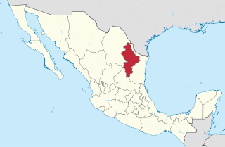
The governmental structures of Nuevo León, a Mexican state, are organized according to article 30 of the state constitution, which provides for a republican, representative and popular government, divided into three independent branches that cannot be joined together in a single person or institution. Nuevo León's relation with the federal government of Mexico places it in a similar relation to that federal government as any other Mexican state, but it retains certain aspects of sovereignty with respect to other Mexican states and even toward foreign countries, especially with reference to its own internal affairs.
Most of the fiestas of the state of Nuevo León, Mexico are related to the anniversaries of the foundation of municipalities, the celebration of local Roman Catholic patron saints or exhibitions of the most popular produce of the particular region. The majority are observed at the local level and, given that the greater part of the municipalities have few inhabitants, the festivals can be a bit austere. Nonetheless, some of them, such as the Festival del Barrio Antiguo or the Exposición Ganadera de Guadalupe receive visitors from throughout Mexico and internationally.

San Nicolás de los Garza, sometimes known only as San Nicolás, is a city and coextensive municipality in the Mexican state of Nuevo León that is part of the Monterrey Metropolitan area. It has become primarily a city for residencies and family houses, although it still has several factories that tend to relocate to the periphery of the metropolitan area. It is the third-largest city in the state, behind Monterrey and Guadalupe.
The Autonomous University of Nuevo León is a public university with seven campuses across the Northern state of Nuevo León, Mexico. Founded as University of Nuevo León on 25 September 1933, it is the third largest public university in Mexico in terms of student population and the most important institution of higher learning in Northeastern Mexico, which offers the highest number of academic programs. It is also the oldest university in the state, it is currently headquartered in San Nicolás de los Garza, a suburb of Monterrey.

General Escobedo, or simply Escobedo, is a city and municipality in Nuevo León, Mexico that is part of the Monterrey Metropolitan area. As of the census of 2005, the population was 295,131 in the city and 299,364 in the municipality. The municipality has an area of around 205 km² and shares borders to the south with San Nicolás de los Garza, Monterrey and Santa Catarina; to the north with Hidalgo and El Carmen; to the east with Apodaca and Salinas Victoria; and to the west with García. Escobedo is also the home of the Mexican Army's 7th Military Zone Army Base.
Blas María de la Garza Falcón was a Spanish settler of Tamaulipas and South Texas.

Montemorelos is a city and surrounding municipality of 60,829 inhabitants located in the Northern Mexican state of Nuevo León, in the valley of the Pilon River. It was named after its founder.
Camargo is a municipality in the Mexican state of Tamaulipas. It is located on the US border, across from Rio Grande City, Texas. It has an official population of 14,933 inhabitants and an international bridge. The municipal seat is Ciudad Camargo, with a population of 7,984. The municipality is connected to Rio Grande City, Texas via the Rio Grande City-Camargo International Bridge.
Los Ramones is the name of a municipality and its corresponding seat of government and main population center in Mexican state of Nuevo Leon.

Ciudad Benito Juárez, or simply Juárez, is the name of a city located in the eastern part of the Monterrey metropolitan area in the state of Nuevo León, Mexico. It is the seat of the municipality of the same name. Ciudad Benito Juárez had a 2010 census population of 256,970 persons and is the eighth-largest city in Nuevo León. It shares borders with the municipalities of Pesquería to the north; to the south with Santiago; to the east with Cadereyta Jiménez; and to the west with Guadalupe.
Mina is town and municipality located in the Northwestern part of the northeastern Mexican state of Nuevo León. The population was 4,309 at the 2005 census. Its name honors Spaniard insurgent general Francisco Javier Mina, who fought for the Mexican side in the independence movement from Spain. Located at the northwestern part of the state of Nuevo León. Mina is a renowned tourist destination, for its mysticism and legends in the state of Nuevo León.
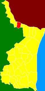
El Carmen, often known as "Carmen", is a town and municipality of the northeastern Mexican state of Nuevo León. The population was 6,996 at the 2005 census. Located in the Salinas Valley region, it is one of the smallest municipalities of the state of Nuevo León, is bordered by the municipalities of Salinas Victoria at North and East, General Escobedo at South, Abasolo and Hidalgo at West. As of 2009, its population is projected to be much higher than it was in the last census, as there is a large number of people moving to this municipality and surrounded municipalities, mainly people from other places outside Nuevo León, because of the lower house prices, compared to that of Monterrey, and the increasing potential of the region due to the relatively close distance to Monterrey, and constant expansion of its metropolitan area, which is estimated to absorb this municipality soon.

General Zuazua Municipality is a municipality in the northeastern Mexican state of Nuevo León, it is located in the north-central part of the state, which has been called peripheral region because of its proximity to Monterrey metropolitan area. The municipality is recognized in Nuevo León because of its well-known Rodeos and the Empalmes, a local dish from this municipality.

Bustamante is a municipality and town of Mexico in the state of Nuevo León. The full name is San Miguel de Bustamante. The municipality has an area of 558 km². It is bordered on the north by Lampazos de Naranjo and the state of Coahuila, on the south by Mina and Villaldama, Nuevo Leon, on the east by Villaldama, and on the west by Mina. In 2010 the population of the municipality was 3,773, of which nearly all lived in the town of Bustamante.
Allende Municipality is a municipality located in the northeastern Mexican state of Nuevo León. It comprises a region known as Región Citrícola, for being a major producer of orange at local, national and even international level. Allende is located at the Sierra Madre Oriental range foothills in the central-southeastern part in the state of Nuevo León. It has a territorial extension of 148.5 km², comprising around 0.22% of the whole extension of Nuevo león. Given its geographic location, the region consists of valleys and hills ranging from 300 meters above sea level on the northeast, to 1,640 meters above sea level in the southwestern part of the municipality. According to the last census data in 2010, it has 32,581 inhabitants, of whom 16,436 are men and 16,145 are women. The main economic activities are agriculture, livestock, beekeeping, poultry and transportation, activities that generate many jobs in the region.
The history of the Mexican city of Monterrey is closely linked with the history of the state of Nuevo León. When the New Kingdom of León was founded, it included Monterrey, Monclova, Saltillo and Cerralvo. The founding families formed a group of about thirty people in each locality. Gradually, Nuevo León was populated with families of nomadic herders of Spanish origin who fought and displaced the native indigenous groups in the region. The city was a step away from the border with the United States and it began to be a strategic location for industry and trade between the two countries. Originally isolated by the Sierra Madre and far from the center of New Spain and independent Mexico, in the late 19th century and throughout the twentieth century various demographic, social, political, and economic issues began to unfold.