
Dharmavaram is a city in Sri Sathya Sai District of the Indian state of Andhra Pradesh. It is the mandal and divisional headquarters of Dharmavaram mandal and Dharmavaram revenue division respectively. The city is known for its handloom silk sarees. The city is renowned for cotton, silk weaving industries and leather puppets. The city is called as Silk city of Andhra Pradesh.

Proddatur is a city in the YSR Kadapa District of Andhra Pradesh.

Tadepalligudem is a City in West Godavari district of the Indian state of Andhra Pradesh. It is a Selection Grade municipality and the mandal headquarters of Tadepalligudem mandal in Bhimavaram revenue division. Tadepalligudem is second biggest town next to Bhimavaram city in west godavari District as per 2011 census in terms of population.

Narsipatnam is a town in Anakapalle district of the Indian state of Andhra Pradesh. It was upgraded from a gram panchayat into municipality in 2012. The town is spread over an area of 42 km2 (16 sq mi) The resting place of the revolutionary Indian freedom fighter Alluri Sitarama Raju is located in Krishna Devi Peta village of Narsipatnam.

Srikalahasti is a holy town in Tirupati district of the Indian state of Andhra Pradesh. It is a municipality and the revenue division of Srikalahasti mandal. It is a part of Tirupati Urban Development Authority, which is located on the banks of the River Swarnamukhi.

Nagari is a Town in Chittoor district of the Indian state of Andhra Pradesh. It is the mandal headquarters of Nagari revenue division.
Atlapragada Konduru is a village in NTR district of the Indian state of Andhra Pradesh. It is the mandal headquarters of Atlapragada Konduru mandal under Tiruvuru revenue division.

Koduru is a village in Krishna district of the Indian state of Andhra Pradesh. It is the Mandal headquarters of Koduru Mandal in Machilipatnam Revenue Division.
Iraga-varam is a village in the West Godavari district of the Indian state of Andhra Pradesh. It is located in Iragavaram mandal in Kovvur revenue division. The nearest railway station is Velpuru (VPU) located at a distance of 7 Km.
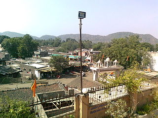
Mandrayal is a town in the state of Rajasthan, India. According to a census from 2011, Mandrayal has a population of 8,590; while the population of Mandrayal Tehsil is 74,600.

Peddapuram mandal is one of the 21 mandals in Kakinada district of the state of Andhra Pradesh, India. Its headquarters are located at Peddapuram. The mandal is bounded by Gandepalle, Jaggampeta, Kirlampudi, Rangampeta, Samalkota and Pithapuram mandals.
Kangan is a town in Ganderbal district, of Jammu and Kashmir, India. It is one of the tehsils in Ganderbal District. It is situated across the Nallah Sindh and spread over a 50-km-long gorge valley, with population of 1,20,934 and literacy rate of 52.8% and sex ratio 868 per thousand males. It is one of the beautiful places surrounded by various picnic spots like Sonamarg and Naranag. It is believed that the place embraces its name with the fact that it is surrounded by mountains in all sides, gives it a ring shape, which is called in Hindi kangan.
Kodesar is a village and a Gram Panchayat in Jhunjhunu district in the state of Rajasthan, India.
Pal is a village situated in Satpura range on the bank of the Suki River in Raver tehsil in Jalgaon district of Maharashtra state of India.
Dagarua (Dagarwa) is a town and a notified area in Purnia district (Purnea) in the Indian state of Bihar. It is a block and village panchayat located near NH 31 in Purnia. It is situated 15 km East of Purnia City. It comes under seemanchal region. It consists of one police station. It has a total population of 2,21,229 in which male are 1,14,933 and female population of 1,06,296 and children is 45,940. It has a literacy rate of 37.39%. It has sex-ratio of 48 out of 52 males.

Pulla is a village in Eluru district of the Indian state of Andhra Pradesh. It is situated in Bhimadole mandal of Eluru revenue division.

Yelwala or Ilvaala is a Census town in the city of Mysore in Karnataka state, India. This place is located between Mysore and Hunsur. Yelwala is a hobli headquarter and a Gram Panchayat. The population of Yelwala in census 2011 was 9,826.
Koniki is a village in Eluru district of the Indian state of Andhra Pradesh. It is located in Pedapadu mandal of Eluru revenue division. The nearest railway station is located at Chirala which is more than 10 km from Koniki.
Yelamanchili mandal is amongst the 46 mandals in West Godavari district of the state of Andhra Pradesh in India. Its headquarters are located in the village of Yelamanchili. The mandal is bordered by the Godavari River to the north and east, the Palacole mandal to the south, and the Poduru and Achanta mandals to the west.

Kaikalur mandal is one of the 28 mandals in Eluru district of the Indian state of Andhra Pradesh. The headquarters of this mandal is located at Kaikalur town. The mandal is bordered by West Godavari district to both north and east, Kalidindi mandal to the south and Mudinepalle mandal and Mandavalli mandal to the west.

