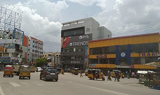
Krishna district is a district in the coastal Andhra Region in Indian state of Andhra Pradesh, with Machilipatnam as its administrative headquarters. It is surrounded on the East by Bay of Bengal, West by Guntur, Bapatla and North by Eluru and NTR districts and South again by Bay of Bengal.
Gandipet is a village in Ranga Reddy district of the Indian state of Telangana. It is located in Gandipet mandal of Rajendranagar revenue division. Chaitanya Bharathi Institute of Technology is located in Gandipet.

Malkajgiri also known as Mallikarjuna Giri is a suburb of Hyderabad, Telangana, India. It is located in Medchal–Malkajgiri district and also Sub-District in Medchal District is the headquarters of Malkajgiri mandal in Malkajgiri revenue division. Erstwhile Malkajgiri Major Grampanchayat was upgraded to a municipality in 1965 and became a municipal corporation in 1985. It was merged into the Greater Hyderabad Municipal Corporation in 2007. It was a part of Ranga Reddy district before the re-organisation of districts in 2016.

Kovur is a village in Nellore district of the Indian state of Andhra Pradesh. The village is also the headquarters of the Kovur Mandal and Assembly Constituency. It is located in Kovur mandal of Nellore revenue division. It forms a part of Nellore Urban Development Authority. The poet "Thikkanna" was born in this place.

The River Nagavali also known as Langulya is one of the main rivers of Southern Odisha and Andhra States in India, between Rushikulya and Godavari basins.

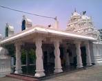
Mopidevi is a village in Krishna district of the Indian state of Andhra Pradesh. It is the mandal headquarters of Mopidevi mandal in Machilipatnam revenue division. It is one of the villages in the mandal to be a part of Andhra Pradesh Capital Region. The village is known for its famous Lord Subrahmanyeswar Swamy Temple. The village is situated 80Km from Vijayawada and 30Km from Machilipatnam.

Movva is the name of a well-known village in the Krishna district of the Indian state known as Andhra Pradesh. It is located in 'Movva mandal of Machilipatnam revenue division'. It is one of the villages in the mandal to be a part of Andhra Pradesh Capital Region.
Jiyyammavalasa is a village in Parvathipuram Manyam district of the Indian state of Andhra Pradesh.

Pathapatnam is a town in Srikakulam district of the Indian state of Andhra Pradesh. It is located in Pathapatnam mandal of Palakonda revenue division. Pathapatnam is located on the border of Srikakulam district of Andhra Pradesh and Gajapati district of Odisha. Parlakhemundi, the headquarters of Gajapati District, can be considered as twin town of Pathapatnam because of its close proximity. It is located around 65 km from srikakulam. It was the old capital of Paralakhemundi Gajapati Maharajah of his erstwhile kingdom.

Cherukupalli Mandal is one of the fifty seven mandals in Bapatla district of the Indian state of Andhra Pradesh. It is under the administration of Repalle revenue division of the district. The village of Cherukupalli is the administrative seat of the mandal.
Kallur is an Urban Area in Kurnool Municipal Corporation located in Kurnool district of the Indian state of Andhra Pradesh. Western part of Kurnool city is called Kallur. Some main areas in Kurnool city like, Ballari Chowrasta, Chennamma Circle, Birla Compound, APSRTC Main Bus stand comes under Kallur mandal.
Birohi is a village in Chhanvey Mandal, Mirzapur District, Uttar Pradesh State. Birohi is located 5 km distance from its Mandal Main Town Chhanvey. Birohi is 13.1 km far from its District Main City Mirzapur. It is 240 km far from its State Main City Lucknow.

Thullur mandal is one of the 18 mandals in Guntur district of the Indian state of Andhra Pradesh. It is under the administration of Guntur Revenue Division and the headquarters are located at Thullur. The mandal is situated on the banks of Krishna River, bounded by Amaravathi, Tadikonda, Tadepalle and Mangalagiri mandals. The mandal is also a part of the new capital city of Andhra Pradesh to be developed. 18 villages from the mandal fall under the jurisdiction of Andhra Pradesh Capital City.

Narasapuram Mandal is one of the 19 mandals in the West Godavari district of the Indian state of Andhra Pradesh. Its headquarters are in Narasapuram, a town in the mandal. The mandal is bordered by the Godavari River to the north, the Bay of Bengal to the east, the Mogalthur mandal to the south, and the Palacole mandal to the west.
Unguturu mandal is one of 28 mandals in the Eluru district of the Indian state of Andhra Pradesh. The headquarters are located at Unguturu. The mandal is bordered by Tadepalligudem mandal and Pentapadu mandal to the north, Nallajerla mandal to the west, Nidamarru mandal to the east, and by Dwaraka Tirumala mandal and Bhimadole mandal to the south
Palakollu mandal is one of the 46 mandals in the West Godavari district of the Indian state of Andhra Pradesh. The headquarters is located at Palakollu City. The mandal is bordered by Yelamanchili mandal in the north, Narasapuram mandal in the east, Poduru mandal in the south and Veeravasaram mandal in the west.

Kalidindi mandal is one of the 28 mandals in Eluru district of the Indian state of Andhra Pradesh. The headquarters of this mandal is located at Kalidindi town. The mandal is bordered by Kalidindi mandal to the north, West Godavari district to the east, Kruthivennu mandal to the south, and Bantumilli mandal to the west.
Kaikalur mandal is one of the 28 mandals in Eluru district of the Indian state of Andhra Pradesh. The headquarters of this mandal is located at Kaikalur town. The mandal is bordered by West Godavari district to both north and east, Kalidindi mandal to the south and Mudinepalle mandal and Mandavalli mandal to the west.
Remidicherla is a small village in Yerrupalem Mandal of Khammam District. It is the second-most populated village in Yerrupalem Mandal.


