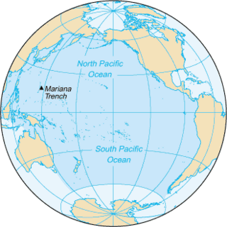
The Pacific Ocean is the largest and deepest of Earth's oceanic divisions. It extends from the Arctic Ocean in the north to the Southern Ocean in the south and is bounded by the continents of Asia and Australia in the west and the Americas in the east.
The Pitcairn Islands, officially the Pitcairn, Henderson, Ducie and Oeno Islands, is a group of four volcanic islands in the southern Pacific Ocean that form the sole British Overseas Territory in the Pacific Ocean. The four islands — Pitcairn proper, Henderson, Ducie, and Oeno — are scattered across several hundred kilometres of ocean and have a combined land area of about 18 square miles (47 km2). Henderson Island accounts for 86% of the land area, but only Pitcairn Island is inhabited. The islands nearest to the Pitcairn Islands are Mangareva to the west and Easter Island to the east.

The Pitcairn Islands consist of four islands: Pitcairn Island, Henderson Island, and two coral atolls, Oeno Island and Ducie Island
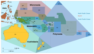
Pacific Islanders, Pasifika, or Pasefika, are the peoples of the Pacific Islands. It is a geographic and ethnic/racial term to describe the inhabitants and diaspora of any of the three major sub-regions of Oceania. It is also sometimes used to describe inhabitants of the Pacific islands.

Colleen Margaretta McCullough was an Australian author known for her novels, her most well-known being The Thorn Birds and The Ladies of Missalonghi.

Moruroa, also historically known as Aopuni, is an atoll which forms part of the Tuamotu Archipelago in French Polynesia in the southern Pacific Ocean. It is located about 1,250 kilometres (780 mi) southeast of Tahiti. Administratively Moruroa Atoll is part of the commune of Tureia, which includes the atolls of Tureia, Fangataufa, Tematangi and Vanavana. France undertook nuclear weapon tests between 1966 and 1996 at Moruroa and Fangataufa, causing international protests, notably in 1974 and 1995. The number of tests performed has been variously reported as 175 and 181.

The history of the Pitcairn Islands begins with the colonization of the islands by Polynesians in the 11th century. The Polynesians established a culture that flourished for four centuries and then vanished. They lived on Pitcairn and Henderson Islands, and on Mangareva Island 540 kilometres (340 mi) to the northwest, for about 400 years.

Oeno Island or Holiday Island is a coral atoll in the South Pacific Ocean, part of the Pitcairn Islands overseas territory.

Henderson Island is an uninhabited island in the south Pacific Ocean. With Pitcairn, Oeno and Ducie Islands it forms the Pitcairn Island Group.

Ducie Island is an uninhabited atoll in the Pitcairn Islands. It lies east of Pitcairn Island, and east of Henderson Island, and has a total area of 1.5 square miles (3.9 km2), which includes the lagoon. It is 1.5 miles (2.4 km) long, measured northeast to southwest, and about 1 mile (1.6 km) wide. The island is composed of four islets: Acadia, Pandora, Westward and Edwards.

Murphy's petrel is a species of seabird and a member of the gadfly petrels. The bird is 15 inches in length, with a 35-inch wingspan and weigh about 13 ounces. It was described by Robert Cushman Murphy in 1949, which is the source of the species' common name.
The Florida naked-tailed rat is a poorly known and possible extinct species of rodent in the family Muridae. It was confined to the Nggela Islands in the Solomon Islands. The originally mentioned type locality Ugi Island is an erratum.
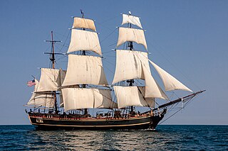
HMS Bounty, also known as HM Armed Vessel Bounty, was a small merchant vessel that the Royal Navy purchased in 1787 for a botanical mission. The ship was sent to the South Pacific Ocean under the command of William Bligh to acquire breadfruit plants and transport them to the West Indies. That mission was never completed owing to a 1789 mutiny led by acting lieutenant Fletcher Christian, an incident now popularly known as the mutiny on the Bounty. The mutineers later burned Bounty while she was moored at Pitcairn Island. An American adventurer rediscovered the remains of the Bounty in 1957; various parts of it have been salvaged since then.

Honiara is the capital and largest city of Solomon Islands, situated on the northwestern coast of Guadalcanal. As of 2017, it had a population of 84,520 people. The city is served by Honiara International Airport and the seaport of Point Cruz, and lies along the Kukum Highway.

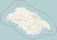
Nancy Stone is a rock off the southeast coast of Pitcairn Island in the south Pacific. It is located off the coast between St Paul's Point and Down Rope. It is said to be "Named for the English name of Toofaiti, the consort of Tararo who was taken by mutineer John Williams, the act that initiated the massacre of most of the men of the island."

Pitcairn Radio Station was a radio station located at Taro Ground near the southern coast of Pitcairn Island in the south Pacific. It was located on the highest point of the island at 272 metres above sea level. It was used by the New Zealand Meteorological Service and VP6PAC, the Pitcairn Island Amateur Radio club. It is reportedly being made into a wind farm to supply the island's population with electricity.

Hotu-iti is an area of southeastern Easter Island that takes its name from a local clan. Located in Rapa Nui National Park, the area includes Rano Raraku crater, the Ahu Tongariki site, and a small bay. In the 15th and 16th centuries, the Hotu-iti clan was one of two polities on Easter Island.
Robert Pitcairn was a Scottish midshipman in the Royal Navy. Pitcairn Island was named after him: he was the first person to spot the island on 2 July 1767, while serving in a voyage in the South Pacific on HMS Swallow, captained by Philip Carteret.
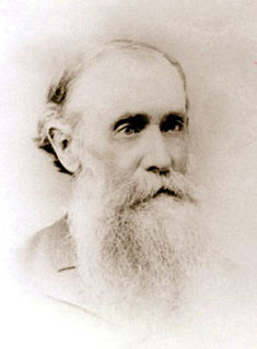
John I. Tay was a Seventh-day Adventist missionary who was known for his pioneering work in the South Pacific. It was through his efforts that most of the inhabitants of Pitcairn Island were converted to Adventism, and that the General Conference of Seventh-day Adventists purchased the Pitcairn schooner for missionary work in the South Pacific.

Pitcairn was a schooner built in 1890 for the Seventh-day Adventist Church for use in missionary work in the South Pacific. After six missionary voyages, the schooner was sold in 1900 for commercial use, and renamed Florence S. She was lost by stranding on the island of Mindoro, Philippine Islands, on 17 October 1912.
