
Pembroke College is a constituent college of the University of Cambridge, England. The college is the third-oldest college of the university and has over 700 students and fellows. It is one of the university's larger colleges, with buildings from almost every century since its founding, as well as extensive gardens. Its members are termed "Valencians". The college's current master is Chris Smith, Baron Smith of Finsbury.

Downing College is a constituent college of the University of Cambridge and currently has around 950 students. Founded in 1800, it was the only college to be added to Cambridge University between 1596 and 1869, and is often described as the oldest of the new colleges and the newest of the old. Downing College was formed "for the encouragement of the study of Law and Medicine and of the cognate subjects of Moral and Natural Science", and has developed a reputation amongst Cambridge colleges for Law and Medicine.
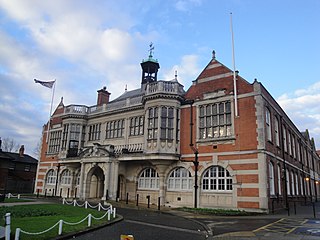
Hendon is an urban area in the London Borough of Barnet, northwest London 7 miles (11 km) northwest of Charing Cross. Hendon was an ancient manor and parish in the county of Middlesex and a former borough, the Municipal Borough of Hendon; it has been part of Greater London since 1965. Hendon falls almost entirely within the NW4 postcode, while the West Hendon part falls in NW9. Colindale to the northwest was once considered part of Hendon but is today separated by the M1 motorway.

The Royal Mile is a succession of streets forming the main thoroughfare of the Old Town of the city of Edinburgh in Scotland. The term was first used descriptively in W. M. Gilbert's Edinburgh in the Nineteenth Century (1901), describing the city "with its Castle and Palace and the royal mile between", and was further popularised as the title of a guidebook by R. T. Skinner published in 1920, "The Royal Mile (Edinburgh) Castle to Holyrood(house)".

Pall Mall is a street in the St James's area of the City of Westminster, Central London. It connects St James's Street to Trafalgar Square and is a section of the regional A4 road. The street's name is derived from pall-mall, a ball game played there during the 17th century, which in turn is derived from the Italian pallamaglio, literally "ball-mallet".
William Wilkins was an English architect, classical scholar and archaeologist. He designed the National Gallery and University College London, and buildings for several Cambridge colleges.

Marie de St Pol, Countess of Pembroke was the second wife of Franco-English nobleman Aymer de Valence, 2nd Earl of Pembroke, and is best known as the founder of Pembroke College, Cambridge.
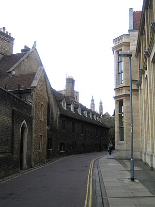
Free School Lane is a historic street in central Cambridge, England which includes important buildings of University of Cambridge. It is the location of the Whipple Museum of the History of Science, the Department of History and Philosophy of Science (HPS,) the University's faculty of Social and Political Sciences, and is the original site of the Engineering Department, and the Physics Department's Cavendish Laboratory. At the northern end is Bene't Street and at the southern end is Pembroke Street. To the east is the New Museums Site of the University. To the west is Corpus Christi College.

Richmond Green is a recreation area near the centre of Richmond, a town of about 20,000 inhabitants situated in south-west London. Owned by the Crown Estate, it is leased to the London Borough of Richmond upon Thames. The Green, which has been described as "one of the most beautiful urban greens surviving anywhere in England", is roughly square in shape and its open grassland, framed with broadleaf trees, extends to roughly twelve acres. On the north-east side there is also a smaller open space called Little Green. Richmond Green and Little Green are overlooked by a mixture of period townhouses, historic buildings and municipal and commercial establishments including the Richmond Lending Library and Richmond Theatre.

West Kensington, formerly North End, is an area in the ancient parish of Fulham, in the London Borough of Hammersmith and Fulham, England, 3.4 miles (5.5 km) west of Charing Cross. It covers most of the London postal area of W14, including the area around Barons Court tube station, and is defined as the area between Lillie Road and Hammersmith Road to the west, Fulham Palace Road to the south, Hammersmith to the north and West Brompton and Earl's Court to the east. The area is bisected by the major London artery the A4, locally known as the Talgarth Road. Its main local thoroughfare is the North End Road.
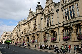
St Aldate's is a street in central Oxford, England, named after Saint Aldate, but formerly known as Fish Street.

The New Museums Site is a major site of the University of Cambridge, located on Pembroke Street and Free School Lane, sandwiched between Corpus Christi College, Pembroke College and Lion Yard. Its postcode is CB2 3QH. The smaller and older of two university city-centre science sites, the New Museums Site houses many of the university's science departments and lecture theatres, as well as two museums.

The Downing Site is a major site of the University of Cambridge, located in the centre of the city of Cambridge, England, on Downing Street and Tennis Court Road, adjacent to Downing College. The Downing Site is the larger and newer of two city-centre science sites of the university. Largely populated with utilitarian brick buildings dating from the 1930s, the more notable buildings include the Zoology Laboratory (1900–04), Sedgwick Museum of Earth Sciences (1904–11) and Downing Street entrance (1904–11).
The campus of Rice University is located on a heavily wooded 290-acre (120-hectare) plot of land on South Main Street in the Museum District of Houston, Texas. It is located east of Rice Village, a retail district, south of Boulevard Oaks and Southampton, west of the Texas Medical Center, and north of Southgate.
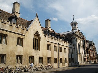
Trumpington Street is a major historic street in central Cambridge, England. At the north end it continues as King's Parade where King's College is located. To the south it continues as Trumpington Road, an arterial route out of Cambridge, at the junction with Lensfield Road.

Pembroke Street is a street in central Cambridge, England. It runs between Downing Street and Tennis Court Road at the eastern end and a junction with Trumpington Street at the western end. It continues west on the other side of Trumpington Street as Mill Lane.

Tennis Court Road is a historic street in central Cambridge, England. It runs parallel with Trumpington Street to the west and Regent Street to the east. At the northern end is a junction with Pembroke Street to the west and Downing Street to the east. To the south as a T-junction with Lensfield Road. Fitzwilliam Street leads off the road to the west towards the Fitzwilliam Museum.
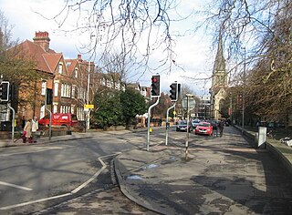
Lensfield Road is a road in southeast central Cambridge, England. It runs between the junction of Trumpington Street and Trumpington Road to the west and the junction of Regent Street and Hills Road to the west. It continues as Gonville Place to the northeast past Parker's Piece, a large grassy area with footpaths.

The Old Addenbrooke's Site is a site owned by the University of Cambridge in the south of central Cambridge, England. It is located on the block formed by Fitzwilliam Street to the north, Tennis Court Road to the east, Lensfield Road to the south, and Trumpington Street to the west.

Coe Fen is a semi-rural meadowland area to the east of the River Cam in the south of the city of Cambridge, England. It lies at the back of Peterhouse to the north, the Fitzwilliam Museum, and The Leys School to the south. The fen is straddled by the Fen Causeway across the Cam. There is also a footbridge at the back of The Leys School to the south and Crusoe Bridge is just north of the Fen Causeway Bridge.


