
Pembroke College is a constituent college of the University of Cambridge, England. The college is the third-oldest college of the university and has over 700 students and fellows. It is one of the university's larger colleges, with buildings from almost every century since its founding, as well as extensive gardens. Its members are termed "Valencians". The college's current master is Chris Smith, Baron Smith of Finsbury.

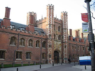
Peterhouse is the oldest constituent college of the University of Cambridge in England, founded in 1284 by Hugh de Balsham, Bishop of Ely. Peterhouse has around 300 undergraduate and 175 graduate students, and 54 fellows.

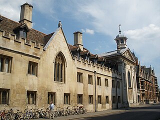
St Catharine's College is a constituent college of the University of Cambridge. Founded in 1473 as Katharine Hall, it adopted its current name in 1860. The college is nicknamed "Catz". The college is located in the historic city-centre of Cambridge, and lies just south of King's College and across the street from Corpus Christi College. The college is notable for its open court that faces towards Trumpington Street.
The A10 is a major road in England which runs between The City of London and King's Lynn in Norfolk.
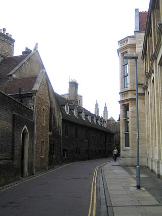
Free School Lane is a historic street in central Cambridge, England which includes important buildings of University of Cambridge. It is the location of the Whipple Museum of the History of Science, the Department of History and Philosophy of Science (HPS,) the University's faculty of Social and Political Sciences, and is the original site of the Engineering Department, and the Physics Department's Cavendish Laboratory. At the northern end is Bene't Street and at the southern end is Pembroke Street. To the east is the New Museums Site of the University. To the west is Corpus Christi College.

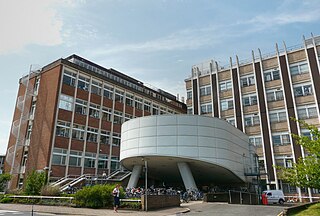
The New Museums Site is a major site of the University of Cambridge, located on Pembroke Street and Free School Lane, sandwiched between Corpus Christi College, Pembroke College and Lion Yard. Its postcode is CB2 3QH. The smaller and older of two university city-centre science sites, the New Museums Site houses many of the university's science departments and lecture theatres, as well as two museums.

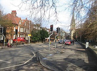
Hobson's Conduit, also called Hobson's Brook, is a watercourse that was built from 1610 to 1614 by Thomas Hobson and others to bring fresh water into the city of Cambridge, England from springs at Nine Wells, a Local Nature Reserve, near the village of Great Shelford. It is now a Scheduled Ancient Monument and historical relic. The watercourse currently runs overground until Cambridge University Botanic Garden and Brookside, where it is at its widest. At the corner of Lensfield Road stands a hexagonal monument to Hobson, which once formed part of the market square fountain, and was moved to this location in 1856, after a fire in the Market. The flow of water runs under Lensfield Road, and subsequently runs along both sides of Trumpington Street in broad gutters towards Peterhouse and St Catharine's College, and also St Andrew's Street. The conduit currently ends at Silver Street.

King's Parade is a street in central Cambridge, England. The street continues north as Trinity Street and then St John's Street, and south as Trumpington Street. It is a major tourist area in Cambridge, commanding a central position in the University of Cambridge area of the city. It is also a place frequented by many cyclists and by students travelling between lectures during term-time.
Trumpington Street is a major historic street in central Cambridge, England. At the north end it continues as King's Parade where King's College is located. To the south it continues as Trumpington Road, an arterial route out of Cambridge, at the junction with Lensfield Road.

Trumpington Road is an arterial road in southeast central Cambridge, England. It runs between the junction of Trumpington Street and Lensfield Road at the northern end to the junction of the High Street in the village of Trumpington and Long Road at the southern end. The Fen Causeway leads off to the west near the northern end, over Coe Fen and the River Cam.

Downing Street is a street in central Cambridge, England. It runs between Pembroke Street and Tennis Court Road at the western end and a T-junction with St Andrew's Street at the eastern end. Corn Exchange Street and St Tibbs Row lead off to the north. Downing Place leads off to the south.
St John's Street is a historical street in central Cambridge, England. The street links with Bridge Street, Round Church Street, and Sidney Street to the north. It continues to the south as Trinity Street, then King's Parade and Trumpington Street. This thoroughfare is the main area for some of the most historic University of Cambridge colleges.

Silver Street is located in the southwest of central Cambridge, England. It links Queen's Road to the west with Trumpington Street to the east. The road continues west out of central Cambridge as Sidgwick Avenue.

Bene't Street is a short historic street in central Cambridge, England, the name being derived from St Benedict. There is a junction with King's Parade to the north and Trumpington Street to the south at the western end of the street. Free School Lane leads off to the south. To the east, the street continues as Wheeler Street.

Wheeler Street is a street in central Cambridge, England. It runs between Bene't Street to the southwest and Guildhall Street and Corn Exchange Street to the northeast. To the east, Guildhall Place, a cul-de-sac, runs southeast from the junction with Guildhall Street, parallel with Corn Exchange Street at its northwestern end, as an extension of Guildhall Street.

Tennis Court Road is a historic street in central Cambridge, England. It runs parallel with Trumpington Street to the west and Regent Street to the east. At the northern end is a junction with Pembroke Street to the west and Downing Street to the east. To the south as a T-junction with Lensfield Road. Fitzwilliam Street leads off the road to the west towards the Fitzwilliam Museum.
Hills Road is an arterial road in southeast Cambridge, England. It runs between Regent Street at the junction with Lensfield Road and Gonville Place to the northwest and a roundabout by the Cambridge Biomedical Campus, continuing as Babraham Road to the southeast.
Lensfield Road is a road in southeast central Cambridge, England. It runs between the junction of Trumpington Street and Trumpington Road to the west and the junction of Regent Street and Hills Road to the west. It continues as Gonville Place to the northeast past Parker's Piece, a large grassy area with footpaths.

The Old Addenbrooke's Site is a site owned by the University of Cambridge in the south of central Cambridge, England. It is located on the block formed by Fitzwilliam Street to the north, Tennis Court Road to the east, Lensfield Road to the south, and Trumpington Street to the west.

Trumpington War Memorial is a war memorial cross in the village of Trumpington, on the southern outskirts of Cambridge. The memorial was designed by Eric Gill. It was unveiled in 1921, and became a Grade II* listed building in 1999.

