Peterhouse is the oldest constituent college of the University of Cambridge in England, founded in 1284 by Hugh de Balsham, Bishop of Ely. Peterhouse has around 300 undergraduate and 175 graduate students, and 54 fellows.

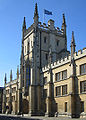
Corpus Christi College is a constituent college of the University of Cambridge. From the late 14th century to the early 19th century it was also commonly known as St Benet's College.

Thomas Hobson was an English carrier, best known as the origin of the expression Hobson's choice.

The Ascension Parish Burial Ground, formerly known as the burial ground for the parish of St Giles and St Peter's, is a cemetery off Huntingdon Road in Cambridge, England. Many notable University of Cambridge academics are buried there, including three Nobel Prize winners.
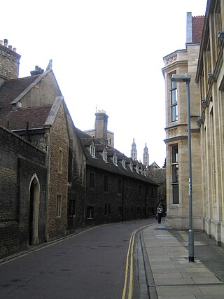
Free School Lane is a historic street in central Cambridge, England which includes important buildings of University of Cambridge. It is the location of the Whipple Museum of the History of Science, the Department of History and Philosophy of Science (HPS,) the University's faculty of Social and Political Sciences, and is the original site of the Engineering Department, and the Physics Department's Cavendish Laboratory. At the northern end is Bene't Street and at the southern end is Pembroke Street. To the east is the New Museums Site of the University. To the west is Corpus Christi College.

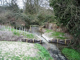
Hobson's Conduit, also called Hobson's Brook, is a watercourse that was built from 1610 to 1614 by Thomas Hobson and others to bring fresh water into the city of Cambridge, England from springs at Nine Wells, a Local Nature Reserve, near the village of Great Shelford. It is now a Scheduled Ancient Monument and historical relic. The watercourse currently runs overground until Cambridge University Botanic Garden and Brookside, where it is at its widest. At the corner of Lensfield Road stands a hexagonal monument to Hobson, which once formed part of the market square fountain, and was moved to this location in 1856, after a fire in the Market. The flow of water runs under Lensfield Road, and subsequently runs along both sides of Trumpington Street in broad gutters towards Peterhouse and St Catharine's College, and also St Andrew's Street. The conduit currently ends at Silver Street.

Little St Mary's or St Mary the Less is a Church of England parish church in Cambridge, England, on Trumpington Street between Pembroke College's Mill Lane Project development site and Peterhouse. The church is in the Diocese of Ely and follows the Anglo-Catholic or high-church tradition of the Church of England. In addition to its main Sunday Mass, the church has a strong tradition of daily morning and evening prayer, regular weekday Communion and the keeping of church festivals. The church has a particular ministry helping both men and women to explore possible vocations to the priesthood. Little St Mary's has active overseas mission links, provides support to local mental health projects, and participates in Hope Cambridge's Churches Homeless Project. The vicar is Canon Robert Mackley, who has been the incumbent since 2012.

King's Parade is a street in central Cambridge, England. The street continues north as Trinity Street and then St John's Street, and south as Trumpington Street. It is a major tourist area in Cambridge, commanding a central position in the University of Cambridge area of the city. It is also a place frequented by many cyclists and by students travelling between lectures during term-time.

Trumpington Road is an arterial road in southeast central Cambridge, England. It runs between the junction of Trumpington Street and Lensfield Road at the northern end to the junction of the High Street in the village of Trumpington and Long Road at the southern end. The Fen Causeway leads off to the west near the northern end, over Coe Fen and the River Cam.

Pembroke Street is a street in central Cambridge, England. It runs between Downing Street and Tennis Court Road at the eastern end and a junction with Trumpington Street at the western end. It continues west on the other side of Trumpington Street as Mill Lane.

Bene't Street is a short historic street in central Cambridge, England, the name being derived from St Benedict. There is a junction with King's Parade to the north and Trumpington Street to the south at the western end of the street. Free School Lane leads off to the south. To the east, the street continues as Wheeler Street.

Tennis Court Road is a historic street in central Cambridge, England. It runs parallel with Trumpington Street to the west and Regent Street to the east. At the northern end is a junction with Pembroke Street to the west and Downing Street to the east. To the south as a T-junction with Lensfield Road. Fitzwilliam Street leads off the road to the west towards the Fitzwilliam Museum.
Hills Road is an arterial road in southeast Cambridge, England. It runs between Regent Street at the junction with Lensfield Road and Gonville Place to the northwest and a roundabout by the Cambridge Biomedical Campus, continuing as Babraham Road to the southeast.

Market Hill is the location of the marketplace in central Cambridge, England. Operating as a marketplace since Saxon times, a daily outdoor market with stalls continues to run there.
Lensfield Road is a road in southeast central Cambridge, England. It runs between the junction of Trumpington Street and Trumpington Road to the west and the junction of Regent Street and Hills Road to the west. It continues as Gonville Place to the northeast past Parker's Piece, a large grassy area with footpaths.

The Old Addenbrooke's Site is a site owned by the University of Cambridge in the south of central Cambridge, England. It is located on the block formed by Fitzwilliam Street to the north, Tennis Court Road to the east, Lensfield Road to the south, and Trumpington Street to the west.

Great Kneighton is a large housing development and residential area in the southern part of the City of Cambridge district of Cambridgeshire, adjacent to, and integrated with, the neighbouring village of Trumpington. Together with nearby development Trumpington Meadows, it forms part of the southern fringe expansion of the city. Currently nearing completion by developers Countryside Properties, it will ultimately consist of almost 2,300 homes.

The following is a timeline of the history of the city of Cambridge, England.
Nine Wells is a 1.2 hectare Local Nature Reserve east of Trumpington, on the southern outskirts of Cambridge. It is owned and managed by Cambridge City Council.