
Thomas Hobson was an English carrier, best known as the origin of the expression Hobson's choice.
The A10 is a major road in England which runs between The City of London and King's Lynn in Norfolk.
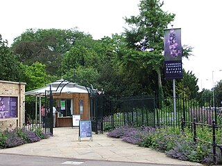
The Cambridge University Botanic Garden is a botanical garden located in Cambridge, England, associated with the university Department of Plant Sciences. It lies between Trumpington Road to the west, Bateman Street to the north and Hills Road to the east.

The A1309 is a short road which links the two ends of the A10 to north and south of Cambridge city centre in Cambridgeshire, England. It was numbered as part of the A10 prior to the construction of the Cambridge Western Bypass and the Northern Bypass.

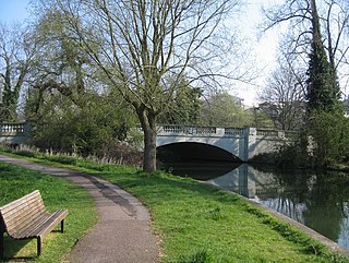
Hobson's Conduit, also called Hobson's Brook, is a watercourse that was built from 1610 to 1614 by Thomas Hobson and others to bring fresh water into the city of Cambridge, England from springs at Nine Wells, a Local Nature Reserve, near the village of Great Shelford. It is now a Scheduled Ancient Monument and historical relic. The watercourse currently runs overground until Cambridge University Botanic Garden and Brookside, where it is at its widest. At the corner of Lensfield Road stands a hexagonal monument to Hobson, which once formed part of the market square fountain, and was moved to this location in 1856, after a fire in the Market. The flow of water runs under Lensfield Road, and subsequently runs along both sides of Trumpington Street in broad gutters towards Peterhouse and St Catharine's College, and also St Andrew's Street. The conduit currently ends at Silver Street.

The A1120 is an 'A' road in the English county of Suffolk. It links Stowmarket to Yoxford passing through the centre of the county. It is 26 miles (42 km) long.
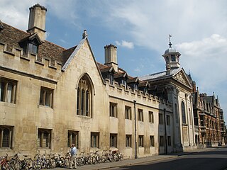
Trumpington Street is a major historic street in central Cambridge, England. At the north end it continues as King's Parade where King's College is located. To the south it continues as Trumpington Road, an arterial route out of Cambridge, at the junction with Lensfield Road.

Pembroke Street is a street in central Cambridge, England. It runs between Downing Street and Tennis Court Road at the eastern end and a junction with Trumpington Street at the western end. It continues west on the other side of Trumpington Street as Mill Lane.

Downing Street is a street in central Cambridge, England. It runs between Pembroke Street and Tennis Court Road at the western end and a T-junction with St Andrew's Street at the eastern end. Corn Exchange Street and St Tibbs Row lead off to the north. Downing Place leads off to the south.

Tennis Court Road is a historic street in central Cambridge, England. It runs parallel with Trumpington Street to the west and Regent Street to the east. At the northern end is a junction with Pembroke Street to the west and Downing Street to the east. To the south as a T-junction with Lensfield Road. Fitzwilliam Street leads off the road to the west towards the Fitzwilliam Museum.

St Andrew's Street is a major street in central Cambridge, England. It runs between Sidney Street, at the junction with Hobson Street, to the northwest and Regent Street to the southeast. Downing Street leads off to the west.

Regent Street is an arterial street in southeast central Cambridge, England. It runs between St Andrew's Street, at the junction with Park Terrace, to the northwest and Hills Road at the junction with the A603 to the southeast. Regent Terrace runs in parallel immediately to the northeast. Beyond that is Parker's Piece, a large grassed area with footpaths.
Hills Road is an arterial road in southeast Cambridge, England. It runs between Regent Street at the junction with Lensfield Road and Gonville Place to the northwest and a roundabout by the Cambridge Biomedical Campus, continuing as Babraham Road to the southeast.

Market Hill is the location of the marketplace in central Cambridge, England. Operating as a marketplace since Saxon times, a daily outdoor market with stalls continues to run there.
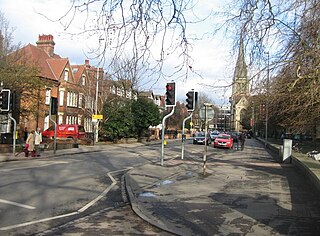
Lensfield Road is a road in southeast central Cambridge, England. It runs between the junction of Trumpington Street and Trumpington Road to the west and the junction of Regent Street and Hills Road to the west. It continues as Gonville Place to the northeast past Parker's Piece, a large grassed area with footpaths.
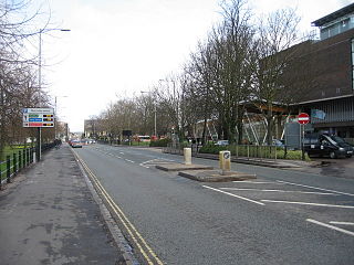
Gonville Place is a road in southeast central Cambridge, England. It forms part of the city's inner ring road. At the southwest end is the junction of Regent Street and Hills Road, where the road continues as Lensfield Road. At the northeast end is the junction of Parkside and Mill Road, where the road continues as East Road, a dual carriageway.

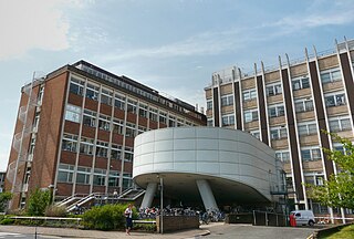
The Old Addenbrooke's Site is a site owned by the University of Cambridge in the south of central Cambridge, England. It is located on the block formed by Fitzwilliam Street to the north, Tennis Court Road to the east, Lensfield Road to the south, and Trumpington Street to the west.
Fen Causeway is a link road in the city of Cambridge, United Kingdom, constructed in the mid-1920s to ease the pressure on Silver Street. It forms part of the A1134 ring road. It links Newnham Road and Trumpington Road and spans the River Cam with Sheep's Green to the south and Coe Fen to the north. There is little residential development on this road.

Great Kneighton is a large housing development and residential area in the southern part of the City of Cambridge district of Cambridgeshire, adjacent to, and integrated with, the neighbouring village of Trumpington. Together with nearby development Trumpington Meadows, it forms part of the southern fringe expansion of the city. Currently nearing completion by developers Countryside Properties, it will ultimately consist of almost 2,300 homes.
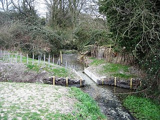
Nine Wells is a 1.2 hectare Local Nature Reserve east of Trumpington, on the southern outskirts of Cambridge. It is owned and managed by Cambridge City Council.


