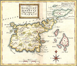
Guernsey is an island in the English Channel off the coast of Normandy that is part of the Bailiwick of Guernsey, a British Crown Dependency.
The Bailiwick of Guernsey is one of three Crown Dependencies.

Fort Grey, colloquially known as the "cup and saucer", is a Martello tower located on a tidal rock in Rocquaine Bay in Saint Peter, Guernsey on the west coast of the island.

St Sampson is a parish of Guernsey, an island in the Bailiwick of Guernsey, directly north of St Peter Port. It is on the north-west and north-east coasts of the island and is split into two sections, intersected by Vale.

Castle Cornet is a large island castle in Guernsey, and former tidal island, also known as Cornet Rock or Castle Rock. Its importance was as a defence not only of the island, but of the roadstead. In 1859 it became part of one of the breakwaters of the Guernsey's main harbour, St Peter Port's harbour.
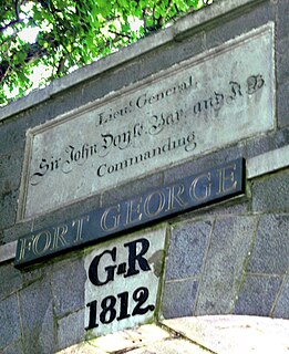
Fort George is situated in Saint Peter Port, Guernsey, and was built to become the main island military headquarters and to protect barracks to house the island garrison for the British Army, in place of Castle Cornet.

Victoria Tower is a monument in Saint Peter Port, Guernsey, erected in honor of a visit by Queen Victoria and Prince Albert to the island in 1846.
Daniel de Lisle Brock (1762–1842) was Bailiff of Guernsey from 1821 until his death 1842.

Jerbourg Point or the Jerbourg Peninsula is the southeastern point of the Bailiwick of Guernsey in the English Channel off the coast of Normandy, lying within St Martin Parish. It marks the end of the east coast cliffs and beginning of the south coast cliffs. It provides scenic views of the Little Russel and the various islands.
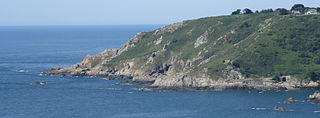
Icart Point is a point of southern Guernsey, located west of Jerbourg Point and east of Petit Port, Moulin Huet and Saint's Bay. It is in the parish of Saint Martin, Guernsey

The Bréhon Tower is accessible only by boat and sits on Bréhon Rock, an island in the Little Russell channel about 1.5 km northeast of St Peter Port, Guernsey, between the port and the islands of Herm and Jethou. Thomas Charles de Putron (1806–1869) built the oval tower of granite from Herm, completing the work in 1857.

Fort Hommet is a fortification on Vazon Bay headland in Castel, Guernsey. It is built on the site of fortifications that date back to 1680, and consists of a Martello tower from 1804, later additions during the Victorian Era, and bunkers and casemates that the Germans constructed during World War II.

The British built 15 Guernsey loophole towers at various points along the coast of Guernsey between August 1778 and March 1779 to deter possible French attacks after France had declared itself an ally of the Americans in the American Revolutionary War. Towards the start of the Napoleonic Wars several towers received additional reinforcement in the form of batteries at their bases. Today, 12 towers still survive, three having been destroyed at different times. Two of the survivors, Petit Bôt and Rousse, contain interpretive exhibits that the public may examine.
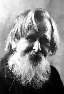
William Caparne (1855–1940), born William John Caparn, was a British horticulturist and a painter of floral and other subjects. He created the first hybrids in the intermediate bearded iris group, and is thought to have created more than 100 cultivars of bulbous iris.

The Royal Guernsey Militia has a history dating back 800 years. Always loyal to the British Crown, the men were unpaid volunteers whose wish was to defend the Island of Guernsey from foreign invaders.
The Braye du Valle is the area between the main Island of Guernsey and Le Clos du Valle, which was a tidal island to the north.
The evacuation of civilians from the Channel Islands in 1940 was an organised, partial, nautical evacuation of Crown dependencies in the Channel Islands, primarily from Jersey, Guernsey, and Alderney to Great Britain during World War II. The evacuation occurred in phases, starting with school aged children, their teachers, and mother volunteers. The islands and the British military began the evacuation following the Allies' loss in the Battle of France, after which the British Army withdrew from the islands.

The island of Guernsey has been fortified for several thousand years, the number of defence locations and complexity of the defence increasing with time, manpower and the improvements in weapons and tactics.

