Vepada is a village in Vizianagaram district of the Indian state of Andhra Pradesh, India.
Masovia Governorate was an administrative unit (governorate) of the Congress Poland.

Dębniki is a village in the administrative district of Gmina Strzelin, within Strzelin County, Lower Silesian Voivodeship, in south-western Poland. Prior to 1945 it was in Germany.
Brzyków is a village in the administrative district of Gmina Trzebnica, within Trzebnica County, Lower Silesian Voivodeship, in south-western Poland. Before 1945 it was in Germany.
Małe Rudy is a village in the administrative district of Gmina Szubin, within Nakło County, Kuyavian-Pomeranian Voivodeship, in north-central Poland.
Borek is a village in the administrative district of Gmina Zławieś Wielka, within Toruń County, Kuyavian-Pomeranian Voivodeship, in north-central Poland. It lies approximately 21 km (13 mi) north-west of Toruń and 24 km (15 mi) east of Bydgoszcz.
Liśnik Duży-Kolonia is a village in the administrative district of Gmina Gościeradów, within Kraśnik County, Lublin Voivodeship, in eastern Poland.

Ashagy Karashanly is a village in the Kalbajar Rayon of Azerbaijan.
Będków is a village in the administrative district of Gmina Rząśnia, within Pajęczno County, Łódź Voivodeship, in central Poland.
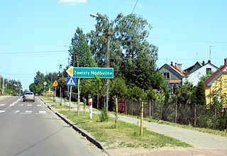
Zawisty Nadbużne is a village in the administrative district of Gmina Małkinia Górna, within Ostrów Mazowiecka County, Masovian Voivodeship, in east-central Poland.
Szczypiornia is a village in the administrative district of Gmina Lutocin, within Żuromin County, Masovian Voivodeship, in east-central Poland. It lies approximately 13 kilometres (8 mi) west of Żuromin and 128 km (80 mi) north-west of Warsaw.
Linie is a village in the administrative district of Gmina Lwówek, within Nowy Tomyśl County, Greater Poland Voivodeship, in west-central Poland. It lies approximately 10 kilometres (6 mi) north-west of Lwówek, 20 km (12 mi) north of Nowy Tomyśl, and 60 km (37 mi) west of the regional capital Poznań.
Tarnowiec is a village in the administrative district of Gmina Lwówek, within Nowy Tomyśl County, Greater Poland Voivodeship, in west-central Poland. It lies approximately 10 kilometres (6 mi) north-west of Lwówek, 20 km (12 mi) north of Nowy Tomyśl, and 60 km (37 mi) west of the regional capital Poznań.
Zębowo is a village in the administrative district of Gmina Lwówek, within Nowy Tomyśl County, Greater Poland Voivodeship, in west-central Poland. It lies approximately 10 kilometres (6 mi) north-west of Lwówek, 20 km (12 mi) north of Nowy Tomyśl, and 60 km (37 mi) west of the regional capital Poznań.
Teresa is a village in the administrative district of Gmina Nowe Miasto nad Wartą, within Środa Wielkopolska County, Greater Poland Voivodeship, in west-central Poland. It lies approximately 21 kilometres (13 mi) south of Środa Wielkopolska and 50 km (31 mi) south-east of the regional capital Poznań.

Oti is a village in Saaremaa Parish, Saare County in western Estonia.

Donje Babine is a village in the municipality of Sokolac, Bosnia and Herzegovina.
The Al Tawheed Mosque is a mosque in Sana'a, Yemen. It lies in the eastern part of the city, southeast of Revolution Hospital and Alemaan Mosque, along the E Ring Road.
House of Folklore is a museum in central Sana'a, Yemen. It is located southwest of the Al-Tahrir Square and south of the Egyptian Embassy and north of the Chinese Embassy. Founded on 11 April 2004 under the permission of the Ministry of Culture, it is "a cultural, research, non-profit and non-governmental organization works on collecting and documenting the Yemeni Folklore". The house was closed in May 2010 due to financial difficulties.

Urvič is a village in the municipality of Vladičin Han, Serbia. According to the 2002 census, the village has a population of 71 people.


