Related Research Articles

The Arctic Archipelago, also known as the Canadian Arctic Archipelago, is an archipelago lying to the north of the Canadian continental mainland, excluding Greenland.

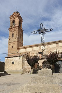
Castronuevo is a municipality in the province of Zamora, Castile and León, Spain. According to the 2009 census (INE), the municipality has a population of 312 inhabitants.
Mehringen is a former municipality in the district of Salzlandkreis, in Saxony-Anhalt, Germany. Since 1 January 2008, it has been part of the town of Aschersleben.
Puszki is a village in the administrative district of Gmina Dorohusk, within Chełm County, Lublin Voivodeship, in eastern Poland, close to the border with Ukraine. It lies approximately 8 kilometres (5 mi) south-west of Dorohusk, 17 km (11 mi) east of Chełm, and 81 km (50 mi) east of the regional capital Lublin.
Wólka Okopska is a village in the administrative district of Gmina Dorohusk, within Chełm County, Lublin Voivodeship, in eastern Poland, close to the border with Ukraine. It lies approximately 7 kilometres (4 mi) west of Dorohusk, 17 km (11 mi) east of Chełm, and 81 km (50 mi) east of the regional capital Lublin.
Əcəxuroba is a village in the Qusar Rayon of Azerbaijan. The village forms part of the municipality of Əcəxur.
Zardoni is a village in the Lerik Rayon of Azerbaijan. The village forms part of the municipality of Tikəbənd.
Orzeżyn is a village in the administrative district of Gmina Błaszki, within Sieradz County, Łódź Voivodeship, in central Poland. It lies approximately 8 kilometres (5 mi) east of Błaszki, 17 km (11 mi) north-west of Sieradz, and 66 km (41 mi) west of the regional capital Łódź.
Podoblin is a village in the administrative district of Gmina Maciejowice, within Garwolin County, Masovian Voivodeship, in east-central Poland. It lies approximately 4 kilometres (2 mi) north-west of Maciejowice, 22 km (14 mi) south of Garwolin, and 67 km (42 mi) south-east of Warsaw.
Wólka Dańkowska is a village in the administrative district of Gmina Błędów, within Grójec County, Masovian Voivodeship, in east-central Poland. It lies approximately 18 kilometres (11 mi) south-west of Grójec and 58 km (36 mi) south of Warsaw.
Zawada Stara is a village in the administrative district of Gmina Policzna, within Zwoleń County, Masovian Voivodeship, in east-central Poland. It lies approximately 17 kilometres (11 mi) north-east of Zwoleń and 96 km (60 mi) south-east of Warsaw.
Szczury is a village in the administrative district of Gmina Ostrów Wielkopolski, within Ostrów Wielkopolski County, Greater Poland Voivodeship, in west-central Poland. It lies approximately 11 kilometres (7 mi) north-east of Ostrów Wielkopolski and 98 km (61 mi) south-east of the regional capital Poznań.
Ruszajny is a village in the administrative district of Gmina Barczewo, within Olsztyn County, Warmian-Masurian Voivodeship, in northern Poland.

Stary Olsztyn is a village in the administrative district of Gmina Purda, within Olsztyn County, Warmian-Masurian Voivodeship, in northern Poland. It lies approximately 11 kilometres (7 mi) west of Purda and 8 km (5 mi) south of the regional capital Olsztyn. It is located within the historic region of Warmia.
Radacz is a village in the administrative district of Gmina Borne Sulinowo, within Szczecinek County, West Pomeranian Voivodeship, in north-western Poland.

Zighoud Youcef is a town and commune in Constantine Province, Algeria. According to the 2008 census it has a population of 28,764. The town was formerly known as Smendou, and was renamed to its current name in honor of Youcef Zighoud, a guerrilla leader who was killed fighting for Algerian independence against the French.
Bukovica is a village in the municipality of Kraljevo, western-central Serbia. According to the 2002 census, the village has a population of 599 people.

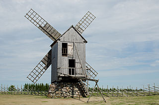
Angla is a village in Saaremaa Parish, Saare County in western Estonia.
Abdita is a Syrian village located in Ihsim Nahiyah in Ariha District, Idlib. According to the Syria Central Bureau of Statistics (CBS), Abdita had a population of 1440 in the 2004 census.
References
Coordinates: 51°43′N11°32′E / 51.717°N 11.533°E