The Conmhaícne Mara or Conmaicne Mara, were an early people of Ireland. Their tuath settled in the extreme west of County Galway, giving their name to Connemara, an anglicised form of Conmhaicne Mara.
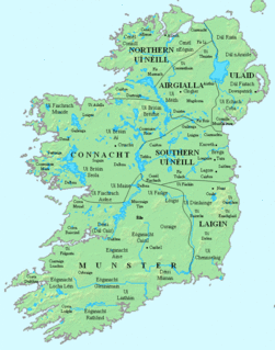
Uí Fhiachrach Aidhne was a kingdom located in what is now the south of County Galway.
Aidhne, also known as Uí Fhiachrach Aidhni, Mag nAidni, later Maigh Aidhne, was the territory of the Uí Fhiachrach Aidhni, a túath located in the south of what is now County Galway in the south of Connacht, Ireland.. Aidhne is coextensive with the present diocese of Kilmacduagh. The territory of Aidhne is bounded on the west by Loch Lurgan and the barony of Burren in County Clare in the province of Munster. County Clare also bounds Aidhne on its south and south-east side. Aidhne is bounded on the east by the low mountains of Sliabh Echtghe / Slieve Aughty, which separate Uí Fhiachrach Aidhni from the territory of Uí Maine in eastern County Galway. On the north-east Aidhne is bounded by the plains of Uí Mhaine and on the north by Mag Mucruime. On the north-west Aidhne is bounded by the parish of Mearaí / Maree which is in the territory of Uí Briúin Seola.

Ó Rothláin is an Irish surname. The name is a Patronym meaning "descendant of Rothlán." It is suggested that it is a possible variant of Ó Raghalláin, or Ó Roghallaigh. It is the pre-anglicised, Irish form of the names Rowlan, Rowland, Rowlands, Rollan, Rollin, Rolan and Rowley. The name can also be found spelled as Ó Rothlán, Ó Rothlain, O'Rothlain, Rothlán, and Rothlan.

Dál nAraidi or Dál Araide was a Cruthin kingdom, or possibly a confederation of Cruthin tribes, in north-eastern Ireland during the Middle Ages. It was part of the over-kingdom of Ulaid, and its kings often contended with the Dál Fiatach for the over-kingship of the province. At its greatest extent, the borders of Dál nAraidi roughly match those of County Antrim, and they seem to occupy the same area as the earlier Robogdii of Ptolemy's Geography, a region shared with Dál Riata. Their capital was Ráth Mór outside Antrim, and their eponymous ancestor is claimed as being Fiachu Araide.
The Uí Briúin were a royal dynasty of Connacht. Their eponymous apical ancestor was Brión, son of Eochaid Mugmedon and Mongfind, and an elder half brother of Niall of the Nine Hostages. They formed part of the Connachta, along with the Uí Fiachrach and Uí Ailello, putative descendants of Eochaid Mugmedon's sons Fiachra and Ailill. The Uí Ailello were later replaced as the third of the Three Connachta, by genealogical sleight of hand, by the Uí Maine.
The Conmhaícne Mheáin Maigh or Conmaicne Mhein or Conmaicne Máenmaige or Conmaicne Críche Meic Erca, were an early people of Ireland, their tuath comprising the barony of Loughrea, in County Galway.
Fachtna Ó hAllgaith, Irish erenagh and benefactor, died 1232.
Fearghal mac Catharnach, Lord of Loch Riach, died 821/823.

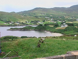
Inis Cealtra, or Holy Island, is an island off the western shore of Lough Derg in Ireland. Now uninhabited, it was once a monastic settlement. It has an Irish round tower, and the ruins of several small churches, as well as part of 4 high crosses and a holy well. Despite the lack of population, the cemetery on this island is still in use. Coffins and mourners are transported the short distance from County Clare in small boats. Boat trips can be taken from the harbour at Mountshannon. It is conserved by the East Clare Heritage Centre.

Cashelore, also called Cashel Bir or Bawnboy, is a stone ringfort (cashel) and National Monument located in County Sligo, Ireland.
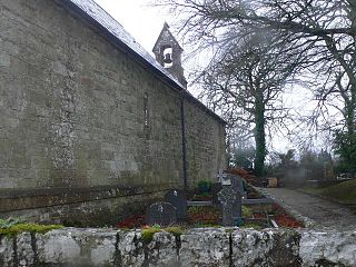
St. Cronan's Church is a 10th-century Church of Ireland church in Tuamgraney, County Clare, Ireland. It is the oldest church in continuous use in Ireland. The Tuamgraney parish operates as a unit with the Mountshannon parish in the Killaloe Union of parishes in the Diocese of Limerick and Killaloe.
Isert Kelly Castle is a tower house and National Monument located in County Galway, Ireland.
Aughrim Ringforts are a pair of ringforts forming a National Monument located in County Galway, Ireland.

Kilbennen or Kilbannon is a medieval ecclesiastical site and National Monument located in County Galway, Ireland.

The Priory of Saint Mary, Clontuskert-Hy-Many, also called Clontuskert Abbey, is a medieval Augustinian priory and National Monument located in County Galway, Ireland.

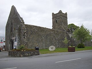
The Priory Church of Saint Peter and Saint Paul, Athenry, also called Athenry Priory, is a medieval Dominican priory and National Monument located in Athenry, Ireland.
Dunmore Abbey is a medieval Augustinian friary and National Monument located in County Galway, Ireland.
Moycarn is a barony in County Roscommon, Republic of Ireland.
Rathdown Castle is a ruined castle and ancient settlement site located in County Wicklow, Ireland.


