Drumlemble

Last updated

Kilkivan Cemetery and Chapel, by Wester Drumlemble Kilkivan Cemetery and Chapel.jpg
Kilkivan Cemetery and Chapel, by Wester Drumlemble

Drumlemble (Scottish Gaelic : Druim Leamhan, pronounced  [t̪ɾumˈlãũ.an] ) is a small village on the Kintyre peninsula in Argyll and Bute, Scotland.

Kintyre peninsula

Kintyre is a peninsula in western Scotland, in the southwest of Argyll and Bute. The peninsula stretches about 30 miles (48 km), from the Mull of Kintyre in the south to East Loch Tarbert in the north. The area immediately north of Kintyre is known as Knapdale.

Argyll and Bute Council area of Scotland

Argyll and Bute is both one of 32 unitary authority council areas and a lieutenancy area in Scotland. The administrative centre for the council area is in Lochgilphead.

Scotland Country in Europe, part of the United Kingdom

Scotland is a country that is part of the United Kingdom. Sharing a border with England to the southeast, Scotland is otherwise surrounded by the Atlantic Ocean to the north and west, by the North Sea to the northeast and by the Irish Sea to the south. In addition to the mainland, situated on the northern third of the island of Great Britain, Scotland has over 790 islands, including the Northern Isles and the Hebrides.

The village of Drumlemble is approximately 4 miles to the west of the nearest town, Campbeltown, [1] on the B843.

Campbeltown town in Scotland, Britain

Campbeltown is a town and former royal burgh in Argyll and Bute, Scotland. It lies by Campbeltown Loch on the Kintyre peninsula. Originally known as Kinlochkilkerran, it was renamed in the 17th century as Campbell's Town after Archibald Campbell was granted the site in 1667. Campbeltown became an important centre for Scotch whisky, and a busy fishing port.

Drumlemble Halt was a small station on the Campbeltown and Machrihanish Light Railway, opening in 1906 and closing in 1932. [1]

Drumlemble Halt was a railway station situated at the road crossing near East Drumlemble Farm on a lane to Lochsanish Farm, Argyll and Bute.

Campbeltown and Machrihanish Light Railway

The Campbeltown and Machrihanish Light Railway was a 2 ft 3 in narrow gauge railway in Kintyre, Scotland, between Campbeltown and the coalmining village of Machrihanish. Only three other passenger-carrying lines in the UK operated on the same gauge, all of them in Wales - the Corris Railway, the short-lived Plynlimon and Hafan Tramway and the Talyllyn Railway.

The village consists of the main settlement of Drumlemble and the two outlying settlements of Easter and Wester Drumlemble. The local school, Drumlemble Primary School, caters for the people of Drumlemble, Machrihanish and other settlements in the southern part of the Laggan plain.

Machrihanish village in United Kingdom

Machrihanish is a village in Argyll, on the west coast of Scotland. It is a short distance north of the tip of the Mull of Kintyre, which faces out towards Ireland and the Atlantic. Machrihanish has a classic links golf course designed by Old Tom Morris, with views towards the islands of Gigha, Islay and Jura. A second, newer course has been built nearby called Machrihanish Dunes. This course is part of a multimillion-pound development by an American company, which has renovated the previously-dilapidated Ugadale Hotel in the village and owns the Royal Hotel on the sea front in nearby Campbeltown.
Related Research Articles

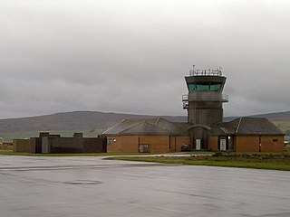
RAF Machrihanish

Royal Air Force Machrihanish or RAF Machrihanish is a former Royal Air Force station located near the town of Machrihanish and 3.5 miles (5.6 km) west of Campbeltown, at the tip of the Kintyre peninsula, Argyll and Bute, in Scotland.

Campbeltown Airport airport in Kintyre, Scotland since 1995

Campbeltown Airport is located at Machrihanish, 3 nautical miles west of Campbeltown, near the tip of the Kintyre peninsula in Argyll and Bute on the west coast of Scotland. The airport was formerly known as RAF Machrihanish and hosted squadrons of the Royal Air Force and other NATO air forces as well as the United States Marine Corps. The airport is at a strategic point near the Irish Sea, and was used to guard the entrance to the Firth of Clyde where US nuclear submarines were based at Holy Loch and where Royal Navy Trident missile submarines are still based at HMNB Clyde.

Royal Naval Air Station Machrihanish, is a former Royal Navy air station, close to Campbeltown in Argyll and Bute, Scotland.

Carradale is a village on the east side of Kintyre, overlooking the Kilbrannan Sound and the west coast of the Isle of Arran in the Firth of Clyde, approximately 14 miles from Campbeltown. To the north of Carradale is the coastal peak known as Torr Mor; nearby are the hamlet of Dippen and Dippen Bay. Population: 1350~ (2009)

Achinhoan village in United Kingdom

Achinhoan is a settlement on the Kintyre peninsula in Argyll and Bute, Scotland. It consists of a handful of buildings, half a mile (one km) west of Achinhoan Head and three miles (five km) southeast of Campbeltown.

Stewarton, Argyll village in Argyll and Bute, Scotland

Stewarton, Kintyre is a village in Argyll and Bute, Scotland.

Campbeltown is a town on the Kintyre peninsula, Argyll and Bute, Scotland.

Glen Scotia distillery trademark

Glen Scotia distillery or sometimes affectionately known as The Scotia or Old Scotia is a distillery that is a producer of single malt Scotch whisky. The distillery was founded in 1832 in Campbeltown, Scotland.

The Machrihanish Coalfield is a coalfield on the Kintyre peninsula in southwest Scotland. It is one of the smallest British coalfields. With the exception of a thin coal beneath the Lyoncross Limestone in the overlying Upper Limestone Formation, all of the coal-bearing strata are found within the Limestone Coal Formation, a subdivision of the Clackmannan Group; all being strata of Namurian age. There are numerous seams of which the Main Coal is the principal one, being some 3 to 4m thick. A further, higher seam known as the Kilkivan Coal has also been worked. The full sequence is:

Machrihanish was a railway station in the village of Machrihanish, Argyll and Bute, serving the town. The Campbeltown and Machrihanish Light Railway was a 2 ft 3 in narrow gauge railway in Kintyre, Scotland, between the towns of Campbeltown and Machrihanish.

Lintmill Halt was a railway station about 2 miles from Campbeltown, Argyll and Bute, serving the rural locale and the nearby lint mill. The Campbeltown and Machrihanish Light Railway was a 2 ft 3 in (686 mm) narrow gauge railway in Kintyre, Scotland, between the towns of Campbeltown and Machrihanish.

Plantation Halt was a railway station situated near the road crossing on the A83 at a small plantation that is no longer extant. Argyll and Bute.

The Gauldrons (Scottish Gaelic: Innean nan Gailleann meaning "Bay of Storms" is a bay facing the Atlantic Ocean in the village of Machrihanish in Argyll, on the west coast of Scotland, a short distance north of the tip of the Mull of Kintyre.

The Campbeltown Heritage Centre is a museum and heritage centre in Campbeltown, Argyll, Scotland. The centre is the main repository for social history for the Kintyre Peninsula from around 1700 to the present day, and is run by the Kintyre Amenity Trust.

Machrihanish Bay

Machrihanish Bay is a large remote tidal north by northeast coastal facing embayment, located next to the Campbeltown Airport within Argyll and Bute, Scotland. It is located on the west coast of the Kintyre peninsula. Machrihanish Bay has the longest continuous stretch of sand in Argyll.

References

  1. 1 2 "Drumlemble". Gazetteer for Scotland. Retrieved 8 April 2018.

Coordinates: 55°24′49″N5°41′22″W / 55.41361°N 5.68944°W / 55.41361; -5.68944

Geographic coordinate system Coordinate system

A geographic coordinate system is a coordinate system that enables every location on Earth to be specified by a set of numbers, letters or symbols. The coordinates are often chosen such that one of the numbers represents a vertical position and two or three of the numbers represent a horizontal position; alternatively, a geographic position may be expressed in a combined three-dimensional Cartesian vector. A common choice of coordinates is latitude, longitude and elevation. To specify a location on a plane requires a map projection.