
Boho is a hamlet and a civil parish 11 kilometres (7 mi) covering approximately 12 km × 7 km southwest of Enniskillen in County Fermanagh, Northern Ireland. It is situated within Fermanagh and Omagh district.

Saint Faber is the patron saint of the Sacred Heart Church in Boho, County Fermanagh and of Monea.

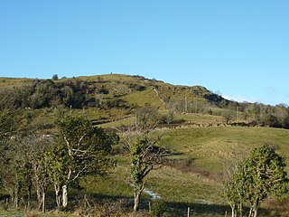
The Boho Caves are a collection of caves centred on the village of Boho, County Fermanagh on the northern slopes of Belmore Mountain. They encompass the main Boho Cave and the smaller Waterfall Cave and Upper and Lower Ravine Caves. The Boho Cave system is the sixth-longest cave system in Northern Ireland, is designated an Area of Special Scientific Interest and is the only example of joint-controlled caves in Northern Ireland.
Knockmore is an upland area and townland situated in County Fermanagh, Northern Ireland outside the village of Derrygonnelly, in the historical barony of Magheraboy. This area, together with the adjacent Barrs of Boho and most of the uplands in Boho parish, are described as the Knockmore Scarplands. The focal point of the area is Knockmore summit at 277 metres (909 ft).
Killydrum is a townland in County Fermanagh, Northern Ireland. It has previously been referred to as Kildrome (1659) and Killdrum (1695). This townland belongs to the land division of Old Barr in the area of Boho.

Reyfad is a townland in County Fermanagh, Northern Ireland. It lies in the land division of Old Barr, in the civil parish of Boho. The townland has previously been called Rayfadd - 1659, Raffada (Magheryboy) - 1672 and Ráith Fada "long fort" - 1833.

Carn or Carngreen is a townland situated in County Fermanagh, Northern Ireland. It is situated within the civil parish of Boho and Fermanagh and Omagh district.
Aghanaglack or Aghnaglack, is a townland in County Fermanagh, Northern Ireland. It is situated in the civil parish of Boho, as well as Fermanagh and Omagh district.
Carr or Corr is a townland in County Fermanagh, Northern Ireland. The area is situated in the civil parish of Boho and contains Carron Lough which is reputed to be quite deep and also the Sillees River. It is situated within Fermanagh and Omagh district.

Clogherbog is a townland in County Fermanagh, Northern Ireland. It is part of the civil parish of Boho, and contains the sub-townlands of Carrickrory, Lough Nacloyduff, Loughanquin, Loughnamanfin and Tullylaur. It is situated within Fermanagh and Omagh district.
Glenkeel is a townland in County Fermanagh, Northern Ireland. It is situated in the south-west corner of the civil parish of Boho, in the land division of Old Barr, in the former barony of Magheraboy. It is situated within Fermanagh and Omagh district.
Kilnamadoo is a townland in County Fermanagh, Northern Ireland. It is situated within the civil parish of the area of Boho, as well as Fermanagh and Omagh district.
Knocknahunshin, is a townland in County Fermanagh, Northern Ireland. It is in the civil parish of Boho, in between the townlands of Glenkeel and Reyfad. Within this area are the sub-townlands of Arduagh, Carricknamulloge, Carricknine, Horse Rock, Legloughra, Owneyglas, Silkins and Sterrickinard.
Aghakeeran is a townland in County Fermanagh, Northern Ireland. It is near Derrygonnelly, in the civil parish of Devenish and is situated within Fermanagh and Omagh district.

Drumbegger is a townland situated in County Fermanagh, Fermanagh and Omagh district, Northern Ireland. It is part of the civil parish of Boho in the old barony of Magheraboy and contains the sub-townland known as Oubarraghan.
Moylehid is a townland in County Fermanagh, Northern Ireland. It is in the civil parish of Boho. This townland has also been variously known as Moylehide (1609), Moolet (1659), Moylehit, Mullyleet, Mul Leathaid and Mul-leithid (1834).
Agharahan is a townland is situated in the land division of Old Barr in the parish of Devenish, Barony of Magheraboy. It has an area of 746,831 m² / 74.68 hectares /0.29 square miles/184.55 acres / 184 acres. The townland runs from the high plateau in the Knockmore Scarpland at 766 ft down to the lowlands at 177 ft above sea level and is between the townlands of Old-Barr to the west, Killydrum to the south, Aghakeeran to the north, Drumbegger to the east and Lattonagh to the south. Agharahan is in the Civil Parish of Devenish but was previously associated with the civil parish of Boho, County Fermanagh.
Aghaherrish is a townland located in Boho in County Fermanagh, Northern Ireland.
Aghahoorin is a townland in the area of Boho, County Fermanagh, Northern Ireland.