Zderaz is a small village in the Pardubice Region of the Czech Republic. It has around 300 inhabitants.
WFYC is a radio station licensed to Alma, Michigan, United States, broadcasting a mainstream country music format. Prior to mid-2016, the station carried a sports radio format from ESPN Radio and the Michigan IMG Sports Network. However, according to http://www.wqbx.biz/wfyc-1280-am.html, WFYC is now Fox Sports.

Dzoragyugh, formerly known as Darakend, is a village in the Lori Province of Armenia.

Andrzejówka is a village in the administrative district of Gmina Biłgoraj, within Biłgoraj County, Lublin Voivodeship, in eastern Poland. It lies approximately 11 kilometres (7 mi) north-west of Biłgoraj and 73 km (45 mi) south of the regional capital Lublin.

Chrzanów is a village in Janów Lubelski County, Lublin Voivodeship, in eastern Poland. It is the seat of the gmina called Gmina Chrzanów. It lies approximately 15 kilometres (9 mi) north-east of Janów Lubelski and 53 km (33 mi) south of the regional capital Lublin.

Bęćkowo is a village in the administrative district of Gmina Szczuczyn, within Grajewo County, Podlaskie Voivodeship, in north-eastern Poland. It lies approximately 5 kilometres (3 mi) north-east of Szczuczyn, 11 km (7 mi) south-west of Grajewo, and 79 km (49 mi) north-west of the regional capital Białystok.

Anbabu is a village in the Astara Rayon of Azerbaijan. The village forms part of the municipality of Motolayataq.

Padar is a village in the Shamakhi Rayon of Azerbaijan.
Łyczanka is a village in the administrative district of Gmina Łososina Dolna, within Nowy Sącz County, Lesser Poland Voivodeship, in southern Poland.

Pęchratka Mała is a village in the administrative district of Gmina Andrzejewo, within Ostrów Mazowiecka County, Masovian Voivodeship, in east-central Poland. It lies approximately 8 kilometres (5 mi) west of Andrzejewo, 15 km (9 mi) east of Ostrów Mazowiecka, and 103 km (64 mi) north-east of Warsaw.
Komorowo is a village in the administrative district of Gmina Kazimierz Biskupi, within Konin County, Greater Poland Voivodeship, in west-central Poland.

Łagiewniki is a village in the administrative district of Gmina Kościan, within Kościan County, Greater Poland Voivodeship, in west-central Poland. It lies approximately 9 kilometres (6 mi) north of Kościan and 35 km (22 mi) south-west of the regional capital Poznań.

Antoniów is a village in the administrative district of Gmina Mykanów, within Częstochowa County, Silesian Voivodeship, in southern Poland. It lies approximately 8 kilometres (5 mi) north of Częstochowa and 69 km (43 mi) north of the regional capital Katowice.

Przybrodzie is a settlement in the administrative district of Gmina Polanów, within Koszalin County, West Pomeranian Voivodeship, in north-western Poland. It lies approximately 2 kilometres (1 mi) east of Polanów, 37 km (23 mi) east of Koszalin, and 160 km (99 mi) north-east of the regional capital Szczecin.

Vukašinovac is a village in the municipality of Aleksinac, Serbia. According to the 2002 census, the village has a population of 512 people.

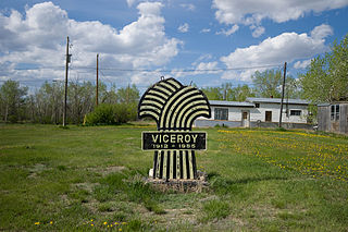
Excel No. 71 is a rural municipality in south-central Saskatchewan, Canada encompassing 1,122.02 square kilometres (433.21 sq mi) in area. The rural municipality maintains its office in Viceroy, Saskatchewan. The rural municipality in conjunction with the provincial government is in charge of maintenance of highways in its area. As well, the municipality provides policing, fire protection and municipal governance for the rural district, with a reeve as its administrator. The municipality was incorporated in 1913.

Izbišno is a village in the municipality of Foča, Republika Srpska, Bosnia and Herzegovina.

Gareva is a village in the municipality of Gacko, Republika Srpska, Bosnia and Herzegovina.
Soodevahe is a village in Saaremaa Parish, Saare County in western Estonia.

Pagryžuvys Manor is a former residential manor in Pagryžuvys village, Kelmė District Municipality, Lithuania, on the right shore of Gryžuva.


