Related Research Articles

Khairpur District is a district in the Pakistani province of Sindh in Sukkur Division. At the 2017 census, it was the fifth most populated district in the province after four districts of Karachi city, with 2.4 million inhabitants. The headquarters of the district is the city of Khairpur. The district is further divided into eight sub-districts: Khairpur Tehsil, Mirwah Tehsil, Kot Diji Tehsil, Kingri Tehsil, Sobho Dero Tehsil, Gambat Tehsil, Faiz Ganj Tehsil and Nara Tehsil.

Harishchandragad is a hill fort in the Ahmednagar district of India. Its history is linked with that of Malshej Ghat, kothale village and it has played a major role in guarding and controlling the surrounding region.

Bilagi is a panchayat town and taluka in the Bagalkot district of Karnataka, India. While only 19.5 km from the district headquarters of Bagalkote, the route by road is 30 km. The main occupation of people in this taluka is agriculture. Most of the farmers grow sugarcane.
Kalaghatagi is an administrative division, or Taluka, in the Dharwad district of the Indian state of Karnataka.

Keshod is a town and a Taluka in Junagadh district in the Indian state of Gujarat.

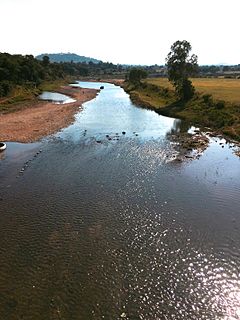
The Manjara, also spelled Manjara or Manjeera, is a tributary of the river Godavari. It passes through the states of Maharashtra, Karnataka and Telangana. It originates in the Balaghat range of hills near Ahmednagar district at an altitude of 823 metres (2,700 ft) and empties into the Godavari River. It has a total catchment area of 30,844 square kilometres (3,084,400 ha).

Began Jarwar is a large village on the road from Tando Allahjyar to Mirwah Town. It is fertile with green lands and thickly populated area. It is about two hundred years old. It is also the Headquarter of Union Council Began Jarwar since 1959. Population of Began Jarwar village is more than 3,000, and population of UC is about 20,000. The village has many basic facilities as dispensary, schools, veterinary centre for animals, agriculture office etc.
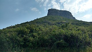
Dhodap, is one of the hill forts in Maharashtra state in India. Situated in Chandwad and kalwan taluka in the Nashik district. the fort is 4829 ft above sea level. It is the site of the second highest fort in the Sahyadri mountains after Salher. Dhodap hill is the second highest hill peak in Maharashtra after Kalsubai and Salher and the 29th highest peak in Western Ghats.
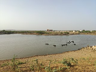
Basavarajeshwari Camp is a village in Sindanur Taluka, Karnataka, India. It is located beside a canal that provides water to three ponds. One stores drinking water for the villagers, and the other two provide water for lands for paddy and wheat cultivation. The two ponds belong to Mullapudi Kumar Raju. He is very fond of his village Satyavathicamp. Satyavathi is the name of his grandmother.
Kumbharia or Kumbhariya is a village in Anjar Taluka of Kutch District of Gujarat State of India. It is situated at a distance of 14 km from Anjar town, the taluka headquarters.

Dhaneti or Dhanetee is a village in Bhuj Taluka of Kutch District of Gujarat State of India. It is at a distance of about 26 km from Bhuj the Taluka and district headquarters of Kutch. Although it is in Bhuj Taluka, the Anjar Taluka headquarters of Anjar is only 18 km away.
Pimpalner, is a small town in Parner Taluka in Ahmednagar district of state of Maharashtra, India. It belongs to Nashik Division. It is located 49 km to the west of District headquarters Ahmednagar. 12 km from Parner. 189 km from State capital Mumbai. Pimpalner is surrounded by Parner Taluka to the north, Ahmednagar Taluka to the east, Shrigonda Taluka to the south, Khed Taluka to the west. Shirur, Ahmednagar, Shrigonda, Manchar are the nearby cities to Pimpalner.
The Pench River is an Indian tributary of the Kanhan River. It originates in the Chhindwara district of Madhya Pradesh and flows across Pench National Park, which is a reserve for the Tiger Project of India.

Mathur Madhabhai Savani is a businessman and social worker from Gujarat, India. He established a diamond firm Savani Brothers. He worked in the field of water conservation in Saurashtra region of Gujarat..
Thari Mirwah, or Thari (ٺري), is the capital city of Mirwah Subdivision in Khairpur District, Sindh, Pakistan. Thari weather is hetregenous (diverse) average temperature recorded is 14 - 40 c in winter and summer. Weather conditions allows growing many cereals and vegetable crops.
PS-33 (Khairpur-V) is a constituency of the Provincial Assembly of Sindh., Its constituted areas of Mirwah Sub-division which includes tehsil Thari Mirwah, Faiz Ganj, and sometimes parts of Sobhodero and Naro taluka.
Mangad Fort is a survey fort which is situated in Borwadi, an area near Mashidwadi in Mangaon, a taluka in Raigad district in the Indian state of Maharashtra. The fort is made sacred by the footsteps of the founder of Hindavi Swaraj, the famous Maratha king Chhatrapati Shivaji Maharaja. Mangaon is situated about 150 km from Mumbai.
Kalyangad Fort/Nandgiri is in the taluka Koregaon)of Satara district of Maharashtra. The fort stands at the end of a spur of the Mahadev range running south-west from the villages of Vikhale and Bhadle, eight miles north of Koregaon and about fourteen miles north-east of Satara. Its elevation is 3,537 feet above sea level.

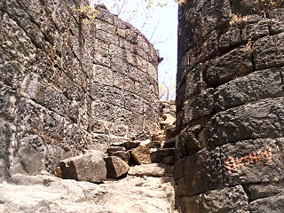
Ankai Fort is a historic site found in the Satmala Range hills in western India. It is located in Yeola Taluka of Nashik district in the state of Maharashtra. The fort was built by Yadava of Devgiri. Geographically, it is near Manmad. The Ankai fort and Tankai fort are two different forts on adjacent hills. A common fortification is constructed to secure both. The Ankai fort is located on a hill with perpendicular scarps on all the sides, except for a narrow nose on the eastern side.
Indrai Fort / Indragiri Fort is a fort located 75 km from Nashik, in Nashik district, of Maharashtra. This fort though is an important fort in Nashik district but, it is less visited by the trekkers. In Chandwad taluka, there are 4 forts in a line on the Satmal hill range, the Chandwad fort, Indrai fort, Rajdher fort, and Koldher fort. This fort is easy to climb but requires 3 hours to reach the fort.
References
| | This Sindh location article is a stub. You can help Wikipedia by expanding it. |