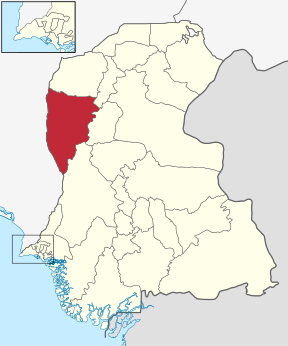
Sindh is one of the four provinces of Pakistan. Located in the southeast of the country, it is the home of the Sindhi people. Sindh is the third largest province of Pakistan by area and second largest province by population after Punjab. Sindh is bordered by Balochistan province to the west and Punjab province to the north. Sindh also borders the Indian states of Gujarat and Rajasthan to the east and Arabian Sea to the south. Sindh's landscape consists mostly of alluvial plains flanking the Indus River, the Thar desert in the eastern portion of the province closest to the border with India and the Kirthar Mountains in the western part of Sindh.

Khairpur is a city and the capital of the Khairpur District, in Pakistan's Sindh province. It is the 46th largest city in Pakistan by population.

Khairpur District is a district in the Pakistani province of Sindh in Sukkur Division. At the 2017 census, it was the fifth most populated district in the province after four districts of Karachi city, with 2.4 million inhabitants. The headquarters of the district is the city of Khairpur. The district is further divided into eight sub-districts: Khairpur Taluka, Mirwah Taluka, Kot Diji Taluka, Kingri Taluka, Sobho Dero Taluka, Gambat Taluka, Faiz Ganj Taluka and Nara Taluka.

The Kirthar Mountains are a mountain range that mark the boundary between the Pakistani provinces of Balochistan and Sindh, and which comprise much of the Kirthar National Park. The mountain range forms part of the Kirthar-Sulaiman geologic province, which stretches from the Arabian Sea coast north to the Sulaiman Mountains in northwest Pakistan. The highest peak of the mountains is Zardak Peak at 7,430 ft (2,260 m).

The State of Khairpur, also transliterated as Khayrpur, was a princely state of British India on the Indus River in northern Sindh, modern Pakistan, with its capital city at Khairpur. It was established as capital for the Sohrabani branch of the Talpur dynasty, and was established shortly after Talpur ascendency in 1783 as one of several Talpur dominions. Whereas the other Talpur dominions were conquered by the British in 1843, the Khairpur state entered into treaty with the British, thereby maintaining some of its autonomy as a princely state. The last Mir of Khairpur opted to join the new state of Pakistan in 1947, and the dominion was thus made a Princely state of Pakistan, until it was fully amalgamated into West Pakistan in 1955.

The ancient site at Kot Diji was the forerunner of the Indus Civilization. The occupation of this site is attested already at 3300 BCE. The remains consist of two parts; the citadel area on high ground, and outer area. The Pakistan Department of Archaeology excavated at Kot Diji in 1955 and 1957.

Dadu District, is a district of Sindh Province, Pakistan. With headquarters the city of Dadu, the district was created in 1931 by merging Kotri and Mahal Kohistan tehsils from Karachi District and Mehar, Khairpur Nathan Shah, Dadu, Johi and Sehwan tehsils from Larkana District. IN 2004, several talukas in the south were split off to create the new Jamshoro District. Its boundary touches with four districts of Sindh i.e. Jamshoro, Naushahro Feroze, Shaheed Benazirabad and Kamber Shahdadkot.

The history of Sindh or Sind refers to the history of the modern-day Pakistani province of Sindh, as well as neighboring regions that periodically came under its sway. Sindh was a cradle of civilization as the center of the ancient Indus Valley civilization, and through its long history was the seat of several dynasties that helped shape its identity.
The Tharro Hills are located in Sindh, Pakistan. Important archaeological sites relating to the Amri culture have been discovered in the area.

Lakhan-jo-daro is an archeological site and one of the largest cities of the Indus Valley Civilization. It is located within an industrial zone on the outskirts of the modern city of Sukkur and situated at the distance of mere 75 Kilometers from another major city of its contemporary era, Mohenjo Daro. It covers an expanse of more than 300 Hectares.

The Talpur dynasty were rulers based in Sindh, in what is now the modern-day Pakistan. Four branches of the dynasty were established following the defeat of the Kalhora dynasty at the Battle of Halani in 1743: one ruled lower Sindh from the city of Hyderabad, another ruled over upper Sindh from the city of Khairpur, a third ruled around the eastern city of Mirpur Khas, and a fourth was based in Tando Muhammad Khan. The Talpurs were ethnically Baloch. They ruled from 1783, until 1843, when they were in turn defeated by the British at the Battle of Miani and Battle of Dubbo. The northern Khairpur branch of the Talpur dynasty, however, continued to maintain a degree of sovereignty during British rule as the princely state of Khairpur, whose ruler elected to join the new Dominion of Pakistan in October 1947 as an autonomous region, before being fully amalgamated into West Pakistan in 1955.

The Hindu and Buddhist architectural heritage of Pakistan is part of a long history of settlement and civilization in Pakistan. The Indus Valley civilization collapsed in the middle of the second millennium BCE and was followed by the Vedic Civilisation, which extended over much of northern India and Pakistan.

Buddhism in Pakistan took root some 2,300 years ago under the Mauryan king Ashoka. Buddhism has played a major role in the history of Pakistan — the land of which over time has been part of predominantly Buddhist empires such as the Indo-Greek Kingdom, the Kushan Empire, the Maurya Empire of Ashoka, the Pala Empire.

Aror or Alor or Arorkot is the medieval name of the city of Rohri. Aror once served as the capital of Sindh.

Gambat is a city and capital of Gambat Taluka, an administrative subdivision of Khairpur District, located in Sindh province of Pakistan.

Thari Mirwah, or Thari (ٺري), is the capital city of Mirwah Subdivision in Khairpur District, Sindh, Pakistan. Thari weather is hetregenous (diverse) average temperature recorded is 14 - 40 c in winter and summer. Weather conditions allows growing many cereals and vegetable crops. Ground water is sweet for drinking.
Khairpur railway station is located in Khairpur city, Khairpur district of Sindh province of the Pakistan.

Khairpur Medical College is an 8th public medical institution located in the city of Khairpur, Sindh, Pakistan.

Rohri Hills in Upper Sindh, Pakistan are scarped rocks of limestone running South South East of Rohri between Indus river in the west and Nara river in the east. The hills are about 40 kilometres long and 16 kilometres wide. These hills are home to a large number of archaeological sites. Flint artifacts of Paleolithic period have been discovered here.

SadarJi Bhatyoon is a village in Sindh province of Pakistan.


