
Dunalley Bay refers to a bay on the North East aspect of Norfolk Bay, which lies adjacent to Dunalley, Tasmania, the largest town of Norfolk Bay [1]
Dunalley Bay refers to a bay on the North East aspect of Norfolk Bay, which lies adjacent to Dunalley, Tasmania, the largest town of Norfolk Bay [1]

USS Card (AVG/ACV/CVE/CVHE/CVU/T-CVU-11/T-AKV-40) was an American Bogue-class escort carrier that saw service in World War II. She was named for Card Sound, a continuation of Biscayne Bay, south of Miami, Florida. She was the flagship of Task Group 21.14 a hunter-killer group formed to destroy German submarines in the North Atlantic.

Lillie Glacier is a large glacier in Antarctica, about 100 nautical miles (190 km) long and 10 nautical miles (19 km) wide. It lies between the Bowers Mountains on the west and the Concord Mountains and Anare Mountains on the east, flowing to Ob' Bay on the coast and forming the Lillie Glacier Tongue.

USS Mount Hood (AE-11) was the lead ship of her class of ammunition ships for the United States Navy in World War II. She was the first ship named after Mount Hood, a volcano in the Cascade Range in the US state of Oregon. On 10 November 1944, shortly after 18 men had departed for shore leave, the rest of the crew were killed when the ship exploded in Seeadler Harbor at Manus Island in Papua New Guinea. The ship was obliterated while also sinking or severely damaging 22 smaller craft nearby.

The Forestier Peninsula is a peninsula located in south-east Tasmania, Australia, approximately 60 kilometres (37 mi) by the Arthur Highway, south-east of Hobart. The peninsula is connected to mainland Tasmania at East Bay Neck, near the town of Dunalley at its northern end. At Eaglehawk Neck, the southern end of the Forestier Peninsula is connected to the Tasman Peninsula.

The Taunton River watershed or Taunton River basin is made up of 562 square miles (1,500 km2) of rivers, lakes, ponds, streams, and wetlands in southeastern Massachusetts, US. It is the second largest watershed in the state. Also, it is a significant part of a much larger multi-state watershed, the Narragansett Bay watershed.
The Billabong Creek, a perennial river of the Murrumbidgee catchment within the Murray-Darling basin, is located in the South West Slopes region of New South Wales, Australia.

Smooth Island, is a privately owned island with an area of 59.31 ha lying close to the south-eastern coast of Tasmania, Australia. The island is part of the Sloping Island Group situated in Norfolk Bay and surrounded by the Tasman and Forestier Peninsulas. The towns Dunalley and Murdunna are nearby. Smooth Island differs from other Tasmanian islands as it has an unencumbered freehold title down to the high-water mark.

King George Island is an island in south-eastern Australia. It is part of the Sloping Island Group, lying close to the south-eastern coast of Tasmania around the Tasman and Forestier Peninsulas. The island was once inhabited and farmed and contains the ruins of two buildings on its eastern side. A conservation covenant is in place on this island.
The 1949 Tasmanian Australian National Football League (TANFL) premiership season was an Australian Rules football competition staged in Hobart, Tasmania over fifteen (15) roster rounds and four (4) finals series matches between 30 April and 24 September 1949.
Doolette Bay is a bay in Antarctica lying at the junction of the western side of the Ninnis Glacier Tongue with the mainland. It was discovered by the Australasian Antarctic Expedition (1911–14) under Douglas Mawson, who named it after George Doolette of Adelaide, a patron of the expedition.
The 1959 Tasmanian Australian National Football League (TANFL) premiership season was an Australian Rules football competition staged in Hobart, Tasmania over eighteen (18) roster rounds and four (4) finals series matches between 28 March and 19 September 1959.
Dunalley is a rural / residential locality in the local government areas (LGA) of Sorell (37%) and Tasman (63%) in the South-east LGA region of Tasmania. The locality is about 31 kilometres (19 mi) south-east of the town of Sorell. The 2016 census provides a population of 316 for the state suburb of Dunalley. It is a small fishing village on the east coast of Tasmania.
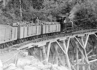
The Sandfly Colliery Tramway was a 20 km (12 mi), 2 ft narrow gauge tramway linking the Kaoota Mine to Margate, Tasmania. Constructed in 1905–06, the Tramway climbed 457 m (1,499 ft) above sea level and crossed ten bridges. After coal mining ceased the tramway was used to transport logs, fruit and passengers. The line was lifted and abandoned in 1922 after bushfires destroyed several bridges along the line. Currently, 6 km (3.7 mi) of the old track is used as cycling/walking tracks, while the remainder of the old line is on private property.
There are few canals in Australia. Of the canals constructed, only a small number are navigable waterways. The following list provides a summary of known navigable waterways and other types of constructed or artificial waterways in Australia.
The Norfolk Bay is a body of water in the south east of Tasmania, Australia. The north west aspect of Norfolk Bay is continuous with Frederick Henry Bay. The north east aspect of Norfolk Bay is continuous with Blackman Bay via the Denison Canal.
Blackman Bay is located on the south-east coast of Tasmania. It extends from the bay's inlet at the southern peninsula of Marion Bay to the village of Dunalley. Historically this bay was referred to as "Frederick Henry Bay".

King George Sound is a body of water within Norfolk Bay, in Tasmania, Australia. It opens into Norfolk Bay at King George Island and extends to the town of Murdunna.
Flinder's trench is a region within Norfolk Bay, to the south of King George Island (Tasmania), Australia, which used to demarcate the northernmost extent of a region which was rich with mussels and other oceanic invertebrates. This region extended to Smooth Island (Tasmania) and as far south as Taranna. The region was subjected to unregulated fishing practices and dredging, leading to substantially reduced shellfish populations.
East Bay Neck refers to an isthmus connecting the Forestier Peninsula to the mainland of Tasmania.
Coordinates: 42°55′S147°48′E / 42.917°S 147.800°E
| | This Tasmania geography article is a stub. You can help Wikipedia by expanding it. |