
Cadbury Castle is a Bronze and Iron Age hillfort in the civil parish of South Cadbury in the English county of Somerset. It is a scheduled monument and has been associated with King Arthur's legendary court at Camelot.

Dolebury Warren is a 90.6 hectares biological Site of Special Scientific Interest (SSSI) and ancient monument near the villages of Churchill and Rowberrow in North Somerset, part of South West England. It is owned by the National Trust, who acquired the freehold in 1983, and managed by the Avon Wildlife Trust.

Bathampton Down is a flat limestone plateau in Bathampton, Somerset, England, overlooking the River Avon and the city of Bath. There is evidence of man's activity at the site since the Mesolithic period including Bathampton Camp, an Iron Age hillfort or stock enclosure. It has also been used for quarrying, and part of it is now a golf course.

Cleeve Toot is an Iron Age univallate hillfort above Goblin Combe, Cleeve, Somerset, England. It is a Scheduled Ancient Monument.

Norton Camp is a Bronze Age hill fort at Norton Fitzwarren near Taunton in Somerset, England.

Black Ball Camp is an Iron Age hill fort South West of Dunster, Somerset, England on the northern summit of Gallox Hill. It is a Scheduled Ancient Monument.
Bury Castle is an Iron Age hill fort near Selworthy, Somerset, England. It has been scheduled as an ancient monument.

Kenwalch's Castle is probably an Iron Age hill fort that may have been converted into a Roman fortress, near Penselwood, Somerset, England, 6.6 kilometres (4 mi) east south east of Bruton at grid reference ST747335. It is a Scheduled Ancient Monument. It is believed to be named after Cenwalh of Wessex.

Burrough Hill is an Iron Age hillfort in Burrough on the Hill, 7 miles (11 km) south of Melton Mowbray in the English county of Leicestershire. Situated on a promontory about 210 metres (690 ft) above sea level, the site commands views over the surrounding countryside for miles around. There has been human activity in the area since at least the Mesolithic, and the hillfort was founded in the early Iron Age. In the medieval period, after the hillfort was abandoned, the hill was used as farmland. This ended in the 17th century when the parish the hill was in was enclosed. Traces of ridge and furrow show where the medieval fields were ploughed. Since the 1930s the site has been the subject of archaeological investigations and renewed excavations under the auspices of the University of Leicester began in 2010. Part of Burrough Hill Country Park and open to the public, the hillfort is protected as a Scheduled Ancient Monument.

Scratchbury Camp is the site of an Iron Age univallate hillfort on Scratchbury Hill, overlooking the Wylye valley about 1 km northeast of the village of Norton Bavant in Wiltshire, England. The fort covers an area of 37 acres (15 ha) and occupies the summit of the hill on the edge of Salisbury Plain, with its four-sided shape largely following the natural contours of the hill.
Worlebury Camp is the site of an Iron Age hillfort on Worlebury Hill, north of Weston-super-Mare in Somerset, England. The fort was well defended with a numerous walls, embankments and ditches around the site. Several large triangular platforms have been uncovered around the sides of the fort, lower down on the hillside. Nearly one hundred storage pits of various sizes were cut into the bedrock, and many of these had human remains, coins, and other artefacts in them. During the 19th and 20th centuries the fort suffered damage and was threatened with complete destruction on multiple occasions. Now, the site is a designated Scheduled monument. it falls within the Weston Woods Local Nature Reserve which was declared to Natural England by North Somerset Council in 2005.

Banwell Camp is a univallate Iron Age hill fort in the North Somerset district of Somerset, England. The hill fort is situated approximately 1.6 miles (2.6 km) east from the Village of Banwell. Some artefacts found on the site dates back to the Bronze Age and the Stone Age. In places it is surrounded by a 4 metres (13 ft) high bank and ditch.

King's Castle is a Neolithic hillfort 1 kilometre (0.62 mi) east of Wiveliscombe in Somerset, England. It is surrounded by two banks with a ditch between them. The inner wall ranges up to 2.5 metres (8.2 ft) high and the outer wall gets up to 1.5 metres (4.9 ft) high. Arrowheads, scrapers, and borers have been found at the site. A coin hoard of 1139 coins was found in a pot buried 0.30 metres (1 ft) deep.

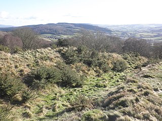
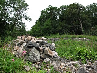
Roddenbury Hillfort is a univallate Iron Age hillfort in the parish of Selwood, Somerset, England. It is a Scheduled Monument and it was on the Heritage at Risk Register in 2011. In 2012 it was announced that it was to undergo major repairs following damage by off road biking. It is close to the later Hales Castle.

Cholesbury Camp is a large and well-preserved Iron Age hill fort on the northern edge of the village of Cholesbury in Buckinghamshire, England. It is roughly oval-shaped and covers an area, including ramparts, of 15 acres (6.1 ha), and measures approximately 310 m (1,020 ft) north-east to south-west by 230 m (750 ft) north-west to south-east. The interior is a fairly level plateau which has been in agricultural use since the medieval period. The hill fort is now a scheduled ancient monument.

Mounsey Castle is an Iron Age irregular triangular earthwork of 1.75 hectares north west of Dulverton, Somerset, England. It has been scheduled as an ancient monument. It has been added to the Heritage at Risk Register.

Highbury Hill in Clutton, Somerset, England is the site of the earthwork remains of an Iron Age univallate hillfort. It occupies an area of woodland at the end of a narrow ridge. It is a Scheduled Ancient Monument, meaning that it is a nationally important archaeological site or historic building, given protection against unauthorised change.

Cornish promontory forts, commonly known in Cornwall as cliff castles, are coastal equivalents of the hill forts and Cornish "rounds" found on Cornish hilltops and slopes. Similar coastal forts are found on the north–west European seaboard, in Normandy, Brittany and around the coastlines of the British Isles, especially in Wales, Scotland and Ireland. Many are known in southwest England, particularly in Cornwall and its neighbouring county, Devon. Two have been identified immediately west of Cornwall, in the Isles of Scilly.

Beacon Hill, also known as Harting Beacon, is a hillfort on the South Downs, in the county of West Sussex in southern England. The hillfort is located in the parish of Elsted and Treyford, in Chichester District. It is a Scheduled Ancient Monument with a list entry identification number of 1015915. The hilltop enclosure is dated to the Late Bronze Age, from the 8th to 6th centuries BC. The hillfort defences were renewed during the Late Iron Age.

