Chodang University (Korean: 초당대학교) is the only university in Muan County, a largely rural district of South Korea's South Jeolla province. The current president is Boung-Sik, Kim.
Daeheungsa (Korean: 대흥사), sometimes called Daedunsa, is a main temple of the Jogye Order of Korean Buddhism. Daeheungsa is located on the slopes of Duryunsan in Samsan township, Haenam County, South Jeolla Province, South Korea.
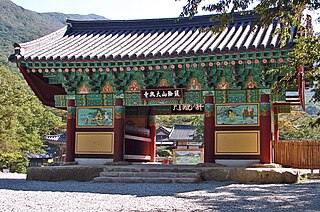
Dalmasan, Mt. Dalma, is part of the Taebaek mountain range and lies in Haenam county, South Jeolla province, South Korea. Its elevation is 489 meters, and its peak offers views of the "Land's Edge," (땅끝) the southernmost point on the Korean peninsula, 땅끝마을, and outlying islands such as Wando. Also in the vicinity are Mihwangsa and a number of hermitages affiliated with it.
Strmac is a village located in the Užice municipality of Serbia. In the 2002 census, the village had a population of 296 people.

WZQZ 1180 AM is a radio station broadcasting a country music format. Licensed to Trion, Georgia, the station serves the areas of Summerville, Georgia, Rome, Georgia, and La Fayette, Georgia. WZQZ is currently owned by HS Productions, Inc. The station is in association with NBC Radio News and the Georgia News Network for news broadcasts, and produce their own local news programs. Jimmy Holbrook owns both AM 1180 and HS Productions and moderates as weekday reporter and DJ for the station along with Bonnie Fletcher. The station has six local newscasts daily and serves as the only daily local news source for Chattooga County. The station's signal can also be heard 24 hours-a-day on WSKY Television channel 21.8.
Pireway is an unincorporated community in Columbus County, North Carolina, United States, located at the intersection of North Carolina Highways 904 and 905. It lies at an elevation of 39 feet.

Gamaksan, also known as Kamak Mountain or Hill 675 (675고지) during the Korean War, is a mountain in Gyeonggi Province, South Korea. Its sits between the cities of Paju, Yangju and Yeoncheon County. Gamaksan has an elevation of 675 m (2,215 ft).
Ryan is a populated place in Roane County, West Virginia, United States.
Deoksungsan is a mountain of Chungcheongnam-do, western South Korea. It has an elevation of 495 metres.
Mansusan is a mountain of Chungcheongnam-do, western South Korea. It has an elevation of 575 metres.
Museongsan is a mountain of Chungcheongnam-do, western South Korea. It has an elevation of 614 metres.
Oseosan is a mountain of Chungcheongnam-do, western South Korea. It has an elevation of 791 metres.
Naebyeonsan is a mountain of Jeollabuk-do, western South Korea. It has an elevation of 459 metres.
Seonunsan is a mountain of Jeollabuk-do, western South Korea, with an elevation of 336 metres. It is a popular destination for hiking, with a variety of trails. Some leading to a giant 13m carving of Buddha on a cliff, which dates back to the Goryeo dynasty. It is also one of the premier sport climbing destinations in South Korea, having perhaps the highest concentration of difficult routes in the country.
Heukseoksan is a mountain of Jeollanam-do, southwestern South Korea. It has an elevation of 650 metres.
Jeamsan is a mountain of Jeollanam-do, southwestern South Korea. It has an elevation of 807 metres.
Suinsan is a mountain in the South Jeolla Province of southwestern South Korea. It has an elevation of 561 metres.
Sudosan is a mountain of Gyeongsangbuk-do, eastern South Korea. It has an elevation of 1,317 metres.
Dolsan-eup is a town in the Yeosu city in South Korea. It is located on the island Dolsando.
The Battle of Sabzak was an engagement between Spanish and Italian forces of NATO's International Security Assistance Force (ISAF) and Taliban insurgents supported by militant Tajik tribals. The action took place from 3 to 4 September 2009 on Sabzak pass, in the province of Badghis, during the War in Afghanistan.
