
DeKalb County is located in the north central portion of the U.S. state of Georgia. As of the 2020 census, the population was 764,382, making it Georgia's fourth-most populous county. Its county seat is Decatur.
Decatur is a city in, and the county seat of, DeKalb County, Georgia, which is part of the Atlanta metropolitan area. With a population of 24,928 in the 2020 census, the municipality is sometimes assumed to be larger since multiple ZIP Codes in unincorporated DeKalb County bear Decatur as the address. The city is served by three MARTA rail stations. The city is located approximately five miles northeast of Downtown Atlanta and shares its western border with both the city of Atlanta and unincorporated DeKalb County. The Druid Hills neighborhood is to the northwest of Decatur. The unofficial motto of Decatur used by some residents is "Everything is Greater in Decatur."

The Metropolitan Atlanta Rapid Transit Authority is the principal public transport operator in the Atlanta metropolitan area. Formed in 1971 as strictly a bus system, MARTA operates a network of bus routes linked to a rapid transit system consisting of 48 miles (77 km) of rail track with 38 train stations. MARTA's rapid transit system is the eighth-largest rapid transit system in the United States by ridership.
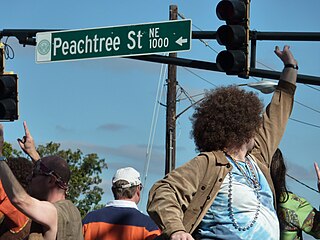
Peachtree Street is one of several major streets running through the city of Atlanta. Beginning at Five Points in downtown Atlanta, it runs North through Midtown; a few blocks after entering into Buckhead, the name changes to Peachtree Road at Deering Road. Much of the city's historic and noteworthy architecture is located along the street, and it is often used for annual parades,, as well as one-time parades celebrating events such as the 100th anniversary of Coca-Cola in 1986 and the Atlanta Braves' 1995 and 2021 World Series victories.

Buckhead is the uptown commercial and residential district of the city of Atlanta, Georgia, comprising approximately the northernmost fifth of the city. Buckhead is the third largest business district within the Atlanta city limits, behind Downtown and Midtown, a major commercial and financial center of the Southeast.

State Route 141 (SR 141) is a 34.1-mile-long (54.9 km) state highway that runs southwest-to-northeast in the northwest part of the U.S. state of Georgia. It connects the Buckhead area of Atlanta with Cumming. Its routing exists within portions of Fulton, DeKalb, Gwinnett, Forsyth counties.
Standing Peachtree was a Muscogee village and the closest Indian settlement to what is now the Buckhead area of Atlanta, Georgia. It was located where Peachtree Creek flows into the Chattahoochee River, in today's Paces neighborhood. It was located in the borderlands of the Cherokee and Muscogee nations. It is referred to in several documents dating as far back as 1762.
Historic ferries operated on rivers around Atlanta, Georgia area, and became namesakes for numerous current-day roads in north Georgia. Most of the ferries date to the early years of European-American settlement in the 1820s and 1830s, when Cherokee and other Native Americans still occupied part of what became Georgia.
From its incorporation in 1847, the municipal boundaries of Atlanta, Georgia, United States, were extended repeatedly from a small area around its railroad station to today's city covering 131.7 square miles (341 km2).

Brookhaven is a city in the northeastern suburbs of Atlanta that is located in western DeKalb County, Georgia, United States, directly northeast of Atlanta. On July 31, 2012, Brookhaven was approved in a referendum to become DeKalb County's 11th city. Incorporation officially took place on December 17, 2012, on which date municipal operations commenced. With a population of around 55,366 as of 2021, it is the largest city in DeKalb County. The new city stretches over 12 square miles (31 km2).

State Route 13 (SR 13) is a 49.5-mile-long (79.7 km) state highway in the north-central part of the U.S. state of Georgia, that travels through portions of Fulton, DeKalb, Gwinnett, and Hall counties.
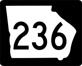
State Route 236 is a 15.00-mile (24.14 km) long state highway in Fulton County and DeKalb County, Georgia. The route begins at Piedmont Road in south Buckhead and ends at Stone Mountain Freeway exit 7 in Stone Mountain. It is signed as Lindbergh Drive in Fulton County, and LaVista Road and Hugh Howell Road in DeKalb County. It is also concurrent with US 29/SR 8 for less than a mile in DeKalb.

Medical Center is a metro station in Sandy Springs, Georgia, serving the Red Line of the Metropolitan Atlanta Rapid Transit Authority (MARTA) rail system. It serves the Pill Hill neighborhood of Perimeter Center, the location of Northside Hospital, St. Joseph's Hospital, and Children's Healthcare of Atlanta at Scottish Rite and DeVry University. North of Medical Center is Dunwoody station and south is Buckhead station. This station's platforms are long enough to accommodate 6-car trains.

Chastain Memorial Park is the largest city park in Atlanta, Georgia. It is a 268-acre (1.08 km2) park near the northern edge of the city. Included in the park are jogging paths, playgrounds, tennis courts, a golf course, swimming pool, horse park and amphitheater.

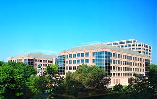
Perimeter Center is a major edge city in metro Atlanta, Georgia, United States. It is centered on Perimeter Mall, the nucleus around which it has formed. Perimeter Center is located north of Atlanta proper, and lies within three cities: Dunwoody, Sandy Springs, and Brookhaven. It is one of metro Atlanta's largest business districts, and one of the largest edge cities in the United States, comprising over 29 million square feet (2,700,000 m2) of office space, 6 million square feet (560,000 m2) of retail space, and 40,000 residents.

Metro Atlanta, designated by the United States Office of Management and Budget as the Atlanta–Sandy Springs–Alpharetta, GA Metropolitan Statistical Area, is the most populous metropolitan statistical area in the U.S. state of Georgia and the eighth-largest in the United States. Its economic, cultural and demographic center is Atlanta, and its total population was 6,144,050 according to the 2021 estimate from the U.S. Census Bureau. The metro area forms the core of a broader trading area, the Atlanta–Athens-Clarke–Sandy Springs Combined Statistical Area. The Combined Statistical Area spans up to 39 counties in north Georgia, and one county in Alabama, Chambers county. The Combined Statistical Area recorded in the 2020 census a population of 6,930,423. Atlanta is the second-largest metropolitan area in the Census Bureau's Southeast region, behind that of Greater Washington, D.C. It surpassed the Greater Miami area in total population in 2021.

Streetcars originally operated in Atlanta downtown and into the surrounding areas from 1871 until the final line's closure in 1949.

Intown Atlanta is a loosely-defined term used by the residents of Atlanta, Georgia, in the United States. It is most frequently used in metro Atlanta to designate an area containing parts of the City of Atlanta and bordering communities. The definition of "intown" varies significantly:
Lenox Park is a neighborhood of homes and office buildings located primarily within the city of Brookhaven, Georgia, just east of the northern border of the city of Atlanta.
Buckhead is large uptown district of Atlanta, Georgia, United States.
