Related Research Articles

Budleigh Salterton is a seaside town on the coast in East Devon, England, 15 miles (24 km) south-east of Exeter. It lies within the East Devon Area of Outstanding Natural Beauty, and forms much of the electoral ward of Budleigh, whose ward population at the 2021 census was 7,671.
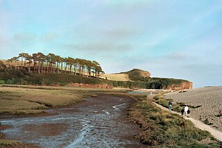
The River Otter is a river that rises in the Blackdown Hills just inside the county of Somerset, England near Otterford, then flows south through East Devon. It enters the English Channel at the western end of Lyme Bay, part of the Jurassic Coast, a UNESCO World Heritage Site. The Permian and Triassic sandstone aquifer in the Otter Valley is one of Devon's largest groundwater sources, supplying drinking water to 200,000 people.

East Budleigh is a small village in East Devon, England. The villages of Yettington, Colaton Raleigh, and Otterton lie to the west, north and east of East Budleigh, with the seaside town of Budleigh Salterton about two miles south. Until the River Otter to the east silted up, the village was a market town and port; it was still being used by ships in the 15th century, according to John Leland.

East Devon is a constituency represented in the House of Commons of the UK Parliament since 2019 by Simon Jupp of the Conservative Party.
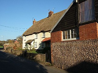
Woodbury is a village and civil parish in East Devon in the English county of Devon, 7 miles (11 km) south east of the city of Exeter. At the 2011 Census the village had a population of 1,605, and the parish had a population of 3,466. It lies on the east bank of the Exe Estuary, has borders – clockwise from the estuary – with the district of Exeter and then the parishes of Clyst St George, Clyst St Mary, Farringdon, Colaton Raleigh, Bicton and Lympstone. Woodbury is part of the electoral ward of Woodbury and Lympstone whose population at the 2011 Census was 5,260.

Honiton was a parliamentary constituency centred on the town of Honiton in east Devon, formerly represented in the House of Commons of the Parliament of the United Kingdom. It sent members intermittently from 1300, consistently from 1640. It elected two Members of Parliament (MPs) until it was abolished in 1868. It was recreated in 1885 as a single-member constituency.
Clyst St Mary is a small village and civil parish 3 miles (4.8 km) east of Exeter on the main roads to Exmouth and Sidmouth in East Devon. The name comes from the Celtic word clyst meaning 'clear stream'. The village is a major part of the electoral ward of Clyst Valley. At the 2011 Census this ward population was 2,326.
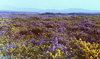
Woodbury Common in East Devon, England is an area of common land that is predominantly heathland adjacent to the village of Woodbury. It is bordered to the south by the edge of the towns of Exmouth and Budleigh Salterton, the hamlet of Yettington to the east, and the A3052 to the north. It is part of the East Devon Area of Outstanding Natural Beauty, and is a Site of Special Scientific Interest.

Otterton is a village and civil parish in East Devon, England. The parish lies on the English Channel and is surrounded clockwise from the south by the parishes of East Budleigh, Bicton, Colaton Raleigh, Newton Poppleford and Harpford and Sidmouth. In 2001 its population was 700, compared to 622 a hundred years earlier. At the 2011 census the population had reduced to 656. Otterton is part of Raleigh electoral ward whose total population at the above census was 2,120.

Colaton Raleigh is a village and civil parish in East Devon, England. The parish is surrounded clockwise from the north by the parishes of Aylesbeare, Newton Poppleford and Harpford, Otterton, Bicton, Woodbury and a small part of Farringdon.
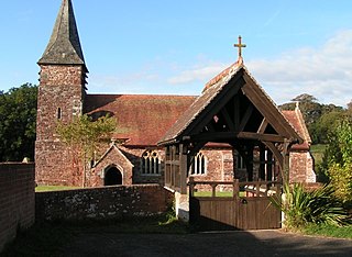
Farringdon is a village, civil parish and former manor in the district of East Devon in the county of Devon, England. The parish is surrounded clockwise from the north by the parishes of Clyst Honiton, Aylesbeare, a small part of Colaton Raleigh, Woodbury, Clyst St Mary and a small part of Sowton.
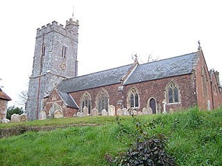
Rockbeare is a village and civil parish in the East Devon district of the county of Devon, England, located near Exeter Airport and the city of Exeter. "Whilst the name has nothing to do with either 'rocks' nor 'bears', it simply means 'rooks in the grove '." "The parish comprises the hamlets of Marsh Green, Pithead, Allercombe, and Little Silver". The village, which is of small extent, is situated on the high road from Honiton to Exeter, and is an agricultural town. The land is nearly evenly divided between arable and pasture, with about 200 acres of common. According to the 2011 Census there were 431 males and 483 females living in the parish. "Rockbeare is written within the Broadclyst ward and electoral division, which is in the constituency of East Devon County Council".

Clyst Hydon is a village and civil parish in the county of Devon, England. It was in the Cliston Hundred and has a church dedicated to St Andrew. The parish is surrounded, clockwise from the north, by the parishes of Cullompton, Plymtree, Payhembury, Talaton, Whimple, Clyst St Lawrence and Broad Clyst.

Clyst St Lawrence is a village and civil parish about 8 miles north-east of the city of Exeter in the county of Devon, England. Historically it formed part of Cliston Hundred. The parish is in the East Devon district and is surrounded, clockwise from the north, by the parishes of Clyst Hydon, Whimple and the large parish of Broad Clyst. In 2001 its population was 105, little changed from the 113 people who lived there in 1901.

The Aylesbeare Mudstone Group is an early Triassic lithostratigraphic group in southwest England. The name is derived from the village of Aylesbeare in east Devon. The Group comprises the Littleham Mudstone Formation, the Exmouth Mudstone and Sandstone Formation and the underlying Clyst St Lawrence Formation. The strata are exposed on the coast between Exmouth and Budleigh Salterton where the type section is defined. The rocks of the Aylesbeare Mudstone Group have also previously been known as the Aylesbeare Group and the Aylesbeare Mudstone Formation.
The 2007–08 South West Peninsula League season was the first in the history of the South West Peninsula League, a football competition in England, that feeds the Premier Division of the Western Football League. The league had been formed in 2007 from the merger of the Devon County League and the South Western League, and is restricted to clubs based in Cornwall and Devon. The Premier Division of the South West Peninsula League is on the same level of the National League System as the Western League Division One.
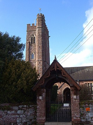
Clyst St George is a village and civil parish in East Devon, England, adjoining the River Clyst some 4 miles (6.4 km) southeast of Exeter and 5 miles (8.0 km) north of Exmouth.
References
- 1 2 "THE HUNDREDS OF DEVON". GENUKI. Retrieved 8 April 2018.