
Beaufort County is a county in the U.S. state of South Carolina. As of the 2020 census, its population was 187,117. Its county seat is Beaufort and its largest community is Hilton Head Island.

Hyde County is a county located in the U.S. state of North Carolina. As of the 2020 census, the population was 4,589, making it the second-least populous county in North Carolina. Its county seat is Swan Quarter. The county was created in 1705 as Wickham Precinct. It was renamed Hyde Precinct in 1712 and gained county status in 1739.

Carteret County is a county located in the U.S. state of North Carolina. As of the 2020 census, the population was 67,686. Its county seat is Beaufort. The county was created in 1722 as Carteret Precinct and gained county status in 1739. It was named for Sir George Carteret, one of the 17th century English Lords Proprietor, or for his descendant and heir John Carteret, 2nd Earl Granville.

Beaufort is a town in and the county seat of Carteret County, North Carolina, United States. Established in 1713 and incorporated in 1723, Beaufort is the fourth oldest town in North Carolina . On February 1, 2012, Beaufort was ranked as "America's Coolest Small Town" by readers of Budget Travel Magazine.

Bogue is a town in Carteret County, North Carolina, United States. The population was 684 in 2010.

Harkers Island is a census-designated place (CDP) in Carteret County, North Carolina, United States. The population of Harkers Island was 1,207 at the 2010 census. Harkers Island is unincorporated and receives most public services, including law enforcement and public education, from Carteret County. A membership cooperative provides the island with electric and water services. Major industries on the island include fishing, boat building, tourism, and waterfowl decoy carving.

Morehead City is a port city in Carteret County, North Carolina, United States. The population was 8,661 at the 2010 census. Morehead City celebrated the 150th anniversary of its founding on May 5, 2007. It forms part of the Crystal Coast.

Newport is a town in Carteret County, North Carolina, United States. The population was 4,510 at the 2010 census.

Beaufort is a city in and the county seat of Beaufort County, South Carolina, United States. Chartered in 1711, it is the second-oldest city in South Carolina, behind Charleston. Beaufort is known as the "Queen of the Carolina Sea Islands". The city's population was 13,607 at the 2020 census. It is part of the Hilton Head Island–Bluffton metropolitan area.

Fort Macon State Park is a North Carolina state park in Carteret County, North Carolina, in the United States. Located on Bogue Banks near Atlantic Beach, the park opened in 1936. Fort Macon State Park is the second most visited state park in North Carolina, with an annual visitation of 1.3 million, despite being one of the smallest state parks in North Carolina with 424 acres (1.72 km2). Fort Macon was built as part of the Third System of US fortifications, and was preceded by Fort Hampton of the Second System.

Otway Burns was an American privateer during the War of 1812 and later, a North Carolina State Senator.

In North Carolina, the Crystal Coast is an 85-mile stretch of coastline that extends from the Cape Lookout National Seashore, which includes 56 miles of protected beaches, southwestward to the New River. The Crystal Coast is a popular area with tourists and second-home owners in the summer, with a name coined by the Carteret County Tourism Development Authority.
Bogue Banks form a 21-mile (34 km) barrier island off the mainland of North Carolina in Carteret County. The island, separated from the mainland by Bogue Sound, runs east to west, with the ocean beaches facing due south. Bogue Banks is the only island on the Carteret County shore that has been developed with housing: numerous communities are located on the island and can be accessed by one of two bridges across Bogue Sound, either from Morehead City to Atlantic Beach, which is the more heavily traveled bridge, or from Cape Carteret to Emerald Isle. The communities of Bogue Banks are the most prominent of the Crystal Coast. NC 58 traverses a majority of the island's length. There are several hotels that dot the island, but most of the land contains private houses, some of which are rented out during the summer, or maritime forest. Stores and other commercial properties are limited to the five main communities.

The Inner Banks is a neologism made up by developers and tourism promoters to describe the inland coastal region of eastern North Carolina. Without historical precedent, the term "Inner Banks" is an early 21st-century construct that is part of an attempt to rebrand the mostly agrarian Coastal Plains east of I-95 as a more attractive region for visitors and retirees.
Francis Borden Mace, in Beaufort, North Carolina, was an American film producer. Mace died on November 21, 2014, in Salisbury, Connecticut.
Michael J. Smith Field is a public airport located one mile (2 km) north of the central business district of Beaufort and northeast of Morehead City, in Carteret County, North Carolina, United States. It is owned by the Beaufort-Morehead City Airport Authority.
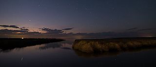
Cedar Island National Wildlife Refuge, located in Carteret County, North Carolina, is on the end of a peninsula marking the southern end of Pamlico Sound. The refuge lies five miles (8 km) east of the Atlantic Ocean and about 40 miles (64 km) northeast of Beaufort, North Carolina. Established in 1964, the refuge consists of approximately 11,000 acres (45 km2) of irregularly flooded, brackish marsh and 3,480 acres (14.1 km2) of pocosin and woodland habitat. The dominant marsh plants include black needlerush, saltmarsh cordgrass, saltmeadow hay, and saltgrass. The woodland areas are dominated by loblolly, longleaf and pond pine. Live oak is also abundant on some upland sites. The marsh and surrounding waters provide wintering habitat for thousands of ducks and nesting habitat for colonial waterbirds.
Carteret County Public Schools (CCPS) is a PK–12 school district serving Carteret County, North Carolina. Its 18 schools serve approximately 8,000 students as of the 2024-2025 school year.
Gloucester is an unincorporated area and census-designated place (CDP) in Carteret County, North Carolina, United States. As of the 2010 census it had a population of 537.
